theweatherguy's website
Philadelphia Weekend Weather and Storm Forecasts

About this blog
theweatherguy's website,
"Thoughts and comments on Philadelphia Weather and Daily Life."
aka "theweatherguy"
![]()
Copy link for RSS feed
These are a few of my favorite links. Meteorology Glossary
Weather Archives:
May Jun Jul Aug Sept Oct Nov Dec
12: Jan Feb Mar Apr
May Jun Jul Aug Sept Oct Nov Dec
11: Jan Feb Mar Apr
May Jun Jul Aug Sept Oct Nov Dec
10: Jan Feb Mar Apr
May Jun Jul Aug Sept Oct Nov Dec
09: Jan Feb Mar Apr
May Jun Jul Aug Sept Oct Nov Dec
May Jun Jul Aug Sept Oct Nov Dec
07: Jan
Feb
Mar
Apr
May Jun
Jul
Aug
Sept
Oct
Nov Dec
06: Jan
Feb
Mar
Apr
May Jun
Jul
Aug
Sept
Oct
Nov
Dec
Commentary:
Miscellaneous
![]()
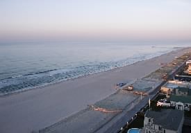
Sun, 31 Jul 2005
Weekend Weather Update
Sun 7/31: The NAM has more clouds than the GFS. Clouds with breaks of sun. High near 86.
Shore Forecast: Slightly more clouds, due to a northeast flow. The sun may break through in the afternoon.
 A stream of moisture along the coast will interact with a northeast surface flow, giving us a mixed bag of clouds and sun, especially at the shore.
posted: Jul 31 2005 at 9:26 am
[/weather/july05] permanent link
Sat, 30 Jul 2005Weekend Weather Update
Sat 7/30: Becoming partly sunny. High near 87.
Sun 7/31: The NAM has more clouds than the GFS. Partly cloudy/partly sunny. High near 86.
Shore Forecast: Following rain in the morning, clouds will linger into the early afternoon, then some sun in the afternoon. Sunday's forecast less clear, as the GFS and NAM are quite different. The GFS has partly sunny skies. Temps low 80s.
![]() Both the GFS and NAM models move the front to our east, along with the clouds and the precipitation.
Both the GFS and NAM models move the front to our east, along with the clouds and the precipitation.
posted: Jul 30 2005 at 10:24 am
[/weather/july05] permanent link
Fri, 29 Jul 2005Weekend Weather For Sat 7/30 and Sun 7/31
Sat 7/23: Partly cloudy/partly sunny, a slight chance of a shower in the morning. Then decreasing clouds in the afternoon. The rain will be heavier at the Jersey shore. High near 83.
Sun 7/24: Becoming mostly sunny. High near 85.
Shore Forecast: Rain may be more substantial, especially on Friday night and Saturday morning. Clouds and showers may linger into early Sunday morning, then clearing. Northeasterly flow will keep things cool.
The position of the stalled front, as predicted by the models, continues to change. Latest morning NAM and GFS model output put most of the precip to our east. There's alot more dry air here in Philadelphia this morning than predicted. So I'm going to move to a more optimistic forecast.
posted: Jul 29 2005 at 12:05 pm
[/weather/july05] permanent link
Weekend Weather For Sat 7/30 and Sun 7/31
Sat 7/23: Mostly cloudy, chance of a shower. The rain will be heavier at the Jersey shore. High near 80.
Sun 7/24: After some early morning clouds, becoming partly sunny. High near 80.
Shore Forecast: Rain may be heavier, especially on Friday and Saturday. Clouds and showers may linger into early Sunday morning, then clearing. Northeasterly flow will keep things cool.
Things are not looking good for this Friday into Sunday morning. The latest GFS pushes several waves of low pressure into our area, especially south Jersey, from Friday afternoon into early Sunday morning. The NAM (less favored model) has plenty of clouds, but most of the precipitation at the Jersey shore.
posted: Jul 29 2005 at 6:43 am
[/weather/july05] permanent link
Thu, 28 Jul 2005Weekend Weather For Sat 7/30 and Sun 7/31
Sat 7/23: Cloudy with periods of rain. The rain may be heavy, especially in Jersey. High near 80.
Sun 7/24: After some morning clouds, partly sunny. High near 80.
Shore Forecast: Rain may be heavier, especially on Friday and Saturday. Clouds and showers may linger into early Sunday morning, then clearing. Northeasterly flow will keep things cool.
Things are not looking good for this Friday into Sunday morning. The latest GFS pushes several waves of low pressure into our area, especially south Jersey, from Friday afternoon into early Sunday morning.
posted: Jul 28 2005 at 4:34 pm
[/weather/july05] permanent link
Weekend Weather Update
There's a question about how far north rain on Friday into Saturday will be. Should be more certain later today. The NAM and GFS are somewhat different. The south Jersey shore may have rain this weekend.
posted: Jul 28 2005 at 5:54 am
[/weather/july05] permanent link
Wed, 27 Jul 2005Weekend Weather For Sat 7/30 and Sun 7/31
Sat 7/23: Partly cloudy; Mostly dry....a chance of showers, especially at the south Jersey shore. High in the low 80s.
Sun 7/24:Partly cloudy. Chance of showers, again, mostly south of Philadelphia and near the south Jersey shore. High in the low 80s.
The latest GFS has the stalled front, mentioned in yesterday's forecast, a bit more to our south. This will keep the precipitation just to our south. The position of the front needs to be watched.
posted: Jul 27 2005 at 6:06 am
[/weather/july05] permanent link
Tue, 26 Jul 2005Weekend Weather For Sat 7/30 and Sun 7/31
Sat 7/23: Mostly cloudy; chance of showers, some of the rain possibly heavy especially at the south Jersey shore. High in the 80s. Specifics too uncertain at this time
Sun 7/24:Mostly cloudy. Chance of showers, again, mostly south of Philadelphia and near the south Jersey shore. High in the 80s. Specifics too uncertain at this time.
The weekend is looking very unsettled and wet, as an upper trough and a stalled front allow moisture and low pressure to form close to Philadelphia and especially the south shore of NJ. Details still not possible, but Friday looks wet, as does part of Saturday and Sunday.
posted: Jul 26 2005 at 6:57 pm
[/weather/july05] permanent link
Weekend Weather For Sat 7/30 and Sun 7/31
Sat 7/23: Partly to mostly cloudy; chance of showers. High in the 80s. Specifics too uncertain at this time
Sun 7/24:Partly to mostly cloudy. Chance of showers. High in the 80s. Specifics too uncertain at this time.
A pattern shift to an upper cyclonic flow may allow moisture and low pressure to form and move up the Appalachians over the weekend. Specifics not clear at this time, but a periods of showers and clouds a strong possibility for this weekend.
posted: Jul 26 2005 at 7:04 am
[/weather/july05] permanent link
Sun, 24 Jul 2005Weekend Weather Update
Sun 7/24: Mostly sunny, a few scattered clouds later in the afternoon. High near 90. Humidity, some clouds return this evening. Thunderstorms a good possibility very late in the night, or before daybreak Monday morning.
Shore Forecast: Winds shift from northeasterly to southerly early this afternoon, bringing in more humidity, but this sea breeze will keep temps a bit lower on the beach.
The low humidity and perfect weather of this past weekend will fade, as humidity returns later tonight and dewpoints rise into the 70s with hot temperatures in the 90s.
posted: Jul 24 2005 at 10:04 am
[/weather/july05] permanent link
Sat, 23 Jul 2005Weekend Weather Update
Sat 7/23: Sunny and very warm. High near 90.
Sun 7/24: Mostly sunny, a few scattered clouds. High near 90.
Shore Forecast: A northeasterly to easterly flow off the water will keeps temps cooler at the beach.
The cool front moved through and, as expected, has caused mostly a dewpoint rather than a temperature drop for Saturday and Sunday. (The humidity returns Sunday night into Monday.)
posted: Jul 23 2005 at 8:01 am
[/weather/july05] permanent link
Fri, 22 Jul 2005Weekend Weather Update
Sat 7/23: Sunny and very warm. High upper 80s to near 90.
Sun 7/24: A mix of sun and some clouds. High near 90.
Shore Forecast: No specific differences beyond slightly lower temps.
The cool front is expected to move throught Friday evening. This weak front is expected to bring lower dewpoints for the weekend, probably in the mid 60s, making the temperatures much more tolerable. The upcoming weekend looks rain-free.
posted: Jul 22 2005 at 9:36 am
[/weather/july05] permanent link
Wed, 20 Jul 2005Weekend Weather For Sat 7/23 and Sun 7/24
Sat 7/23: Sunny and very warm. High in the mid to upper 80s.
Sun 7/24: Sunny and warmer. High near 90.
Shore Forecast: No specific differences beyond slightly lower temps.
 A summertime pattern of warm to hot weather will continue for the upcoming weekend. A weak front on Friday is expected to bring lower dewpoints for the weekend, probably in the mid 60s, making the temperatures much more tolerable. The upcoming weekend is rain-free.
posted: Jul 20 2005 at 7:01 pm
[/weather/july05] permanent link
Mon, 18 Jul 2005Weekend Weather For Sat 7/23 and Sun 7/24
Sat 7/23: Sunny and very warm. High in the mid to upper 80s.
Sun 7/24: A mix of sun and some clouds. Hot. High in the low 90s.
Shore Forecast: No specific differences beyond slightly lower temps.
A summertime pattern of warm to hot weather will continue for the upcoming weekend. A weak front on Friday is expected to bring lower dewpoints for the weekend, probably in the mid 60s, making the temperatures much more tolerable. The upcoming weekend looks rain-free.
posted: Jul 18 2005 at 5:12 pm
[/weather/july05] permanent link
Sat, 16 Jul 2005Weekend Weather Update
Sun 7/17: A mix of sun, clouds and showers. Continued very warm and very humid. High upper 80s to near 90.
I'm off enjoying the sunny and dry weather of San Francisco. But a check of the weather shows scattered thunderstorms continuing through the weekend. As mentioned, the shore has less showers, due to the high pressure ridge off the coast.
Shore Forecast: Similar to Philadelphia. Weak high pressure off the coast will allow more hazy sunshine through each day and less showers.
posted: Jul 16 2005 at 6:18 pm
[/weather/july05] permanent link
Thu, 14 Jul 2005Weekend Weather for Saturday 7/16 and Sunday 7/17
Sat 7/26: A mix of clouds, sun and scattered showers, mostly in the afternoon. Hot and humid. High in the upper 80s.
 The summertime weak upper air pattern has trapped the remains of Dennis over Ohio. Very warm, humid air and the energy leftover from Dennis will provide unstable conditions for thunderstorms to form, mostly in the afternoon. These will form in a random, scattered way. Most of the weekend will be rain-free, but the hazy, partly cloudy warm/humid conditions will persist. Dewpoints in the low 70s means very muggy conditions.
Sun 7/10: A mix of sun, clouds and showers, but more sun expected than Saturday. Continued hot and very humid. High low 90s.
Shore Forecast: Similar to Philadelphia. Weak high pressure off the coast will allow more hazy sunshine through each day.
posted: Jul 14 2005 at 3:57 pm
[/weather/july05] permanent link
Tue, 12 Jul 2005Weekend Weather for Saturday 7/16 and Sunday 7/17
Sat 7/26: A mix of clouds, showers. Warm and humid. High in the mid 80s.
A difficult forecast to nail down specifics for this weekend, but moisture trapped from Dennis will be causing clouds and showers. A fair amount of clouds and showers expected, but not necessarily a rainout.
Sun 7/10: A mix of clouds and showers, but more sun expected than Saturday. High in the upper 80s.
Shore Forecast: Similar to Philadelphia. No significant differences available at this time.
posted: Jul 12 2005 at 8:18 am
[/weather/july05] permanent link
Sun, 10 Jul 2005Weekend Weather Update
Sun 7/10: Sunny and hot. (although dewpoints will remain in the tolerable 60s). High 94.
High pressure will bring hot, but tolerably humid weather to our area.
Shore Forecast: A land breeze will keep things hot, even at the shore.
posted: Jul 10 2005 at 7:46 am
[/weather/july05] permanent link
Sat, 09 Jul 2005Weekend Weather Update
Sat 7/9: Becoming sunny and very warm. There's a good chance of a late afternoon thunderstorm in central and northern New Jersey, and perhaps as far south and Philadelphia and Atlantic City. High mid to upper 80s.
 Following the departure of the remnants of tropical storm Cindy, high pressure will build in at the surface for Saturday and Sunday. An upper low pressure system in New England will allow disturbances to rotate through our area, touching off thunderstorms in the late afternoon.
Sun 7/10: Continued mostly sunny and hot. High low 90s.
Shore Forecast: Fairly breezy at the coast for Saturday.
posted: Jul 09 2005 at 9:59 am
[/weather/july05] permanent link
Fri, 08 Jul 2005Weekend Weather Update
Sat 7/9: Becoming sunny and very warm. High mid to upper 80s.
Following the departure of the remnants of tropical storm Cindy, high pressure will build in for Saturday and Sunday.
Sun 7/10: Continued mostly sunny and hot. High low 90s.
Shore Forecast: Fairly breezy at the coast for Saturday.
posted: Jul 08 2005 at 6:59 am
[/weather/july05] permanent link
Thu, 07 Jul 2005Weekend Weather for Sat 7/9 and Sun 7/10
Sat 7/9: Becoming sunny and very warm. High approaching 90.
Following the departure of the remnants of tropical storm Cindy, high pressure will build in for Saturday and Sunday.
Sun 7/10: Continued mostly sunny and hot. High low 90s.
Shore Forecast: Will evaluate seabreezes on Friday.
posted: Jul 07 2005 at 8:17 pm
[/weather/july05] permanent link
Tue, 05 Jul 2005Weekend Weather for Sat 7/9 and Sun 7/10
Sat 7/9: Becoming sunny and very warm. High upper 80s to near 90.
Low pressure, affecting us on Friday, is expected to depart on Saturday, giving us a mostly sunny and seasonably warm/hot weekend, according to the GFS. The NOGAPS has this system lingering a bit into Saturday before departing.
Sun 7/10: Continued mostly sunny and very warm. High upper 80s to near 90.
Shore Forecast: No differences forecast at this time.
posted: Jul 05 2005 at 7:15 am
[/weather/july05] permanent link
Mon, 04 Jul 2005Weekend Weather Update
Mon 7/4: Fair and warm. High in the low 80s.
The models switched direction late last night and the low level easterly flow never took hold. Fair skies for today.
Shore Forecast: Sunny and a bit cooler. High 79.
posted: Jul 04 2005 at 8:47 am
[/weather/july05] permanent link
Sun, 03 Jul 2005Weekend Weather Update
Sun 7/3: Mostly sunny in the morning, some cloudiness may mix in in the afternoon. High in the low 80s.
With high pressure shifting to the north, a northeasterly flow will develop around the high in our area. In addition, a moisture flow from the south, behind the retreating high, will add to the overall mix. This will result in some clouds for later on Sunday and a good part of Monday, especially at the shore.
Mon 7/4: Mostly cloudy for much of the morning, with clearing in the afternoon. High in the low 80s. W
Shore Forecast: Cooler temps (upper 70s) and a bit more clouds than Philadelphia. Areas to our south (Cape May, DE,) may have more clouds and even a few showers.
posted: Jul 03 2005 at 8:21 am
[/weather/july05] permanent link
Sat, 02 Jul 2005Weekend Weather Update
Sat 7/2: Mostly cloudy early, the sun breaks through occasionally to partly cloudy conditions during the afternoon. If the WRF and RUC models are correct, there's even a chance of a shower or thunderstorm. High near 80.
Examination of satellite imagery as well as latest GFS MOS output suggests more clouds for the weekend than previously thought. The frontal boundary is not moving very far south, and the high pressure system is shifting to our north, rather than moving in from the west. Some mesoscale models even have some showers for the Philadelphia area for Saturday.
Sun 7/3: If high pressure builds in, partly to mostly sunny. We'll have to watch this front to our south, if it stays stationery, more clouds than sun. High near 82.
Mon 7/4: Unclear forecast. Perhaps mostly cloudy. High in the low 80s. We have to watch the front to our south.
Shore Forecast: Slower clearing on Saturday, as clouds will linger into the early afternoon. Cooler temps (upper 70s) and a bit more clouds than Philadelphia, all three days. Areas to our south (Cape May, DE,) may have more clouds and even showers.
posted: Jul 02 2005 at 10:07 am
[/weather/july05] permanent link
Weekend Weather Update
Sat 7/2: Cloudy early, the sun breaks through to partly cloudy conditions during the afternoon. High near 80.
There has been much optimism in the weekend forecast based on high pressure building in for the weekend. That still appears to be the case, but the front has stalled a bit, just to our south and offshore. The GFS had hinted at this as early as Thursday, as mentioned in my previous forecasts, but the optimistic forecast won out. We'll see if that optimism was warranted. The NAM still has us clearing out, but the GFS continues with a stalled front near us, giving us a bit more clouds than previously thought today. Much more uncertainty than previously thought for the weekend forecast. Areas at the shore and south will have more clouds than expected.
Sun 7/3: If high pressure builds in, partly to mostly sunny. We'll have to watch this front to our south. High near 82.
Mon 7/4: Partly sunny. High in the low 80s. We have to watch the front to our south.
Shore Forecast: Slower clearing on Saturday, as some clouds will linger into the early afternoon.Temperatures will be a few degrees cooler, closer to 80 on all three days. Cooler temps (upper 70s) and a bit more clouds than Philadelphia, all three days. Areas to our south (Cape May, DE,) may have more clouds.
posted: Jul 02 2005 at 5:58 am
[/weather/july05] permanent link
Fri, 01 Jul 2005Weekend Weather Update
Sat 7/2: Becoming mostly sunny in the morning. High in the mid 80s.
The cold front expected to move through Friday night should clear the coast by 8AM Saturday, giving us beautiful weather for this weekend. There had been some thought that the front would stall to our south, but the latest model runs have it far enough south to allow full clearing.
Sun 7/3: Sunny and warm. High in the mid 80s.
Mon 7/4: Sunny, warm and a bit more humid. High in the mid 80s.
Shore Forecast: A bit slower clearing on Saturday, as some clouds may linger into the mid morning. Temperatures will be a few degrees cooler, closer to 80 on all three days.
posted: Jul 01 2005 at 9:25 am
[/weather/july05] permanent link
Disclaimer: I am not a meteorologist and provide this information as a hobby and for entertainment (mostly my own :-) . While attempts are made to predict the weather as best as I can, use at your own risk! I am NOT responsible for any direct or indirect consequential injury/damages due to your use of these forecasts. Always check the NWS Official Forecast for your final plans.
The weatherguy.net home page has been visited times since October 2003.