#weather #paweather #wx #pawx #philadelphia
Update Sun 2/19 8:40 AM — As alluded to last night, the model cloud algorithms predicted cloudiness for today, but the vertical relative humidity field values were not all that high, so I was curious about how much cloudiness we would actually see today. So far, not much. While a few periods of cloudiness are still possible, I don’t think it will be as cloudy as the radio forecasts are suggesting.
Previously Posted Sat 8:45 PM —
Some Cloudiness Sunday… Watching next Saturday
Today’s models continue with a forecast of considerable mid-level cloudiness during the day Sunday. This sort of cloudiness can be the sort that lets dim sunlight through. The models also show some areas where there will be intermittent clear skies.
The cloudiness forecast is the result of several weak upper air disturbances moving through.
I’m sort of curious how much cloudiness we actually get, since the relative humidity vertical profiles are not that impressive. I guess we’ll see. High temperatures around 53º (Blue Bell). It will become fairly windy during the afternoon and evening.
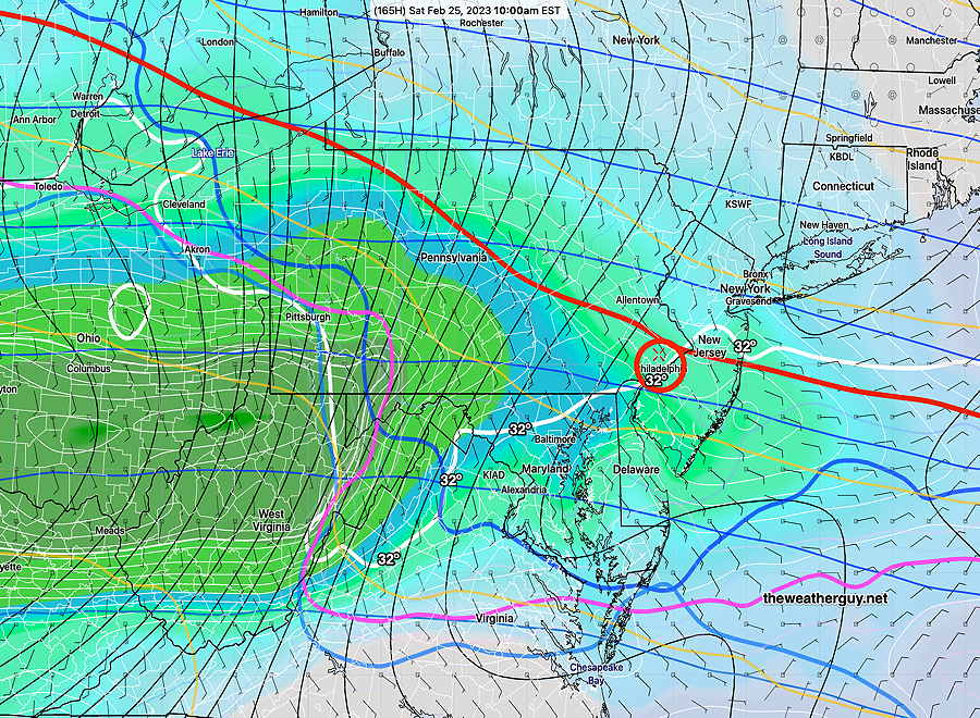
Watching Next Saturday
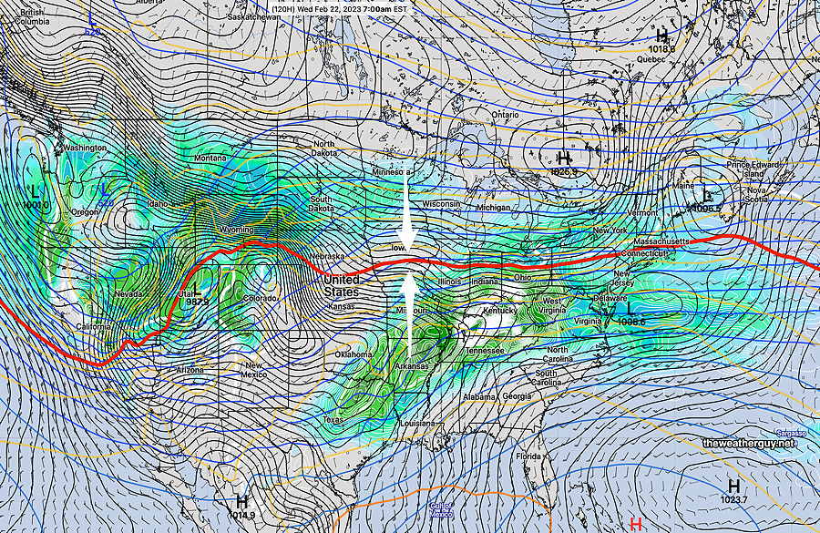
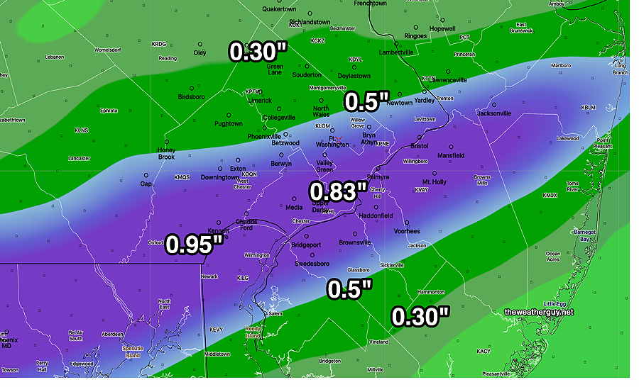
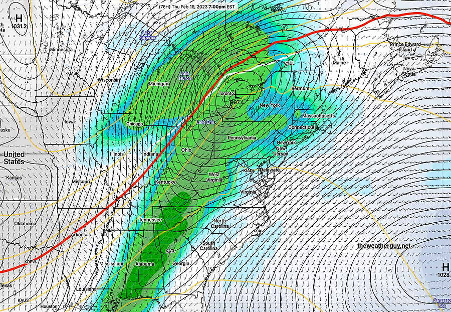
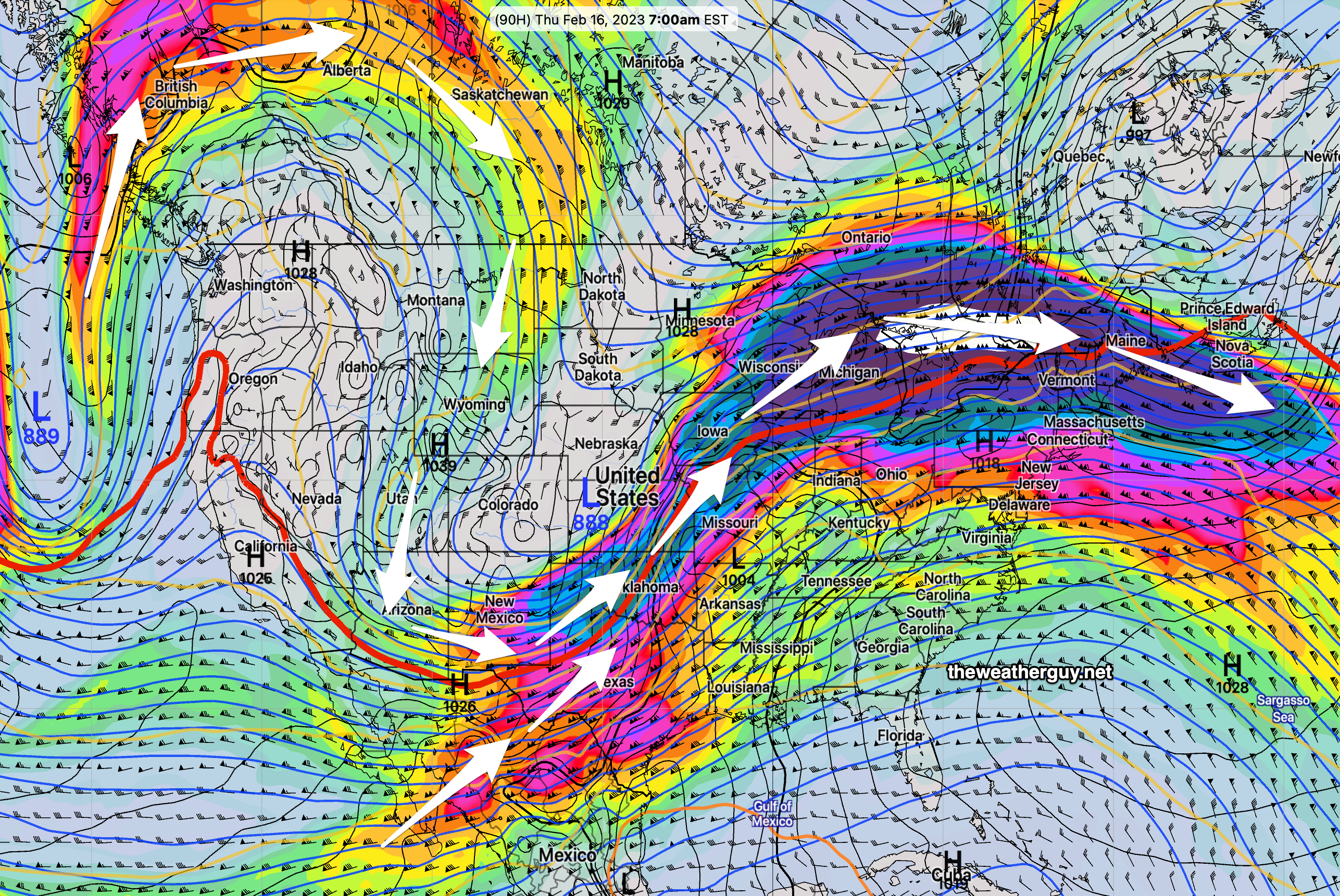
There seems to be usually high agreement with today’s global models (GFS, GEFS, ECMWF, ICON, GEPS, NAEFS) that a ‘cold air damming’ setup will develop early next Saturday as warm air rides over cold air at the surface. This is a snow –> sleet–> rain scenario for the immediate PHL area. An inch or so of actual snow is possible, as currently forecast, but it will all be washed away by rain later in the day. Temperatures rise the next day.
This is the most substantial setup for a bit of snow that I’ve seen this entire winter. Many lesser possibilities have faded into oblivion this winter. (This setup was originally forecast by some models to occur this coming Thursday, but that faded away.)
We must not forget that this is about 7 days away. In the weather world, that’s considerable forecast lead time. Much can change in that time frame. Stay tuned.