Update Sun 12/18 @ 6:08 PM — Updated Winter Storm page.
Update Sun 12/18 @ 9:12 AM — Expect considerable instability cloudiness, similar to Saturday, to move in from the west about 11 AM – noon today. Also updated this week’s Winter Storm page.
NOAA and the NWS has just released the preview version (called the parallel run) of the new NBM model (version 4.1) this past Thursday, and major improvements in precipitation type forecasts suggests that I lean heavily on this new NBM model for the storm’s precipitation type forecast.
From National Weather Service /NOAA—
Improvements in NBM Model 4.1 – inclusion of additional Australian Global and Canadian models and NOAA’S new HIRESW-FV3–
“Improvements in winter weather guidance for snow, ice, freezing rain, and unconditional precipitation type through the increase in [ensemble] membership (18 to 100 members) and leveraging direct model precipitation type guidance averaging direct model precipitation type guidance.”
“Usage of high-quality Quantitative Precipitation Estimates (QPE) observational and long sampled climatological data sets (e.g., the Multi Radar/Multi Sensor System (MRMS) and Multi-Source Weighted-Ensemble Precipitation (MSWEP) for calibrating probabilistic quantitative precipitation forecasts”
Update Sat 12/17 @ 5:30 PM — We did have the cloudiness today. Sunday will likely be similar to Saturday regarding clouds, possibly even cloudier in the afternoon. Colder. Forecast below still holds.
Update Sat 12/17 @ 5:33 PM — Winter Storm page updated for storm expected Thursday to Saturday.
Update Sat 12/17 @ 10:31 AM — Last night’s models are less emphatic about cloudiness this afternoon.
Update Fri 12/16 @ 5:51 PM — Updated Saturday and Sunday forecast below to reflect new model forecasts. Changes are highlighted.
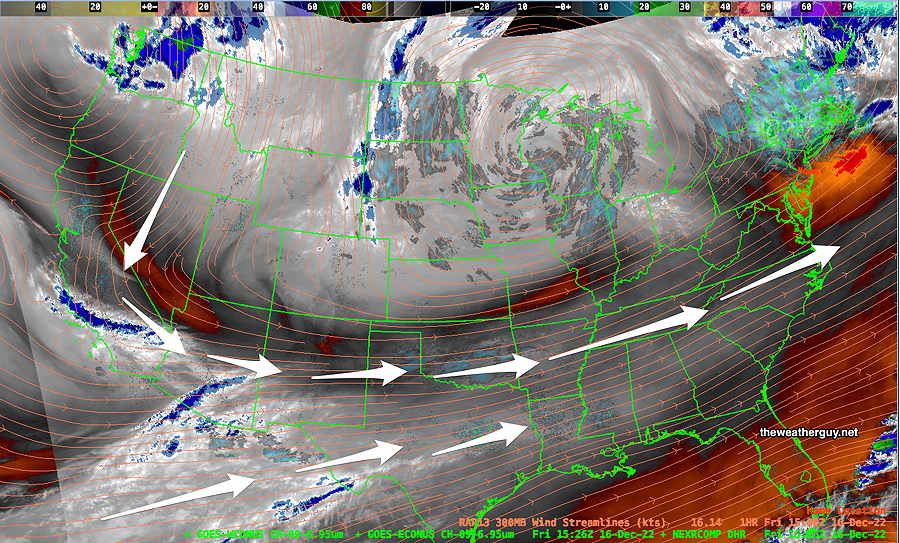
Our weather this weekend will be influenced by a slow moving upper air low and a slowly departing surface low that gave us the rainy weather Thursday into Friday. High pressure will be building in, but disturbances rotating around the upper low will cause windy conditions and some occasional cloudiness.
Water Vapor image shows upper air configuration—
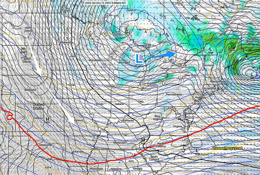
Friday’s GFS forecast for Saturday—
A colder pattern is setting up for the weekend and the coming week with cold high pressure pushing the jet stream to the south of us.
I’m keeping my eye on significant coastal storm that is forecast to form in the late Thursday through early Saturday time frame. The impulse expected to trigger this storm is way off in the Pacific right now and it’s too soon to consider it a reality.
At the same time, this is the first time in a long while where a white Christmas here is a distinct possibility. It currently looks to be a rain–> snow storm for us. Stay tuned.
Previously Posted Fri 12:07 PM —
Saturday
Mostly sunny in the morning, considerable instability cloudiness in the afternoon, especially west of the city. Windy/breezy and cold. Wind chills in the low 30s.
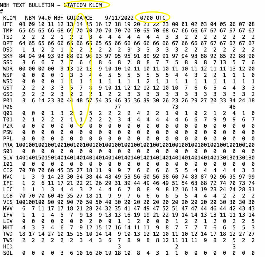
High temperature 40.1º sd 1.8º NBM model – for location Blue Bell, PA
Sunday
Sunny and cold. A period cloudiness in the early afternoon. Still breezy. Wind chills in the 20s!
High temperature 37.0º sd 1.8º NBM model – for location Blue Bell, PA