
Originally Posted — Monday July 18, 2022 6:14 PM
This my second posting about the current dry spell that appears to be developing around the Delaware Valley and eastward into southern New Jersey.
As mentioned in my previous posting, I’ve always wondered how these patterns develop.
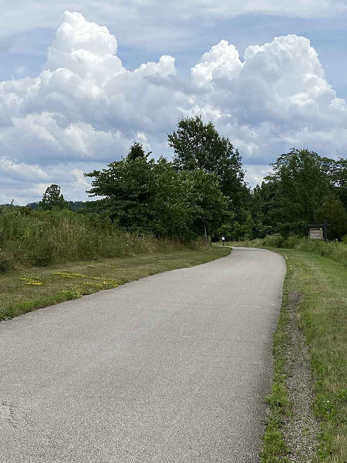
First, aside from just low rainfall, what are the telltale signs of a dry spell (drought)? I think the give away for me is the recognition that lines of storms are just falling apart as they approach Philadelphia and the Delaware Valley.
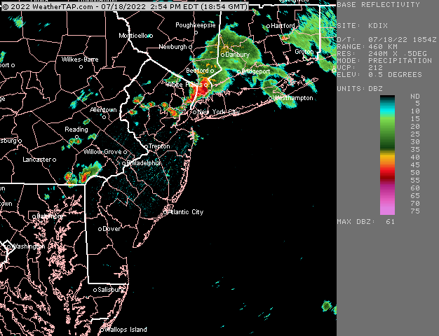
At first, this breakdown of thunderstorms and convective activity seems to occur, despite model forecasts of significant storms.
After awhile, the models seem to show this breakdown in storm strength and intensity in their forecasts
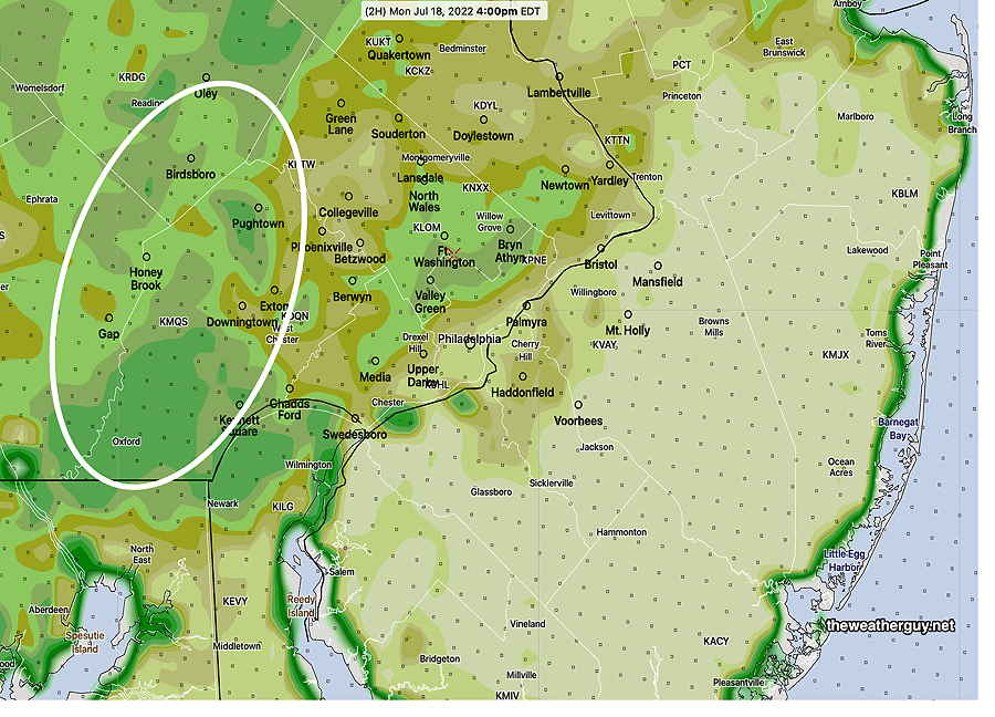
Today, Monday, is a perfect example of a dry spell event. CAPE values are very high today (2000!) and Precipitable Water value (PWAT) is over 2 inches. Surface dew points are in the mid 70s. Plenty of moisture and potential energy to go around!
But one clear thing missing today is high vertical shear. Shear values are forecast to be only 10-15. That’s very low. (High shear keeps convection going and thunderstorms from stabilizing and collapsing from under their own rainfall.)
At this stage, I think we’re beyond just low vertical shear to explain the recurrent lack of rainfall.
Here are my theories. These are my own observations based on years of looking at these events.
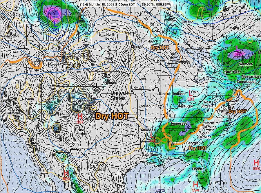
- A “tongue” of warm dry stable high pressure the pushes into our area. It recurrently forms as part of an entrenched weather pattern, usually due to extremely large dome of high pressure in the middle of the US. Here’s what the tongue looks like —
Looking at the same tongue of warm air close up—
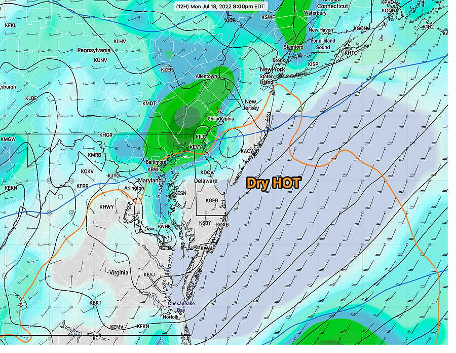
It’s my conjecture that when storms develop west of Philadelphia move into this wall of hot, dry air (denoted by approximately by the 576 thickness contour), they lose their convective instability and fall apart.
Why is this tongue of air intruding into our area? That’s a tough one, but it relates to large size of the hot air mass in the center of country. Who knows what causes these patterns to emerge? (Increase in sunspot activity and total solar irradiance with the current solar cycle?)
2. Low Soil Moisture.
Once the the dry pattern develops, a negative feedback situation reinforces the pattern due to low soil moisture. Convection, once started, may have trouble maintaining itself over drier areas.
Current Volumetric Soil Moisture—
I should indicate that while soil moisture is considered an important feature in thunderstorm convective development, to date, scientific studies have been inconclusive whether it provides a positive or negative feedback effect. Some studies suggest negative feedback, some suggest positive. Some studies suggest that dry conditions prompt convection and some suggest dry diminish convection already developed.
Others studies suggest the negative vs positive feedback effects are regional.
If they are regional, it seems that in our area, “dry begets dry”.
A complicated situation.
I don’t think tonight’s storms are going to end the dry spell. It will take a major hurricane or major pattern change to have the dry spell end.