Tag Archives: Hurricane Isaias

STORM ISAIAS UPDATE FOR THE PHILADELPHIA AREA

Mon 10:45 PM Update — More new model data. Wind gusts may exceed 60mph in Philadelphia and immediate suburbs.
Mon 10:15 PM Update — Tonight’s short range models just becoming available continue with the forecast of a generalized 3-5 inches of rain.  Heaviest amounts in the western suburbs. The precipitation maps posted below are still valid. The storm will be approaching sooner and moving faster. The precipitation rate peaks around 11 AM -2 PM with over an inch of rain per hour falling. Wind gusts are higher, especially in NJ.  

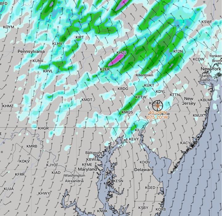
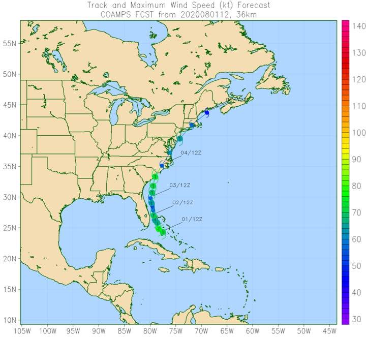
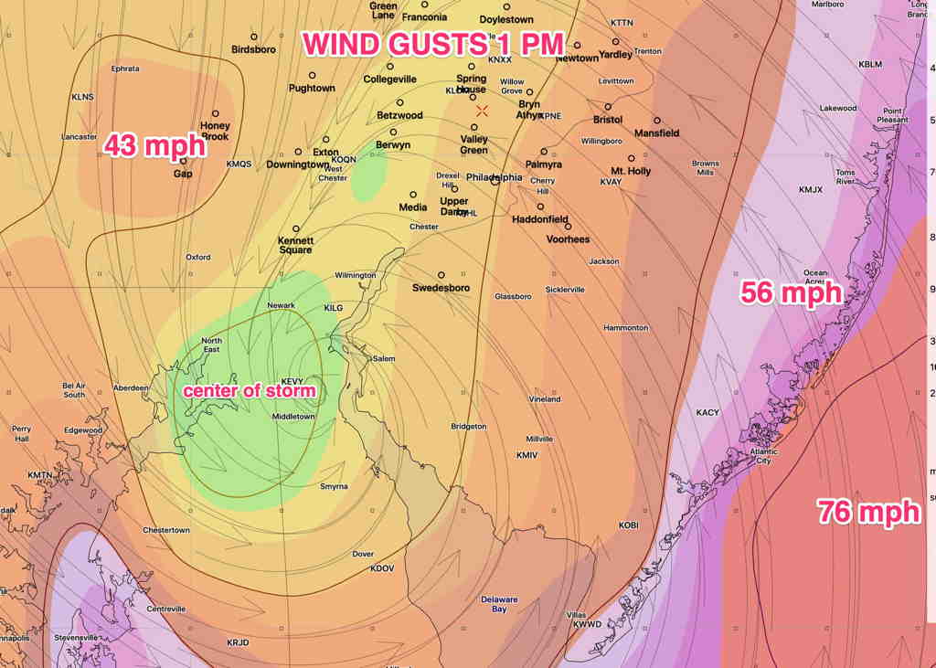
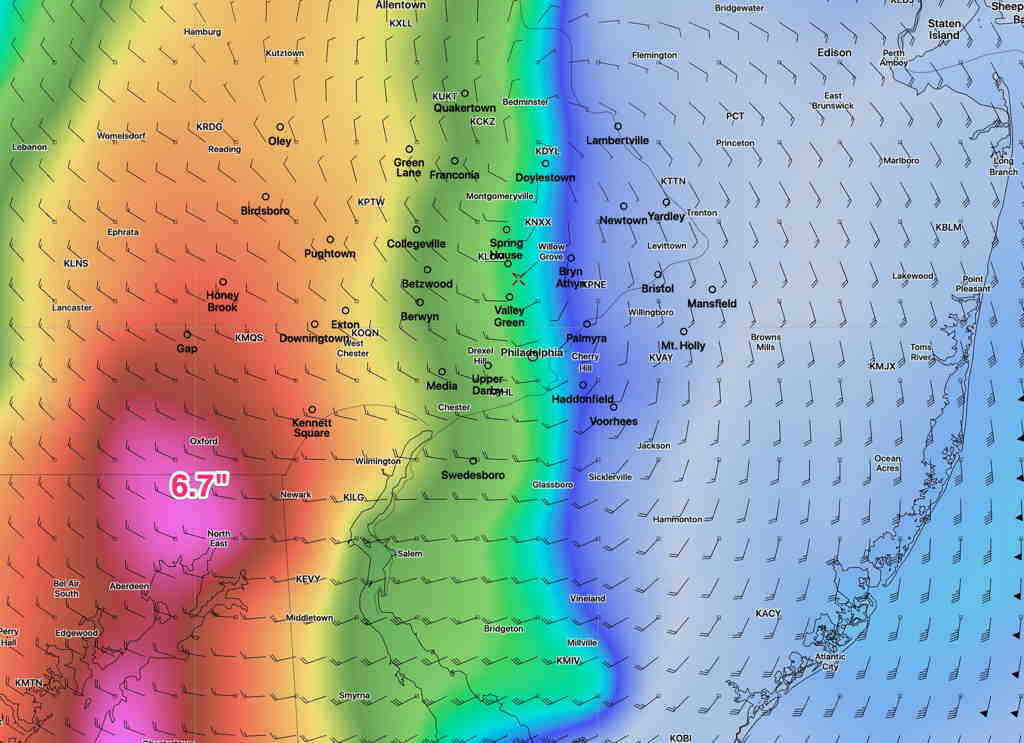
Tropical Storm/Hurricane Isaias continues to move up the coastline.  Very heavy rain continues to be the main threat from this storm. The heaviest rain may fall over a period of just a few hours.

The trend has been for the heaviest rain to fall slightly further west than yesterday’s model runs.  Some models are predicting amounts as high as 5-7 inches of rain in some spots!  The heaviest rain will fall between 11AM and 3 PM Tuesday.

The peak winds will occur around 1-2 PM.  Gusts around 35-50 MPH are forecast by the latest GFS in the PHL area.

GFS wind gusts forecast 1 PM EDT Tuesday  (Click on image for a larger view.)


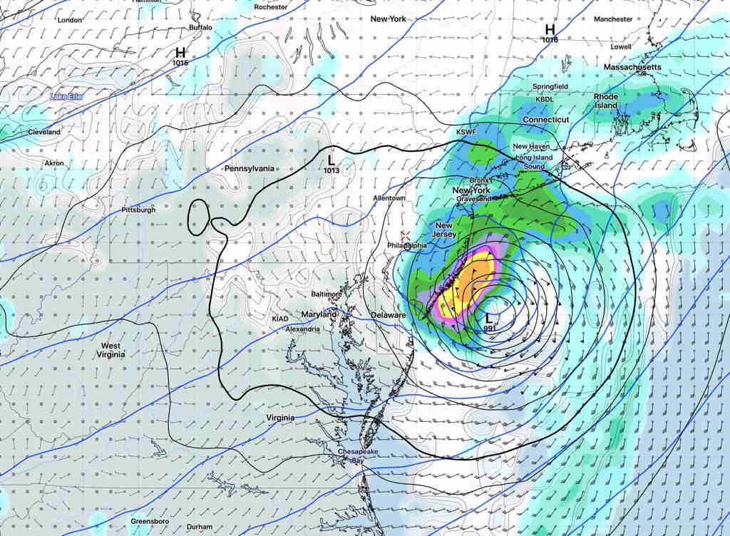
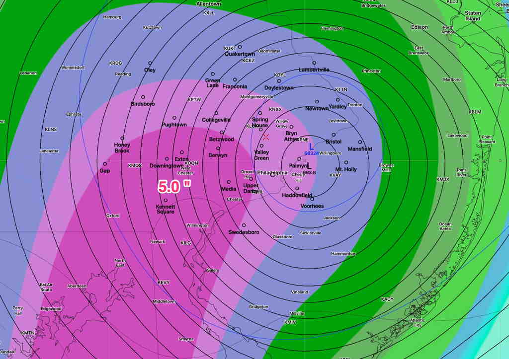
Here are the latest models with their rainfall totals –

GFS model accumulated rain forecast  (Click on image for a larger view.)

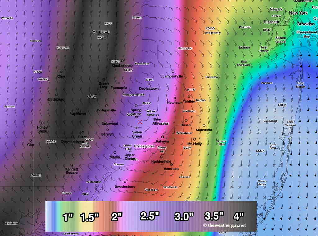
The latest National Blend of Models (NBM version 4.0 ), often correct for QPF values, has even greater amounts—

NBM Accumulated Rain forecast. (Click on image for a larger view.)

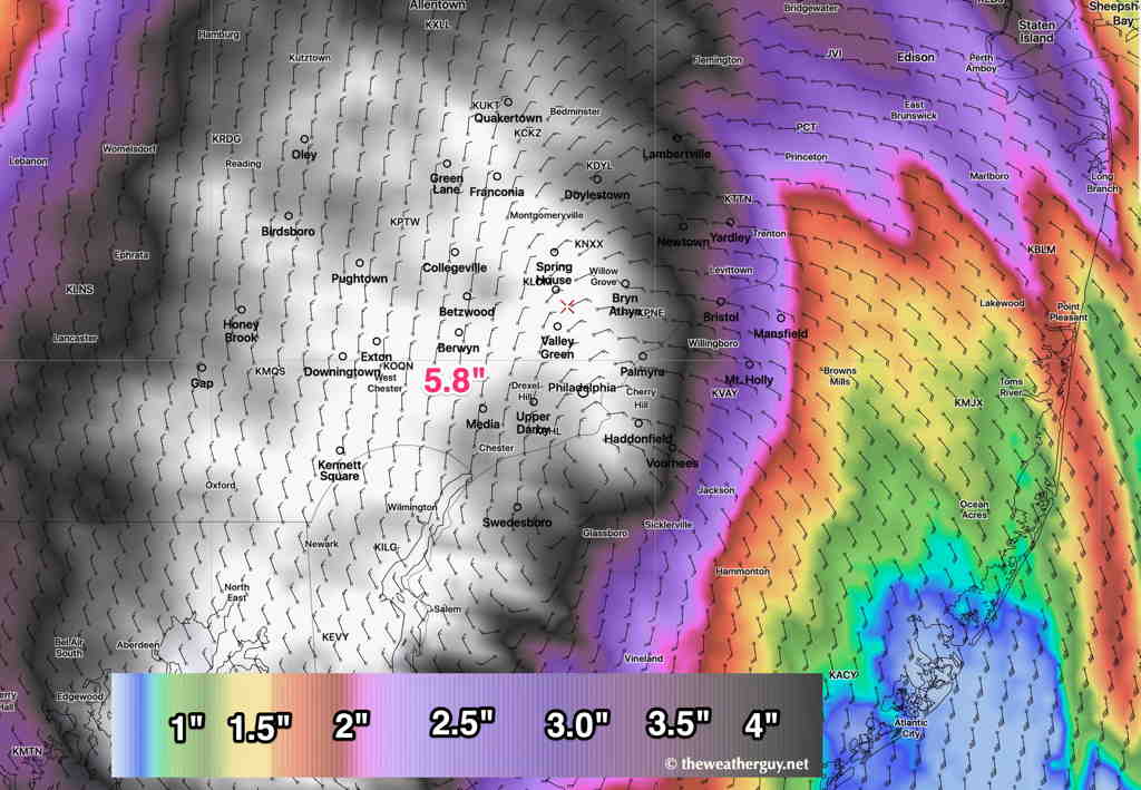
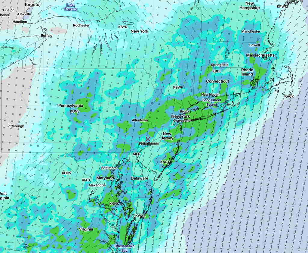
The latest NAM NEST model has the heaviest rain more westward—

NAM NEST Precip forecast (Click on image for a larger view.)

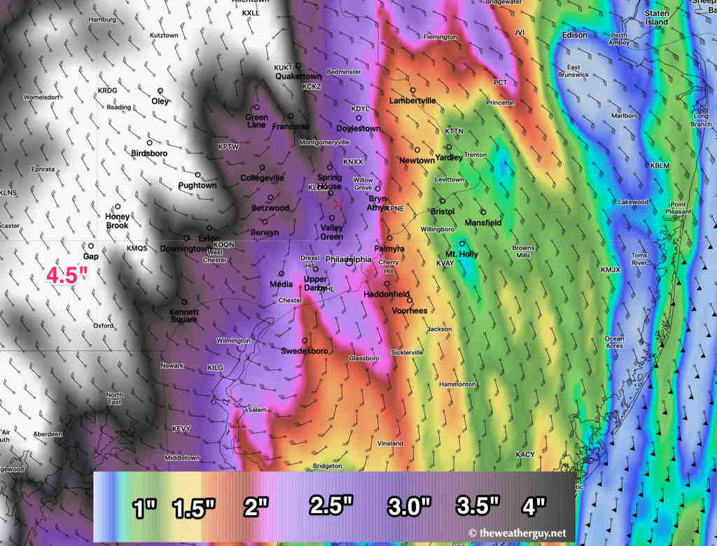
The Canadian Global (GDPS)  is also a bit westward with higher amounts—

Canadian (CMC- GDPS)  Rain Forecast (Different color coding)  (Click on image for a larger view.)

The German ICON model has a similar precip forecast—

German ICON model  (Click on image for a larger view.)

So a generalized very heavy rain event is expected

SUNDAY FORECAST UPDATE & HURRICANE ISAIAS

Sat 10:31 PM Update — Tonight’s models just coming in seem to keep most of the thunderstorms early Sunday morning to our west and north.
NAM NEST precip forecast 8 AM Sunday


Update Saturday 7:56PM— Some scattered thunderstorms also possible Sunday afternoon.  The main events will be early Sunday morning and evening as outlined below.

A warm front will move through our area between 4 AM and 8 AM Sunday morning.  Several models show showers and thunderstorms developing and moving through during this timeframe.

Showers end during the mid morning and we’ll have sunshine by the afternoon.  It will be very hot and humid!  Dew points move into the 70s and temperatures will reach a high of 91.7º sd 2.2º (high spread!)

Another round of thunderstorms are forecast during the early evening hours, between 6 PM and 9 PM Sunday.


As for Hurricane Isaias, the storm is expected by all models to move up the coast and affect our area Tuesday into early Wednesday.  The chief concern will be very heavy rain in the Philadelphia area.  Models are showing 3-5 inches of rain total. 

Last season, the Navy experimental COAMPS tropical model did very well with forecast tracks—

Navy COAMPS forecast track

As always, various hurricane models have different tracks—

Various hurricane model current forecast tracks