The cold front has taken its time moving off the coast, although last night’s models had the sun not breaking through until “mid to late afternoon”. Current radar suggests precip is lingering.
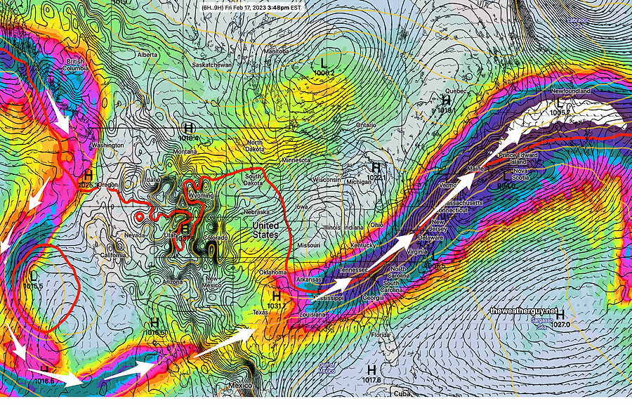
The current weather map (NAEFS) shows the jet stream winds moving up from the south while high pressure over the Great Lakes moves in from the west.
NAEFS forecast for today. Jet Stream Winds, Surface Pressure and 540 thickness line. (Click on image for a larger view.)
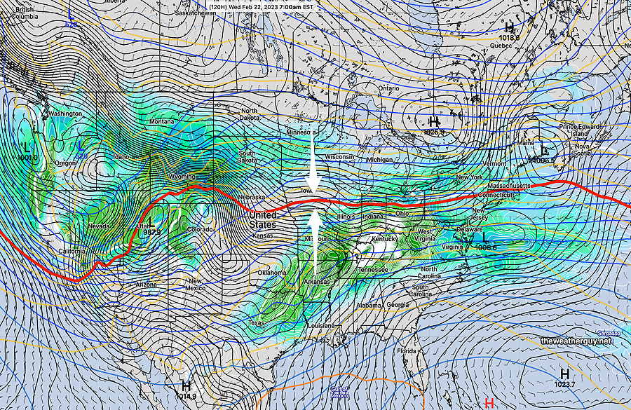
This jet stream pattern will transition to a flat (“zonal”) flow by Wednesday—
NAEFS statistical mode forecast for Wednesday. The red 540 thickness line captures the flatness of the jet flow. The model suggest a fair amount of interaction between moisture (warm) from the south and and colder high pressure to the north, with possible wave formation. This could set up an active weather pattern. Some mixed precipitation possible at some point late in the week, depending upon how things play out.
Saturday
High pressure builds in from the west but will move off to the east by Saturday night.
Sunny and seasonably cold. Still breezy, winds increase during the afternoon.
High temperature 43.5º sd 2.0º ( NBM model location – Blue Bell, PA)
Sunday
As high pressure moves off, moisture returns aloft and a significant amount of mid-level cloudiness is expected.
High temperature 51.1º sd 1.9º ( NBM model location- Blue Bell, PA)
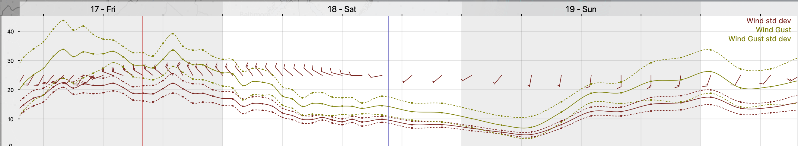
NBM Wind Meteogram for Blue Bell PA (Click on image for a larger view.)