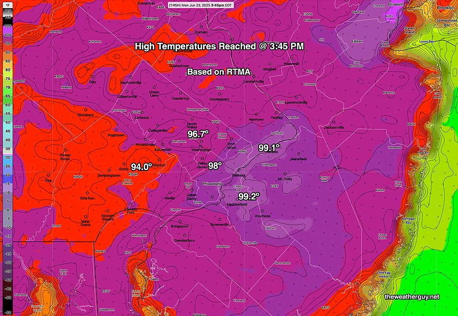
#Philadelphia #weather #PAwx #PhillyWx
Friday Forecast Update
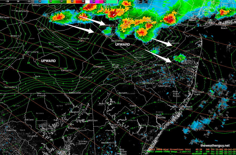
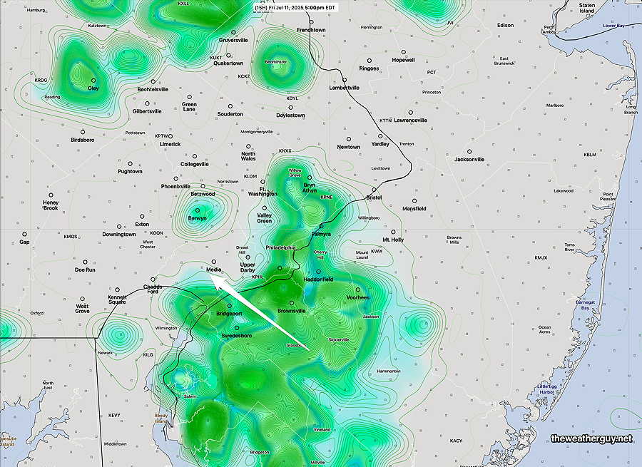
Posted Friday 07/11/25 @ 9:44 AM — The stalled front has pushed offshore but an easterly wind flow and disturbances moving up along the boundary may spark some showers and thunderstorms that move from southeast to northwest late this afternoon.
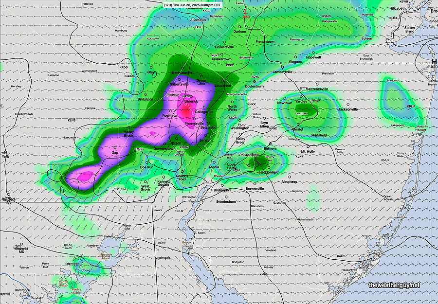
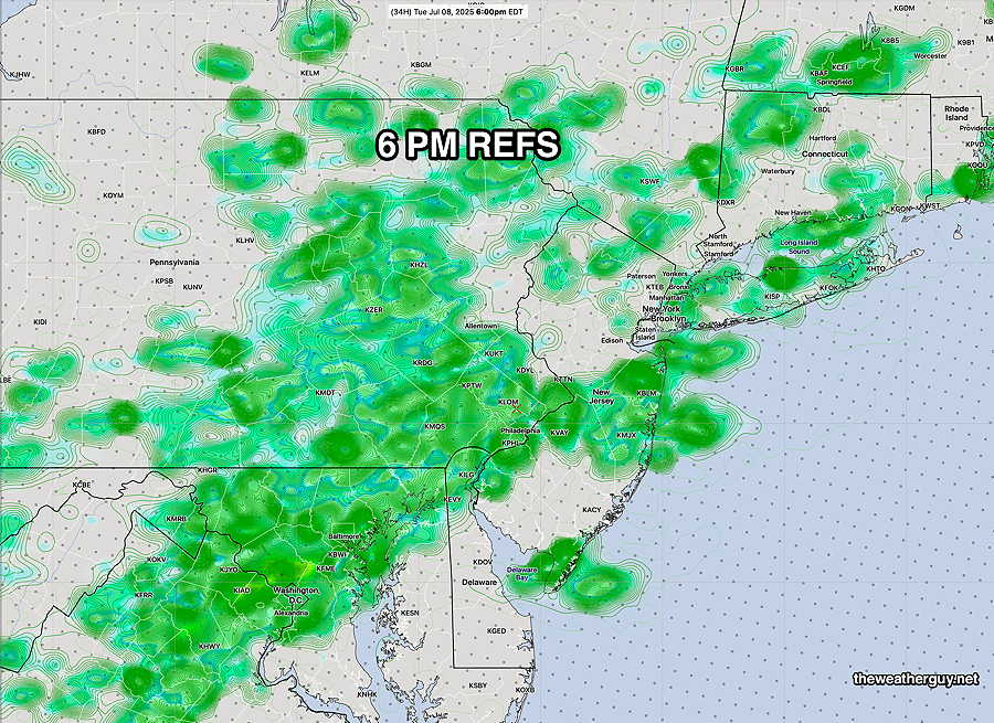
Here’s the latest available REFS—
Friday and Weekend Outlook
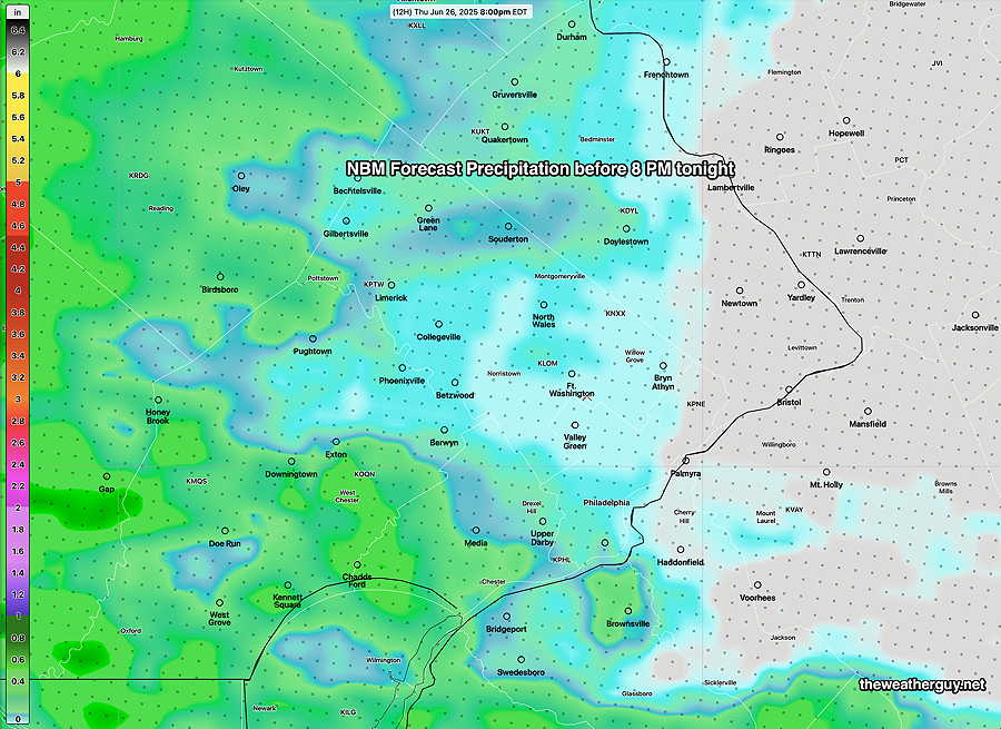
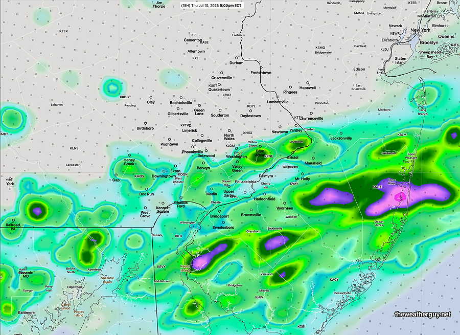
Posted Thursday 07/10/25 @ 5:40 PM — It’s been raining along the central NJ Shore much of the afternoon, as expected, the rain did not make it northwestward into Philadelphia. (The REFS over-predicted a northwestward extent.)
The Friday and the weekend looks to be drier than past days. Low clouds and patchy fog early Friday morning will give way to sunshine. An easterly wind flow will keep temperatures in the mid to upper 80s on Friday but it will still be humid with dew points in the low 70s.
Some models have widely scattered pop-up storms late afternoon and early evening Friday; most areas dry.
Saturday may have some low clouds in the morning, breaking way for sunshine through high clouds by late morning and afternoon. There’s a chance of scattered thunderstorms Saturday evening, especially further west from the city.
Sunday may have considerable cloudiness and some showers/thunderstorms to our west in the afternoon as a warm front takes shape to our south.
I’m using the term “may” here in my forecast for a reason— the weather pattern is quite diffuse and with the high humidity, any random triggers that develop can make a ‘dry’ forecast go bad.
Additionally, the weekend’s easterly/southeasterly wind flow will bring some uncertainty to the forecast regarding temperatures and the potential of wind convergence causing showers.
Things may clarify by tomorrow.
Thursday Forecast Update
Posted Thursday 07/10/25 @ 11:09 AM — This morning’s REFS does show some shower/thunderstorm activity somewhat further north, into Philadelphia, by this evening. Pop up storms possible later in the afternoon.
Posted Thursday 07/10/25 @ 8:23 AM —A quasi-stationary frontal boundary remains over our area. Moisture moving up from the southwest will result in considerable cloudiness, but with the lack of sunshine, instability from daytime heating will be reduced. That means less chance of showers and thundershowers today, especially from northern parts of Philadelphia and northward.
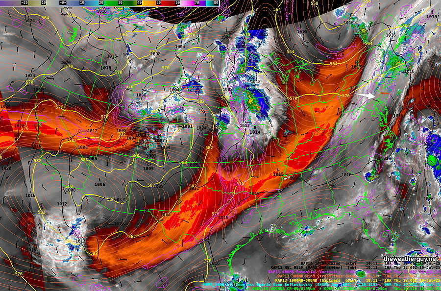
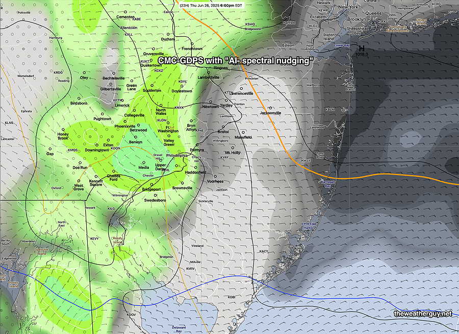
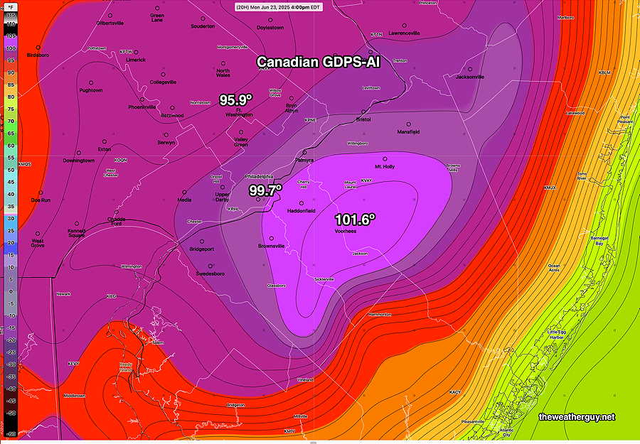
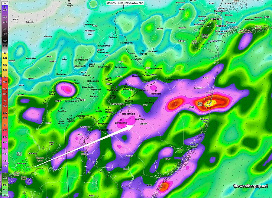
The current Canadian GDPS with “AI Spectral Nudging” captures the northwest extent of the showers today—
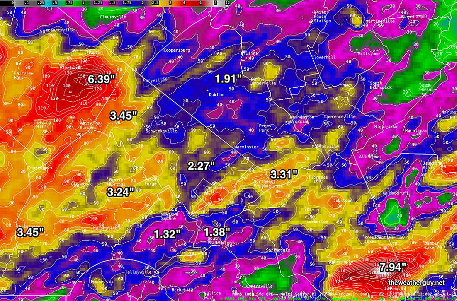
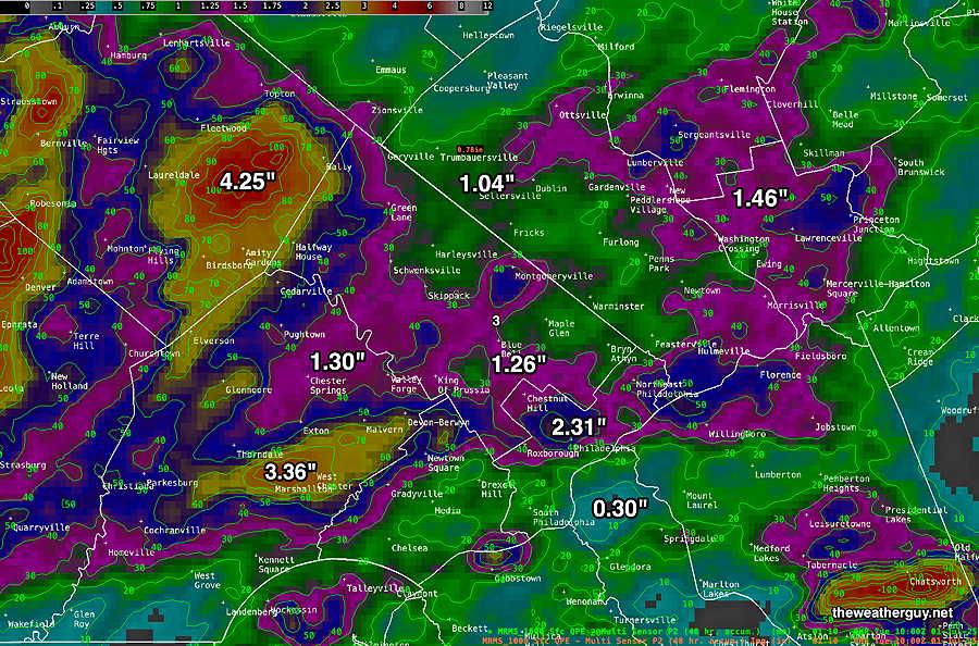
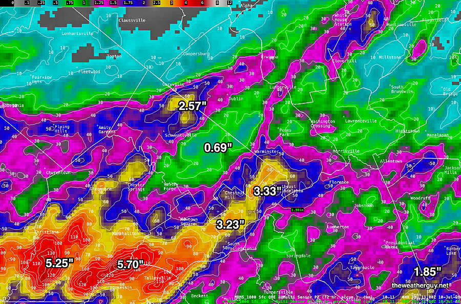
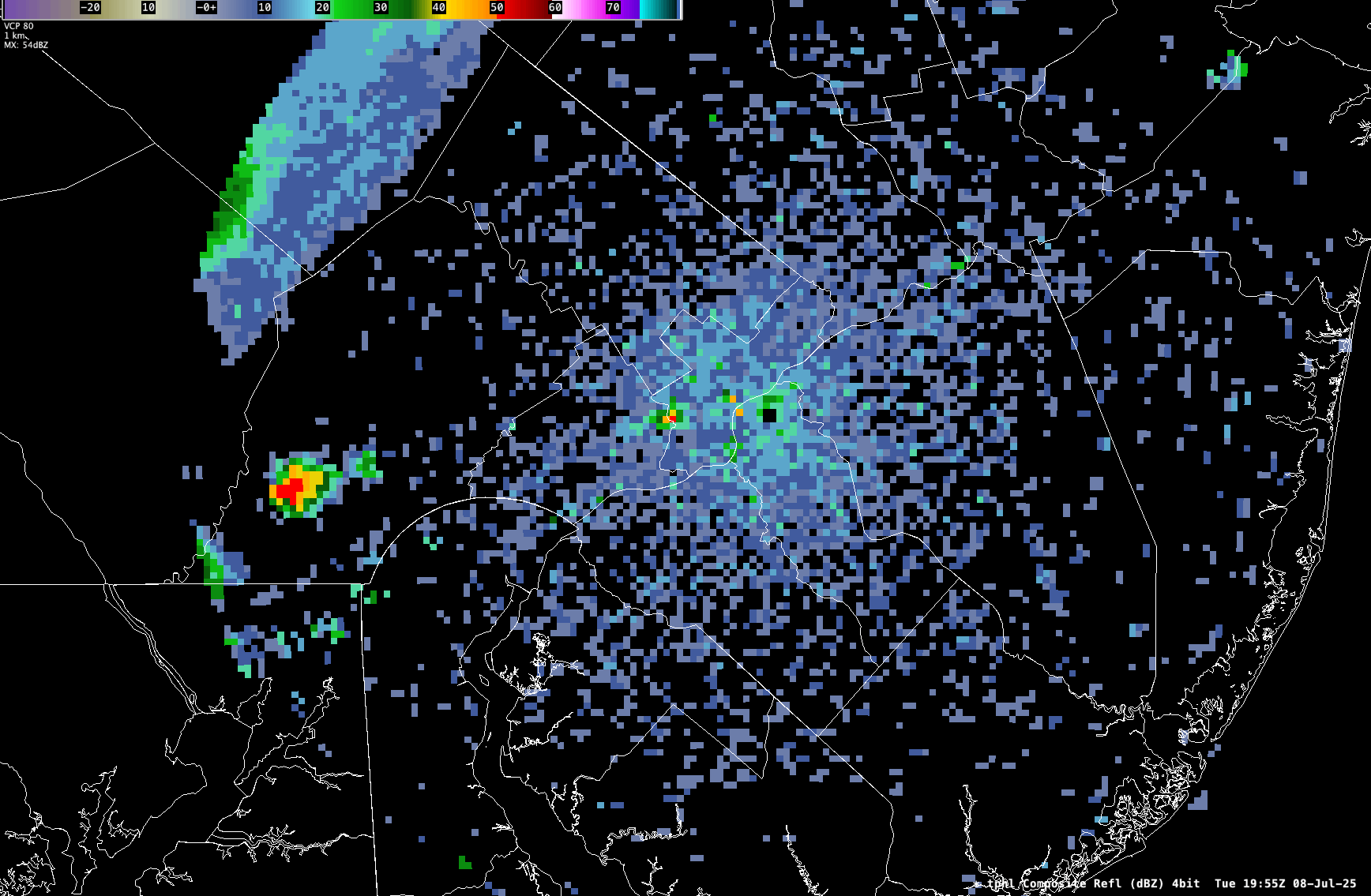
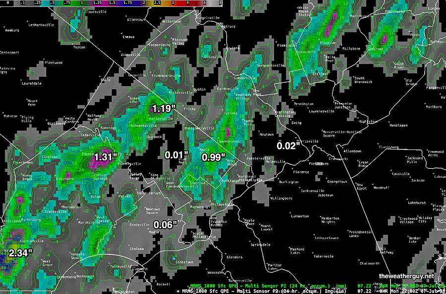
Here’s the latest past 72 hours MRMS precipitation estimate—
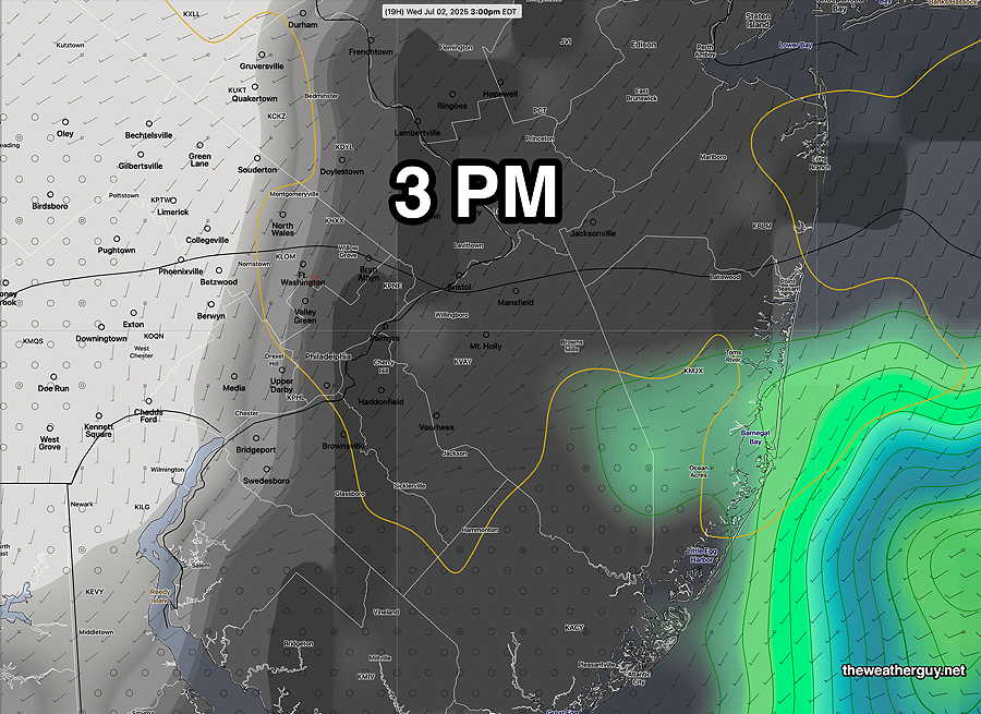
Wednesday’s Storms Update
Posted Wednesday 07/09/25 @ 11:38 AM — The latest HRRR (12z) and REFS/RRFS (06z) are available. The storms and rain will follow a similar timing as Tuesday, with some rain and storms popping up in western suburbs as well as South Jersey by 3-4 PM.
Additional storms form and move across the area from 4 PM through 1 AM Thursday morning. The heaviest activity will be just south and east of the city, near Swedesboro and Bridgeport NJ.
Let’s jump right to the “Severity Comparison Chart”
| Severity Parameter (HRRR) |
Sept 1 , 2021 Tornado Outbreak (example of highly severe) |
Recent 4-1-23 Tornadoes (Example of severe) |
Yesterday 07-09-25 Tornadoes |
Today |
Notes |
| CAPE Joules/kg |
3500-4200 ⚑⚑⚑⚑ |
2100 ⚑⚑ |
2680 ⚑⚑ |
3650 ⚑⚑⚑⚑ |
S Jersey |
| Helicity m^2/s^2 |
1350 ⚑⚑⚑⚑⚑ |
655 ⚑⚑ |
403 ⚐ |
360 ⚑ |
|
| Vertical Shear 1/sec |
40-46 ⚑⚑⚑ |
40-45 ⚑⚑⚑ |
20 ⚐ ⇩ |
32 ⚑⚑ |
|
| Precipitable Water | 2.7″ ⚑⚑⚑⚑ |
0.83” ↓ |
2.6″ ⚑⚑⚑⚑ |
2.6″ ⚑⚑⚑⚑ |
Heavy rain potential |
| Lifted Index º K |
minus 6º ⚑⚑ |
minus 9.3º ⚑⚑⚑ |
Minus 8.3º ⚑⚑ |
Minus 8.2º ⚑⚑ |
|
| HRRR Hail inches |
1.9 ⚑⚑ |
1.4 ⚑ |
1.8 ⚑⚑ |
1.7″ ⚑⚐ |
|
| Peak Wind Gusts mph |
40-50 ⚑⚑ |
40-50 ⚑⚑ |
51.6mph ⚑⚑ |
35-41mph | NJ area |
| Storm Motion Shear Vector Alignment |
Aligned – ~ 90º ⚑⚑ |
Almost aligned ⚑⚑ |
Somewhat aligned ⚑ |
Poorly aligned ⚐ |
|
| 250 mb Jet Stream Wind mph |
63 ⚑ |
135 ⚑⚑ |
41 ⚐ ↓ |
61 ⚑ |
↓ indicates works against Severity ⇩ Significant, but less impact
Many of the severity parameters are similar to those yesterday and it will be difficult to predict in advance whether the storms will be as severe. With temperatures lower and less sunshine today, my guess is for the storms not to be quite as bad. But these things are difficult to predict. There’s more jet stream energy today and much more vertical shear, making it more likely that any storms will maintain their punch.
Wednesday’s Storms
Posted Wednesday 07/09/25 @ 8:38 AM — Just enough time this morning for a quick update. Yesterday’s short wave pulled down a indistinct frontal boundary to just south of Philadelphia.
Several waves will develop along this boundary, causing thunderstorms to again develop and move through. The main area today will be Philadelphia and just south. Northern suburbs may not see much activity. Chester, Delaware counties and southern NJ will be the main target areas to watch. Heavy rain again a possibility.
I’ll update later this morning with new models.
However, my update (below) posted at 3:51 PM showed very impressive vertical motion ahead of the line of storms to our west, and the greater strength of the storms was less of a surprise when they moved in.
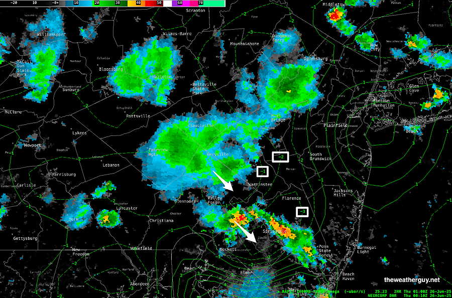
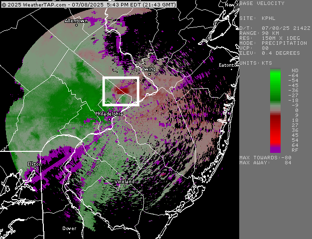
Several tornadic signatures showed on radar. Here’s one that was impressive in upper Montgomery county—
Another tornadic signature in eastern Montgomery county may or may not be an actual tornado.—
What was really impressive was the experimental REFS model which was accurate with its timing of the lead storms in Philadelphia and the subsequent storms that are still lingering. The HRRR, our current high resolution operational model, really got the timing of today’s storms wrong.
The REFS is scheduled to become operational in early 2026, if NOAA is allowed to do its wonderful job. The REFS and the RRFS will be replacing several older, less-skillful “legacy” models such as the NAM and HREF and HIRESW-ARW models.
More about this on my RRFS page.
“Tracking” Storms?? What does that really mean??
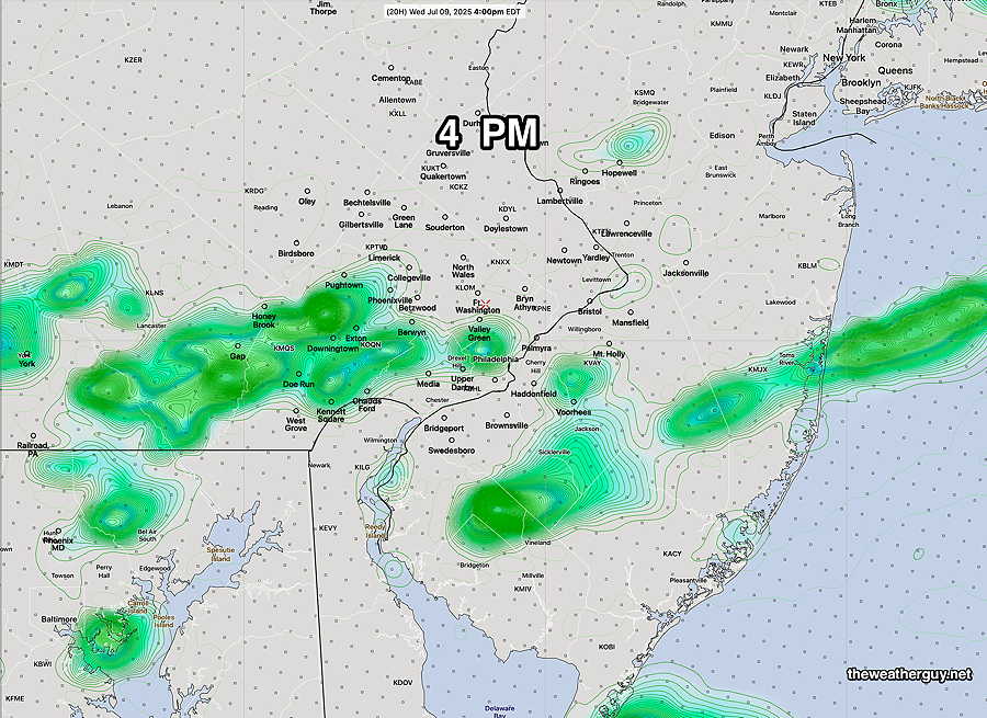
As I’ve said here before, I avoid the using the expression “tracking” the storms. The TV people use this all the time. Storms, and especially thunderstorms, are dynamic processes. They can form at a point almost instantly. They’re not a train that arrives at a scheduled time. There’s nothing to “track”. Case in point are the storms that just formed over Center City after 4 PM.
The appearance of these storms between 4-5PM suggests the REFS is doing a great job with thunderstorms.
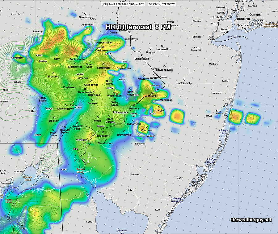
Tuesday’s Storms Update
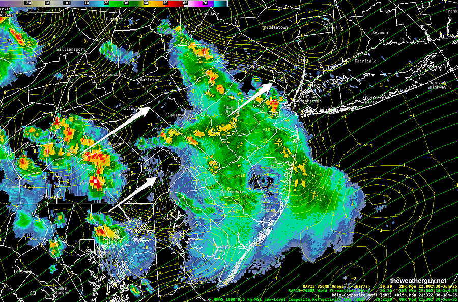
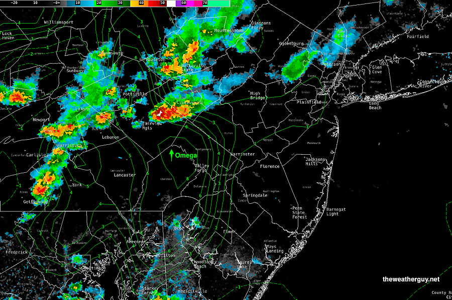
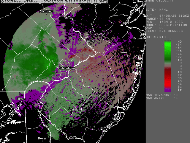
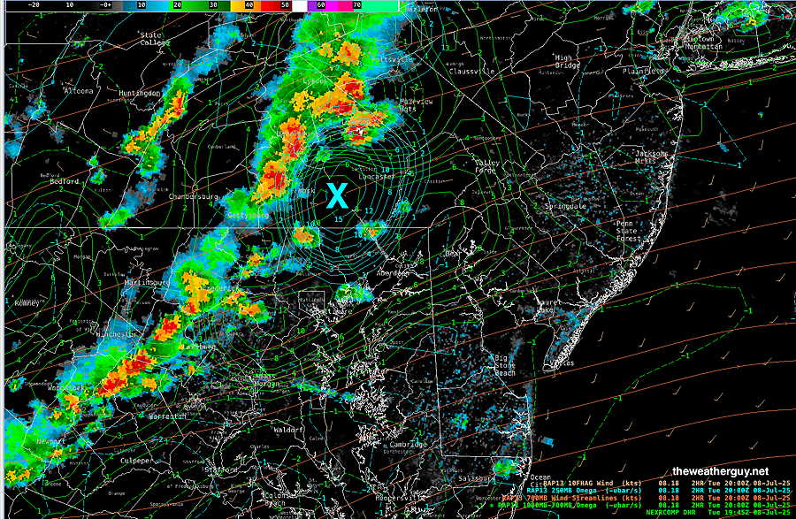
Posted Tuesday 07/08/25 @ 3:51 PM — At 3:45 PM, radar and hourly updated RAP model shows a line of storms far west of the city with significant upward vertical motion (vertical velocity pressure, Omega) ahead of the line. This signifies likelihood of significant strengthening of storms as they approach our area—
The latest REFS (experimental) shows some storms develop here as early as 5 PM, but the main batch of storms arrive near the city between 6 and 8 PM.
For comparison I’ve resurrected an old table with some significant storm histories. The highlighted column is today’s severity parameters and allows you (and me) to compare with today’s values.
| Severity Parameter (HRRR) | Sept 1 , 2021 Tornado Outbreak (example of highly severe) | Recent 4-1-23 Tornadoes (Example of severe) | Recent 08-07-23 18z HRRR Bow Echo | 07-08-25 Today’s 18z HRRR & Impact | Notes |
| CAPE Joules/kg | 3500-4200 ⚑⚑⚑⚑ | 2100 ⚑⚑ | 2600 ⚑⚑ | 2680 ⚑⚑ | |
| Helicity m^2/s^2 | 1350 ⚑⚑⚑⚑⚑ | 655 ⚑⚑ | 726 ⚑⚑ | 403 ⚐ | |
| Vertical Shear 1/sec | 40-46 ⚑⚑⚑ | 40-45 ⚑⚑⚑ | 30 ⚑ | 20 ⚐ ⇩ | |
| Precipitable Water | 2.7″ ⚑⚑⚑⚑ | 0.83” ↓ | 2.1″ ⚑⚑ | 2.6″ ⚑⚑⚑⚑ | Heavy rain potential |
| Lifted Index º K | minus 6º ⚑⚑ | minus 9.3º ⚑⚑⚑ | minus 9.9º ⚑⚑⚑ | Minus 8.3º ⚑⚑ | |
| HRRR Hail inches | 1.9 ⚑⚑ | 1.4 ⚑ | 1.8 ⚑⚑ | 1.8 ⚑⚑ | |
| Peak Wind Gusts mph | 40-50 ⚑⚑ | 40-50 ⚑⚑ | 65mph ⚑⚑ | 51.6mph ⚑⚑ | NJ area |
| Storm Motion Shear Vector Alignment | Aligned – ~ 90º ⚑⚑ | Almost aligned ⚑⚑ | aligned ⚑⚑ | Somewhat aligned ⚑ | |
| 250 mb Jet Stream Wind mph | 63 ⚑ | 135 ⚑⚑ | 74 ⚑ | 41 ⚐ ↓ |
↓ indicates works against Severity ⇩ Significant, but less impact
I just want to add that the HRRR shows the heaviest storms moving north and south of the immediate PHL area. Not true of the REFS and RRFS. Something to watch.
Due to the highly unbalanced political environment on X, I’ve considerably cut back auto-posting there. To receive all of my forecast postings, I suggest following me on mastodon.social or bluesky.social
Tuesday’s Storms Update
One More Thing: the latest Canadian GDPS “with AI nudging” also suggests earlier timing, as early as 4PM, similar to the REFS below.
Posted Tuesday 07/08/25 @ 7:28 AM — A potent short wave and front will move through Tuesday evening. Ahead and along with this disturbance will be strong dynamics that promises more wide spread heavy rainfall and the potential for somewhat more severe storms than Monday.
In terms of timing, the REFS (experimental) still shows some showers/storms as early as 3-5 PM in the western suburbs, then moving eastward. The latest RRFS (experimental) continues to be about two hours later, with storms approaching the immediate PHL area around 6-7 PM.
The latest HRRR shows storms approaching the immediate PHL area around 6-8 PM, somewhat earlier in western suburbs.
In terms of severity, greatest likelihood is in western sections about 5-7 PM. Heavy rain possible throughout the area.
Tuesday Storms
Posted Monday 07/07/25 @ 7:59 PM — Just wanted to add that the GFS shows some storms in Harrisburg moving through our area around midnight. Not shown in REFS or RRFS forecasts for tonight (Monday).
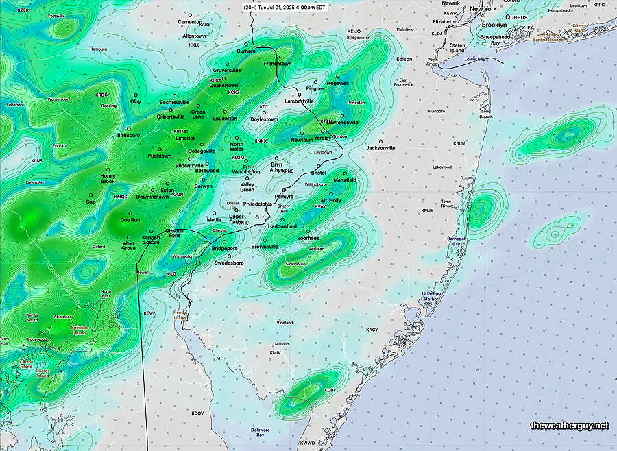
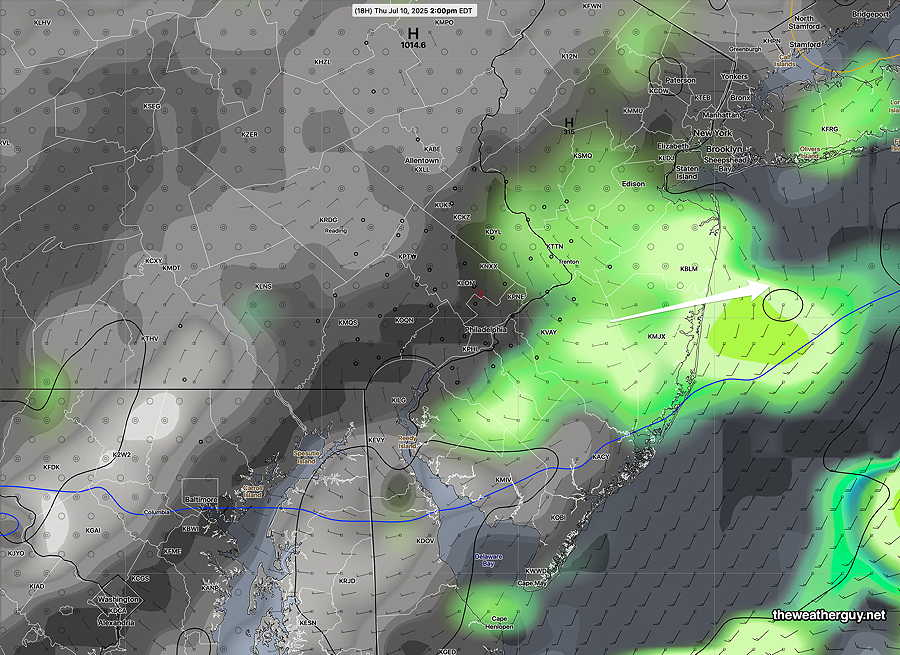
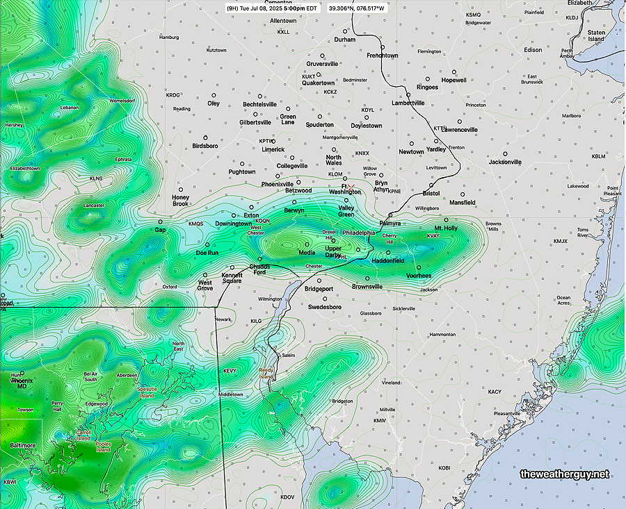
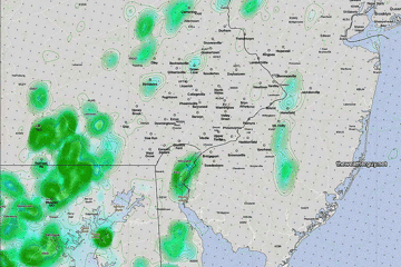
Posted Monday 07/07/25 @ 7:33 PM — The storms developed in many (but not all) areas around Philadelphia this afternoon. Here’s the MRMS rainfall totals—
Tuesday should be mostly sunny hot and VERY humid again. A slight dip in the jet stream and a potent ‘short wave’ will approach, causing the development of widespread showers and thunderstorms beginning about 4 PM. Additionally, we’ll be near the right entrance region of a jet streak, enhancing available energy.
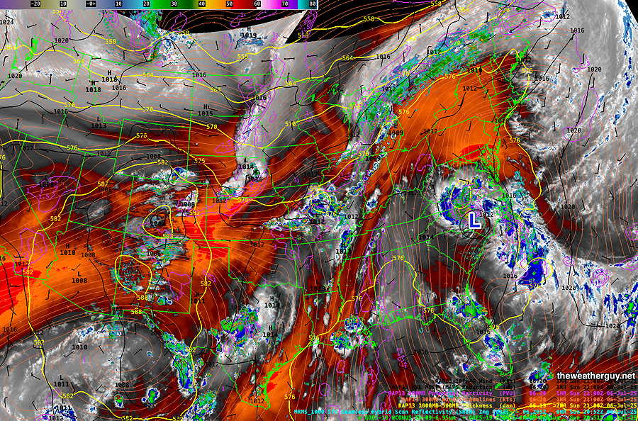
The latest GFS shows this potent area of upward motion around this short wave.
The REFS did well today and I’ll stick with its forecast for Tuesday.
The REFS has showers breaking out west of the city as early as 3 PM, but widespread showers and thunderstorms are expected by 4-6 PM.
(It should be mentioned the the latest RRFS has the storms moving in about 2 hours later than the REFS shown above. )
Several hours of widespread rainfall are expected with storms moving into NJ by 5-6 PM. Localized areas of 1-3″ of rain expected. Unlike today’s storms which were mostly heavy rain, Tuesday’s storms will have somewhat higher vertical wind shear and areas of elevated helicity. Some severe storms possible, especially into South Jersey and Delaware.
Monday Update
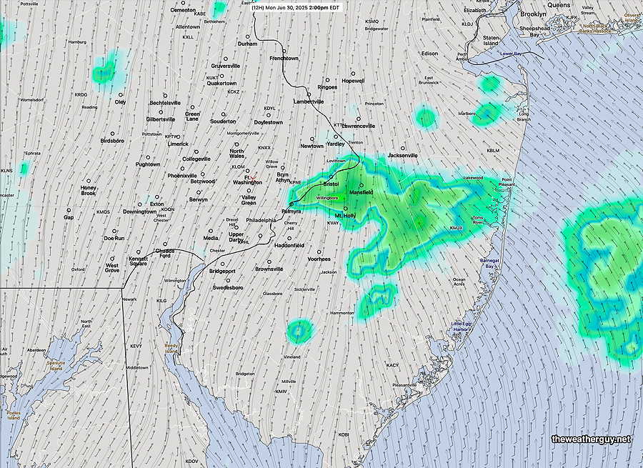
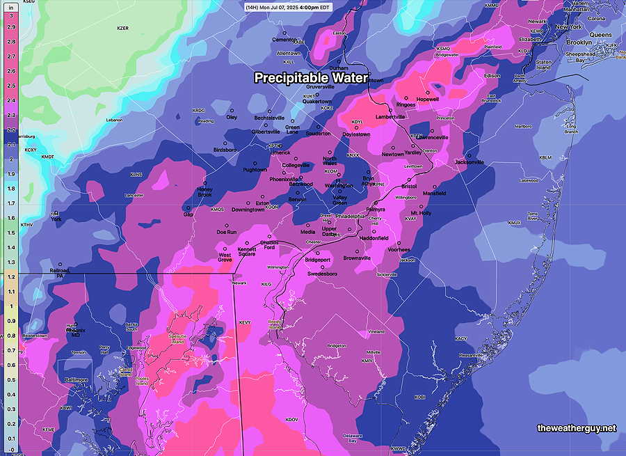
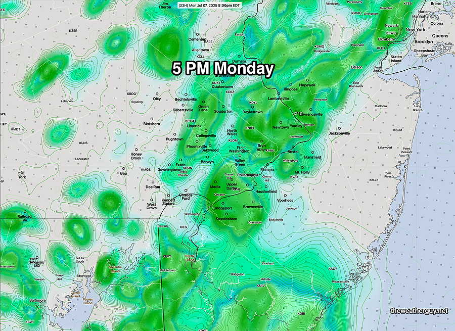
Posted Monday 07/07/25 @ 10:10 AM — The moisture associated with the remnants of tropical depression Chantal have started to move across our area today. Any sunshine will induce instability and thunderstorm formation. Here’s the latest REFS hourly rain forecast at 1 PM, 3 PM and 5 PM today—
Most of the activity will be in the afternoon hours and taper off by 9 PM.
Showers will be scattered, but any storm will be slow moving and capable of dropping heavy rainfall. Precipitable water forecasts are as high as they get around here, 2-3″ – 2.5″ in some areas. Flooding type rains are possible.
Originally Posted Sun 5:37 PM —The remnants of tropical depression Chantal are located in North Carolina and the moisture and energy of this weak system is expected to move over our area on Monday.
Some showers are breaking out in Delaware at this time (Sunday evening) and some showers may make into Delaware County and just south of the city by 8 PM.
More numerous showers and thunderstorms will develop on Monday. Shear and helicity values are weak. The main issue with these showers and storms will be the possibility heavy, slow moving rainfall. The showers will be scattered.
For Monday, a few scattered showers are possible in the morning, but the real deal will be during the afternoon where daytime heating will induce these showers and storms. 2PM to 8 PM will be the likely time slot with showers peaking around 4PM – 5 PM Monday. It will be warm (mid 80s) and VERY humid.
Here’s the latest REFS forecast for 5 PM
Daytime hours on Tuesday look to be dry until about 4 to 8 PM, when showers and storms move in from the southwest. It will be very warm and VERY humid on Tuesday