Saturday night’s model runs briefly showed the possibility of snow, however subsequent model runs have all moved to predicting mostly rain for our area Thursday into Friday.
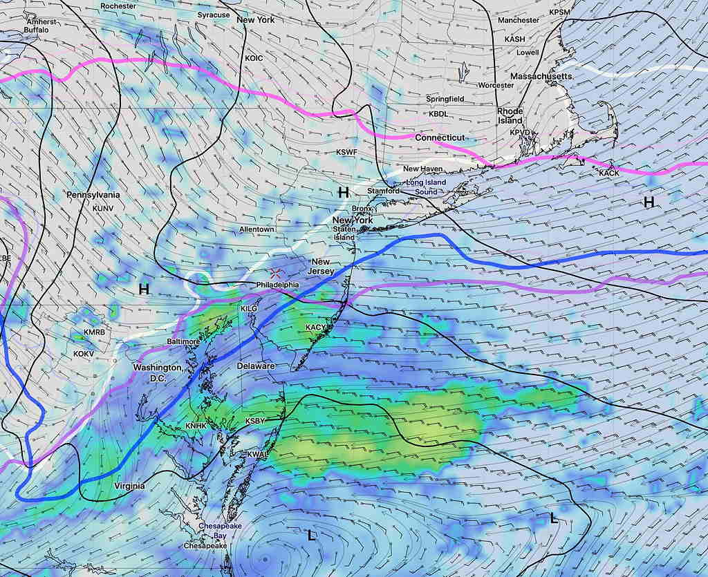
A slow moving cold front in the Midwest will have waves of low pressure move up along the front, bringing rain, possibly heavy for Thursday into Friday. The precipitation starts late Wednesday evening or Thursday after midnight. Some areas to the northwest of Philadelphia will have a period of freezing rain or sleet before daybreak, before changing to all rain.
NAM forecast Simulated Radar for 1 AM Thursday morning – north and west of white line is below freezing at surface- possible freezing rain/sleet. The warm air advances northward by daybreak.
As often happens with the afternoon “off-hour” runs of the models, the forecast can be pushed off course. Such was the case with this afternoon’s NAM. One of these days, I’ll stop looking at them.
Tonight’s latest NAM and GFS models have become available. The trend is towards colder temperatures and higher QPF values.
The NAM has a QPF of 0.89 inches water and the GFS has 0.73.
If this were a straight forward forecast, this would be a 7-10 inch snowfall, even for Philadelphia. However, there’s a few glitches.
The temperatures at critical levels of the upper atmosphere are a bit warm for snow. We’ve had similar data where we have had snow but other times, there was significant sleet and rain in the mix, making the snowstorm forecast a bust.
Here’s my take. Having seen the new NBM correctly predict precipitation type, I’m leaning on it heavily for this forecast, along with NAM thermal profiles.
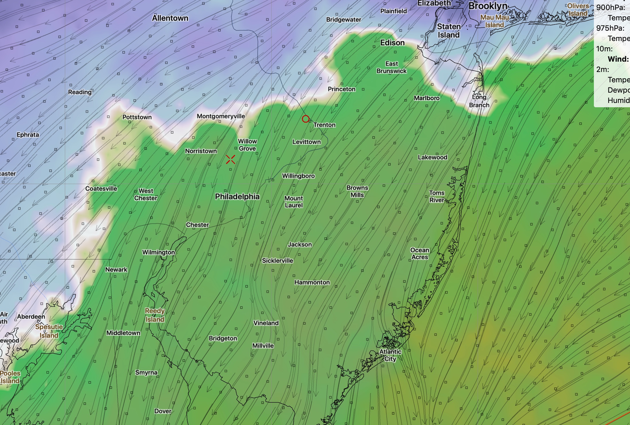
A mix of rain sleet and snow will begin about 3-5 PM The mix will continue, leaning towards a shift to more sleet and rain between 7 and and 11pm in the area south of the white line in graphic below.
Transition line snow – sleet rain
Areas northwest of this white line will be all snow. Total snow accumulation In those areas about 5-8 inches by daybreak Monday.
Areas south of this white line will have a considerable amount of sleet and rain in the mix for at least 1/3 of the total storm QPF, during the heaviest precipitation time. This will significantly reduce total snow accumulations. The sleet line moves back south after midnight, as shown in my earlier afternoon post.
It’s an educated guess but the area from the Delaware river north to that white line may have 2-4 heavy inches. I think the warmer temperatures aloft will play a big role in keeping those numbers lower than they would be otherwise as a result of the sleet rain mix. Very cold temperatures follow later Monday.
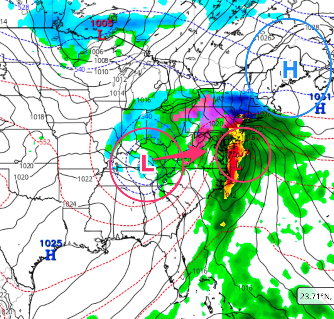
An interesting weather setup is being forecast by most models for Thursday into early Friday for our area.
There’s a blocking high pressure system and an upper cut off low in the midwest.
Upper Low- Blocking High Setup NAM model- Thursday evening.
The blocking high pressure will give us the low level cold damming effect, trapping cold air at the surface. This is what will give us the chance of sleet/freezing rain Thursday morning.
The upper low in the midwest will merge with the surface low on the coast. This will cause intensification of the surface low Thursday night, bringing in enough cold air to turn precipitation to snow Thursday night into early Friday morning.
Let me start by saying that Thursday early morning rush hour should be OK, but moisture moving in from the south during the morning will fall mostly as sleet and freezing rain, especially north and west. (There may be a few snowflakes at the very start.)
I do NOT think we will get snow in the immediate PHL area and surrounding suburbs on Thursday morning or afternoon. This is a sleet/rain event for much of Thursday. Despite the fact that the GFS is calling for snow, based on critical atmospheric thickness levels and the NAM, I think this will be sleet/freezing rain to rain event for early Thursday into Thursday afternoon.
Here’s where things get interesting for late Thursday into Friday, something I alluded to yesterday—
Sometime late Thursday into Thursday evening, the upper cut off low is expected move and merge with the coastal system, causing rapid intensification. The increase in the precipitation rate and the cold air associated with the upper low will cause precipitation to change to snow in the immediate PHL area Thursday night into daybreak Friday. Too early to determine if there will be any accumulations. (The latest GFS doesn’t bring in that much cold air aloft.)
As stated in recent posts, the models have been anything but consistent over the past week. But this scenario has been solidifying over the past two days. Stay tuned.