Tag Archives: Climate Forecast

WINTER 2022-2023 SNOW OUTLOOK

I’m often asked around this time of year whether we’ll get a lot of snow in the coming winter. My response over the past two to three winters has been that I don’t see any pattern evolving that would give us a greater likelihood for large snowfalls.

All I would say is that large temperature swings would be something to expect. The last three winters have been light on large snowfalls with large swings in temperatures every few weeks.

The large swings in temperature are likely to continue this winter.

In years where I see a pattern evolving, I usually wait until the first week of December to make the call. But this year, I’m chiming in early.

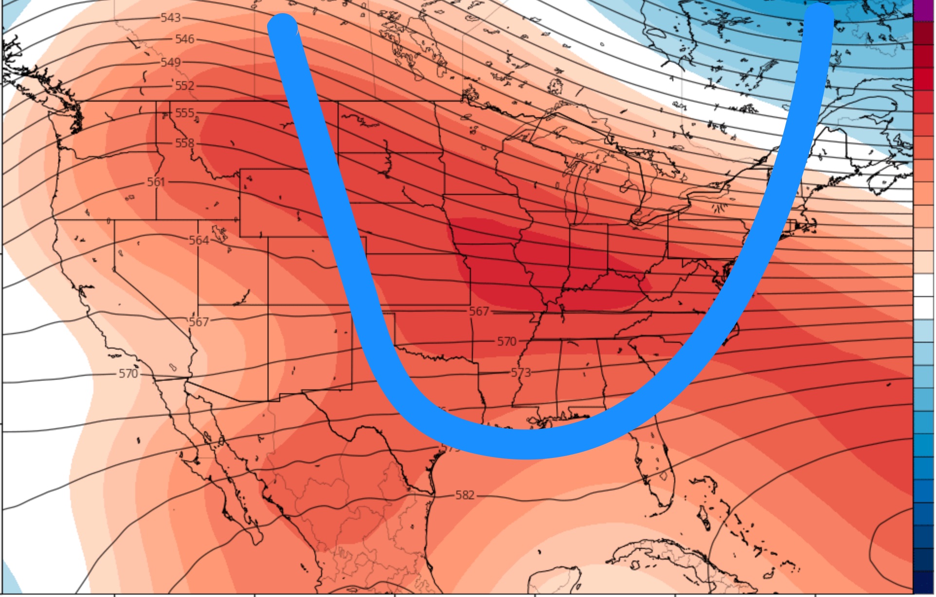
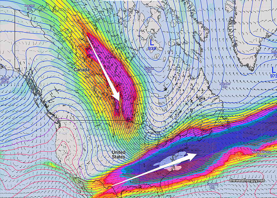
Let me cut to the chase— The jet pattern I’ve seen develop over the past month hasn’t been seen in several past winters. If it continues, it translates into more frequent coastal storm development with higher snowfall amounts this winter for our area.

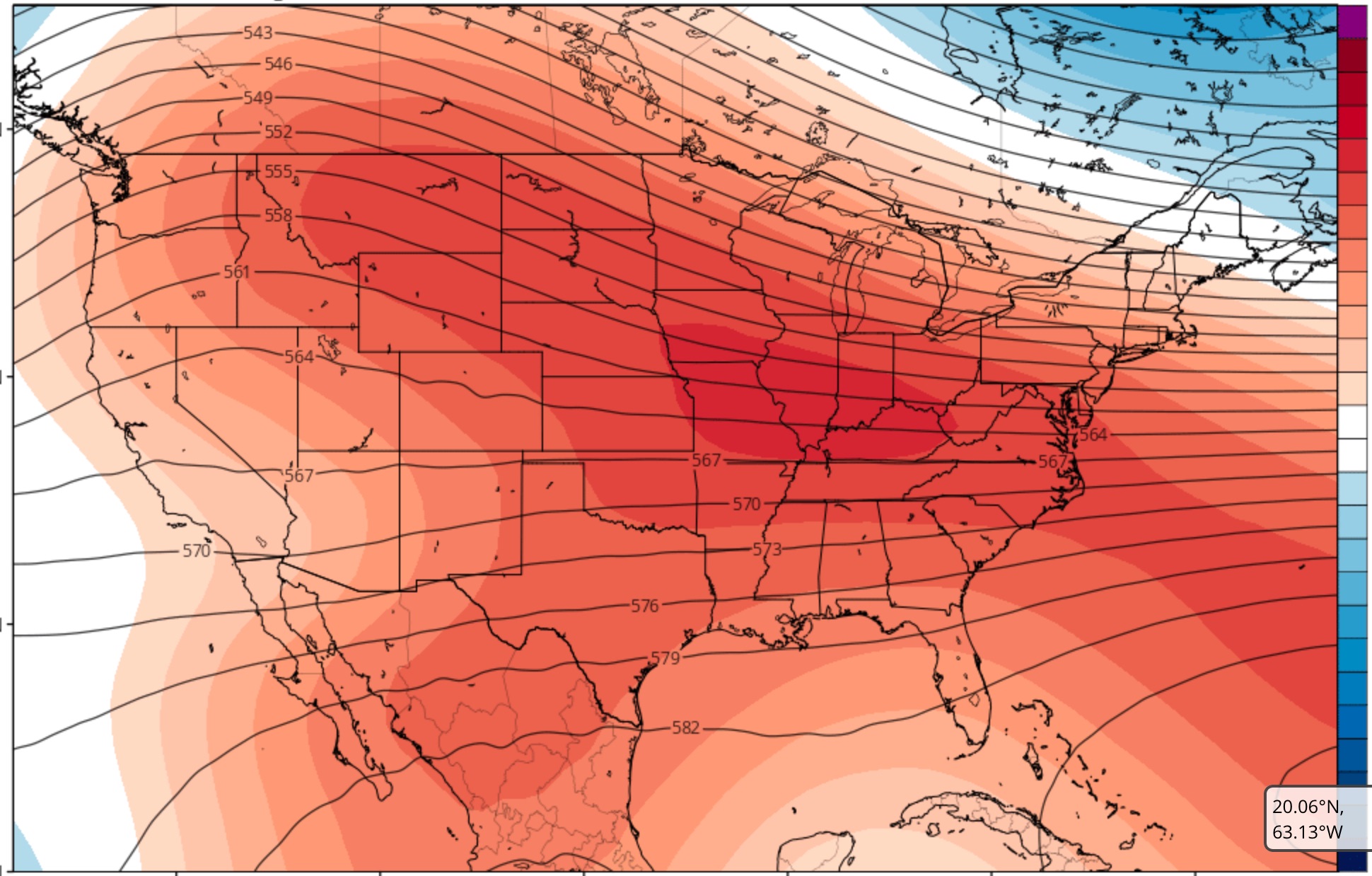
The jet stream pattern forecast for this weekend captures the setup—

NAEFS forecast jet stream (250 mb winds) for Saturday. Plunging jet stream in central Canada with strong southern stream jet flow converging. This is a very different setup than we saw much of last winter where the plunge of cold air was much further into eastern Canada.

Climate forecasts are tough and even the experts at the NWS Climate Center have not always done well. Climate forecasts and weather forecasts, while they may appear on the surface to somewhat similar, are very different sciences. Climatologists even have their own models.

I’m more knowledgeable about weather compared to climate, but I’ve been looking at the maps these past few weeks and I wanted to share what I see in them a bit earlier in the season than usual.

While I’m at it, we need to keep an eye on Thanksgiving weekend, especially next Friday night into Saturday. Our first taste of either light snow or a mix is possible.

WEATHER OUTLOOK

Two more rain storms forecast for this week –one Thursday (possibly missing us, staying to the south) and on Saturday.   The Saturday storm may be a nor’easter, but the lack of cold air makes this an atypical nor’easter for January.  It looks like rain!

The current weather pattern is quite anomalous for January.  There’s little evidence of deep intrusions of cold air into the  continental US for the first two to three weeks of January!

There will be short duration cold air intrusions  into the Northeastern US which will alternate with mild air and wet flows from the southwest.

The current climate model forecast captures this nicely:

CFS Forecast for the first week in January (areas in red/orange are above average upper air heights associated with above normal temperatures.)

What we need for winter to return is for the height contours (shown in black) to take the following configuration, (shown in blue.)

Blue line drawn shows typical configuration for cold air intrusion in January

Obviously, there  would have to be giant changes in the current weather pattern to support my early December climate forecast of significant cold weather and significant precipitation.  I’m not very confident about that forecast at this time.

So enjoy the relatively mild weather!

The current long range climate models show colder intrusions around the third to fourth week in January, a time when we usually get the “January Thaw”.