
Light Snow Possible before Daybreak Wednesday
Update Tue 01/31 @ 4:32 PM — Just a quick update…latest ECMWF and NAM-NEST are forecasting very light snow between 3 AM and 6 AM Wednesday morning. A light dusting possible less than 0.20 inches, especially in South Jersey.
Who Predicted This Wet Snow?
Update Tue 01/31 @ 3:20 PM — So, I’ve been “off-duty” the past two days and I haven’t done a daily forecast, just a jet stream over-view yesterday. But I’m pretty sure I heard the forecast on the radio— ”some showers possible in the morning’. That was about it.
We’ve had very light, wet, non-accumulating snow falling for the past 4-5 hours.
So folks, this is going to have to be a Retroactive Forensic Forecast to answer the question, “what the heck is going on??”
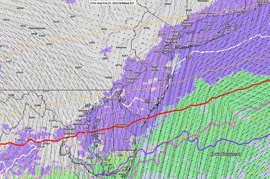
Basically a cold front went through overnight, as had been forecast. Looking back at last night’s models, several were hinting for the front to stall just to our south and several waves of low pressure have apparently formed along the stalling front. That said, this morning’s HRRR had light rain, not light wet snow, and ending earlier than it has.
This morning’s GFS was not capturing this afternoon’s wet snow in its forecast, although the wavy nature of the thermal contours is apparent—
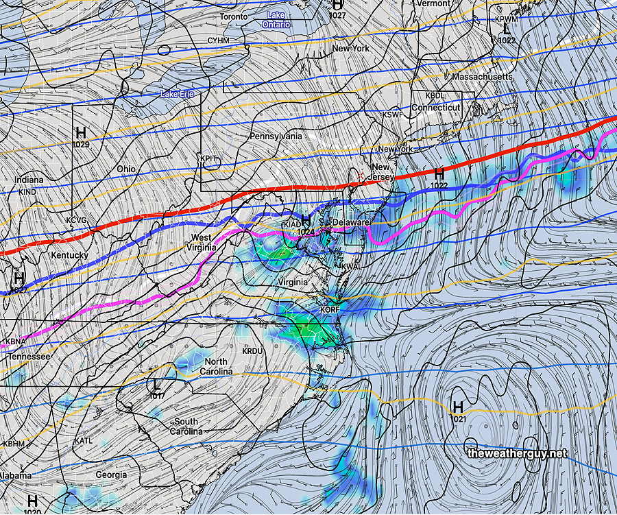
I’ll have to check to see if there are any more surprises in store for us. Stay tuned.
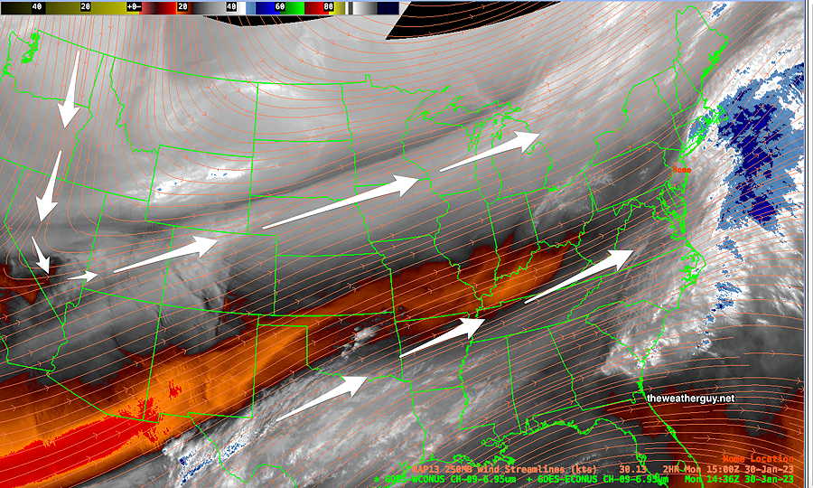
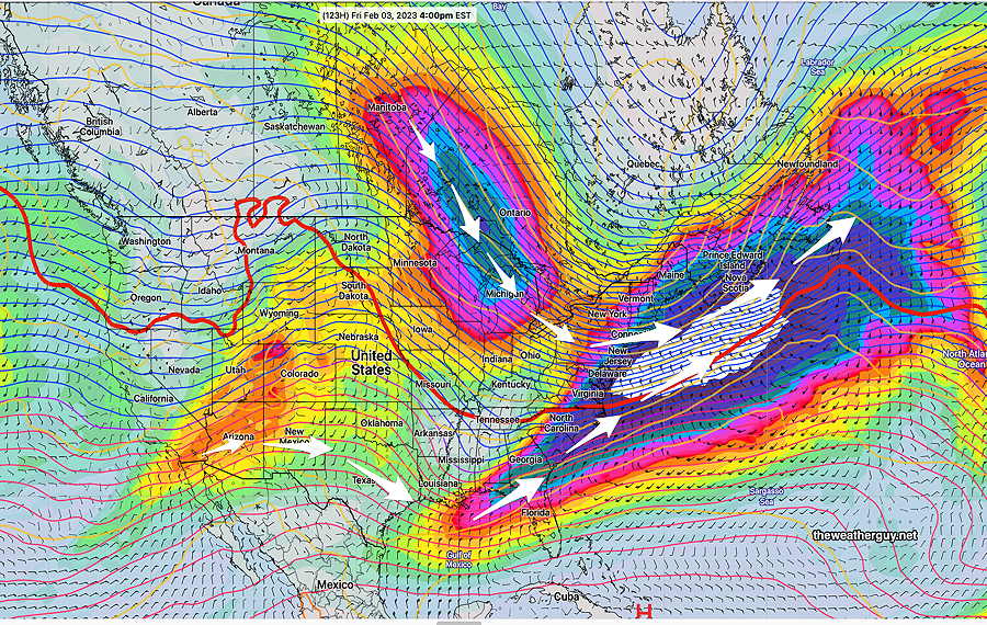
Transitioning Jet Flow
#weather #paweather #wx #pawx #philadelphia
The NWS has an Impact Based Decision Support Services (IDSS) website that provides detailed and up to date hour-by-hour weather information and forecasts. There’s a button that allows you to save a specific location URL to your web browser Favorites or Bookmarks.
Excellent! Better than most weather mobile apps!
A split jet flow, flat in our area, will transition to a trough by Friday. Most systems will pass by to our south and to our north through Friday.
Current Water Vapor Image shows jet positions—
By Wednesday, things begin to change. Here’s the NAEFS model showing more detail at jet stream wind level as it transitions on Wednesday —
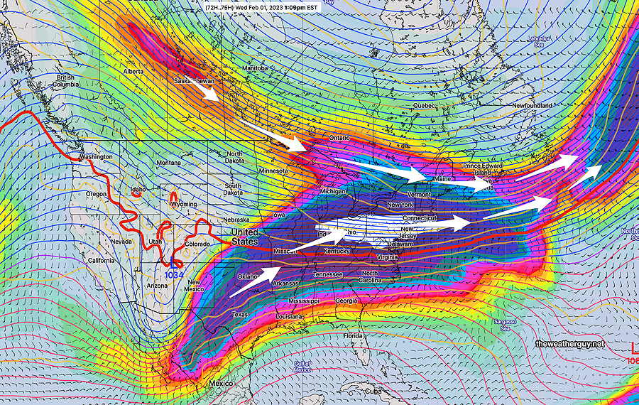
By Friday, we’re under an upper level trough with cold air—
No large storms expected to form here this week and no snowstorms expected here within in the next 10 days.