Weekend Outlook
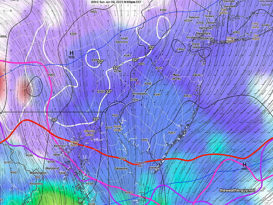
Thu 01/05 @ 7:34 PM —The latest GFS model shows over-running of moisture over a colder lower layer Sunday late afternoon and evening.
Critical thicknesses contours are all south of our area, indicating the precipitation type will be snow. However, note that the surface temperatures will be just above 32º in the immediate PHL area, significantly reducing snow accumulation to just a coating on grassy surfaces.