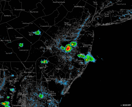
Sun 4:54 PM —Forecast Review —Isolated thunderstorms formed as early as 1:30 PM and and have continued to re-form in pretty much the same areas this afternoon . The HREF forecast just below from this morning did pretty good. Most areas saw sunny skies.
Here’s the radar from 4:30 PM—
Radar composite 4:30 PM (Click on image for a larger view.)
Posted Sunday 07/21/24 @ 9:34 AM— While it’s sunny this morning, many models are showing more clouds with scattered to isolated showers and thundershowers developing early afternoon around the city and additional showers in NJ this afternoon. A line of showers may develop early this evening. It’s not the forecast I’m hearing on the radio this morning.
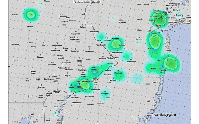
HREF precip accumulation with standard deviation (Click on image for a larger view.)Water Vapor Image 9:13 AM showing disturbance expected to trigger showers here this afternoon. (Click on image for a larger view.)
Posted Saturday 07/20/24 @ 10:45 PM —Tonight’s models are forecasting scattered showers in the Philadelphia area during the afternoon, as early as 1-2 PM. This is a significant change in forecast.
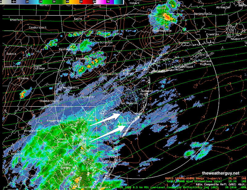
Sat 4:27 PM —Forecast Review —Today was a little cloudier than forecast. Of more interest is the large area of showers moving into South Jersey, that was only predicted by the ECMWF—
Radar image at 4:30 PM with superimposed RAP model jet level wind streams and Omega. While the showers to our north was predicted by most models, the large area of showers in Maryland was predicted best by today’ ECMWF model. This morning’s GFS showed some of this activity but not the full extent. Even the recent 18zHRRR model doesn’t show these showers!. (Click on image for a larger view.)
Posted Saturday 07/20/24 @ 4:40 PM —Based on the above radar and this morning’s ECMWF capturing it best, I’m going with the ECMWF forecast for Sunday. Sunday will have some clouds in the morning and even some light sprinkles in the Philadelphia area. Sunshine should return by noon, but there’s a chance of a few showers in South Jersey in the late afternoon.
Originally Posted Fri 7:56 PM —A stationary front well to our south will gradually move north as a warm front over the next several days. Moisture aloft, in a upper southwesterly flow, will result in showers to our north on Saturday as a weak wave moves up.
Following the weak wave of low pressure, sunnier skies are expected for Sunday.
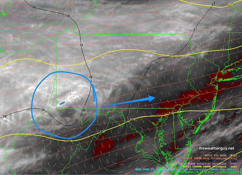
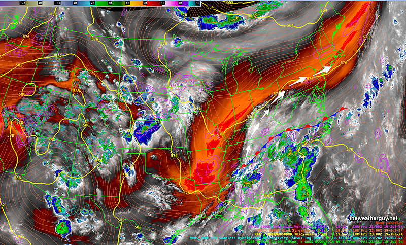
Here’s the current setup on Friday evening—
Current satellite water vapor image with superimposed RAP model 500-1000 mb thickness lines (yellow), jet level wind streamlines (orange contour-arrows) potential vorticity (fine violet contours) and superimposed MRMS radar. (Click on image for a larger view.)
Saturday
Mostly sunny in the morning, then periods of clouds and sunshine through high clouds in the afternoon. Showers expected in Lehigh and Berks counties will likely stay to our north, although some models show a chance of a very isolated shower in the Philadelphia area.
NBM high temperatures: Blue Bell, PA 86º Philadelphia, PA 86º uncertainty (based on standard deviation): average ± 1.7º
Sunday
Mostly sunny and warmer. More humid. There’s still a chance of an isolated thunderstorm in the afternoon.
NBM high temperatures: Blue Bell, PA 89º Philadelphia, PA 90º uncertainty (based on standard deviation): ± 1.5º