Friday will have gradual clearing beginning about noontime. Temperatures will continue to move towards more normal (average) range or slightly above average levels.
The very light snow mentioned for late afternoon and evening Sunday continues to be a low probability event for any accumulation. Accumulation amounts are in the ‘model noise’ range and temperatures are expected to be just above freezing in the immediate PHL area and rise somewhat late Sunday night.
Friday’s 06zNAM snow forecast for Sunday night. (Click on image for a larger view.)
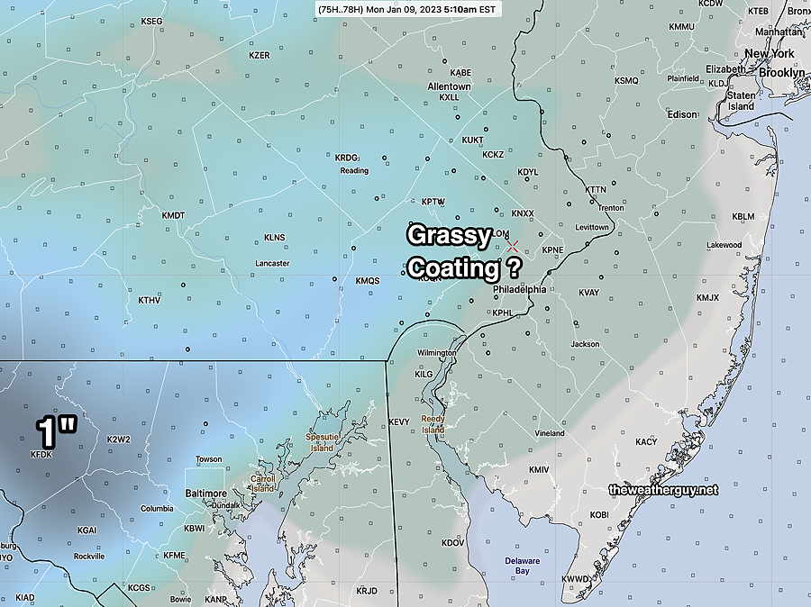
So even the idea that there might be a coating on grassy surfaces now appears to be a stretch.
There’s simply not enough cold air to our north at this time.
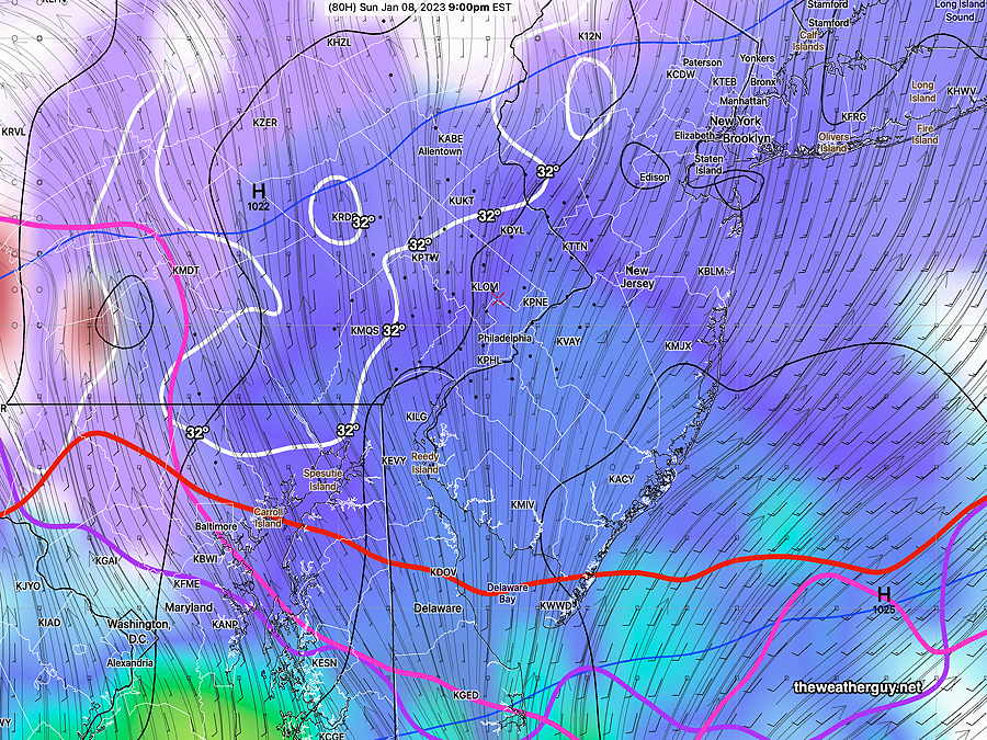
Thu 01/05 @ 7:34 PM —The latest GFS model shows over-running of moisture over a colder lower layer Sunday late afternoon and evening.
Critical thicknesses contours are all south of our area, indicating the precipitation type will be snow. However, note that the surface temperatures will be just above 32º in the immediate PHL area, significantly reducing snow accumulation to just a coating on grassy surfaces.
Thursday’s 18z GFS shows mostly light snow over our area between 5PM and 11 PM. Critical Thickness contours (red, magenta, purple) are all south of the area. Marginally above freezing temperatures will keep accumulations to only a coating on grassy surfaces. (Click on image for a larger view.)
Of course, Sunday morning is the beginning of Daylight Saving Time. I love the extra daylight at the end of the day, but for “weather nerds”, Daylight Saving Time means the models come out an hour later. For those of us on EasternTime, the evening models become available inconveniently late for the next day’s forecasts!
I’ve written extensively about this in past years—