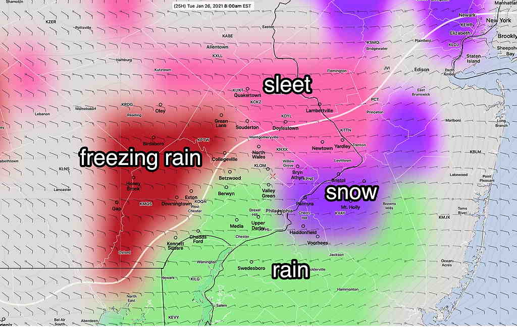
While the model’s PTYPE is still for sleet mid morning, I think we can rule out freezing rain in Philadelphia and immediate suburbs. A changeover to rain still expected. The NAM did poorly with PTYPE, despite my preference for the model from past experience.
from Monday night…..
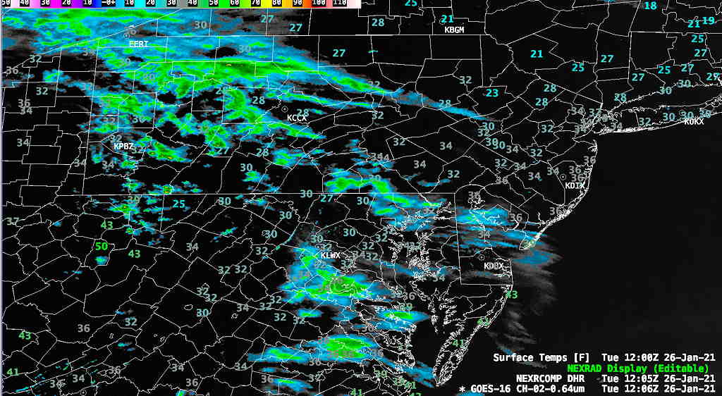
Tuesday’s weather forecast continues to be complex regarding precipitation type (“PTYPE”)— snow, sleet, freezing rain and rain.
First, this will NOT be a snowstorm.
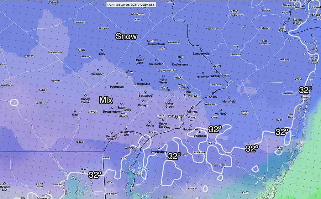
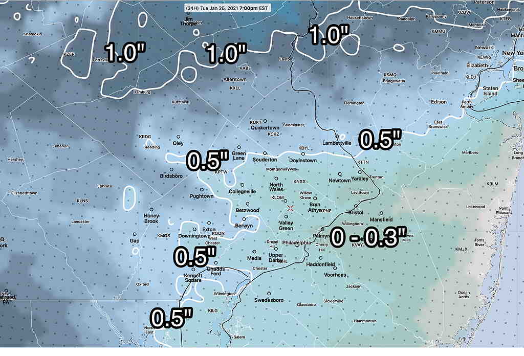
Tonight’s 00z models are just becoming available. The model blend (NBM) has some very light snow possible tonight. Some minor snow accumulation is possible before a changeover to sleet and freezing rain, according to the NBM—
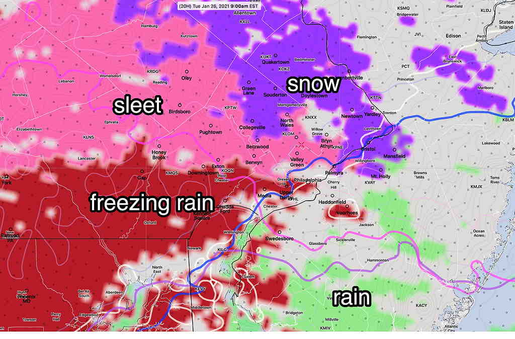
The heavier precipitation arrives during the morning hours, sometime between 9 and noon as sleet, freezing rain, and rain.
The complexity of the forecast revolves around the transition and the PTYPE. The newest HRRR and NAM show heavier precipitation around noontime with some dynamic cooling.
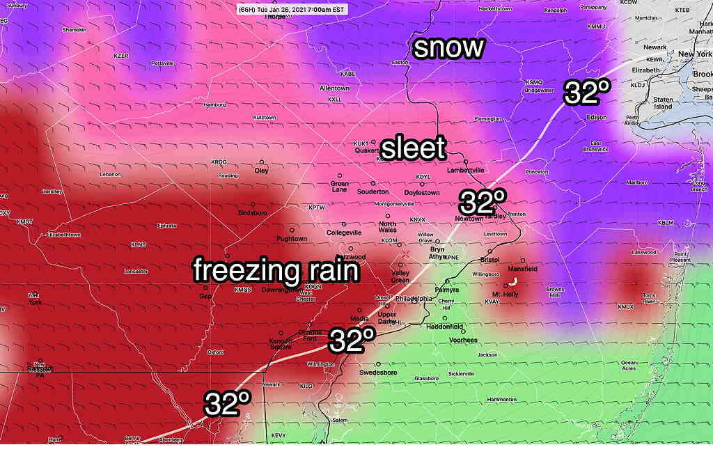
Surface temperatures for most of the area will be above freezing according to the HRRR, but below freezing according to the most recent NAM—
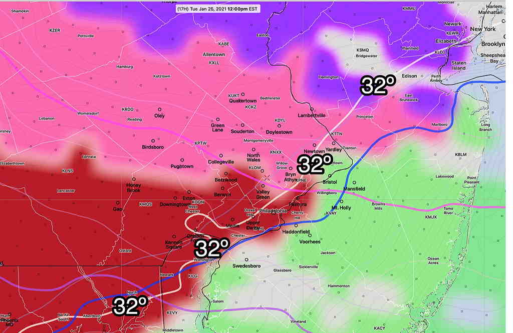
Here’s the somewhat warmer HRRR—
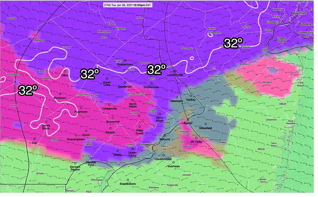
Just available, the HIRESW-MEM2 is very similar to the NAM
In these situations, I have historically gone with the NAM. So a prolonged period of sleet is expected, with possible prolonged period of freezing rain in areas north of the city.
The HRRR changes everything to rain about 2- 3 PM, but the NAM maintains freezing rain north of the city until 3-5 PM.