SNOW UPDATE

Fri 11 PM Update— Tonight’s models just becoming available suggest that widespread accumulations greater than 12 inches are possible with this storm.  I’ll update in the morning.


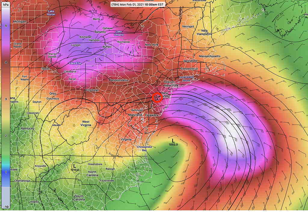
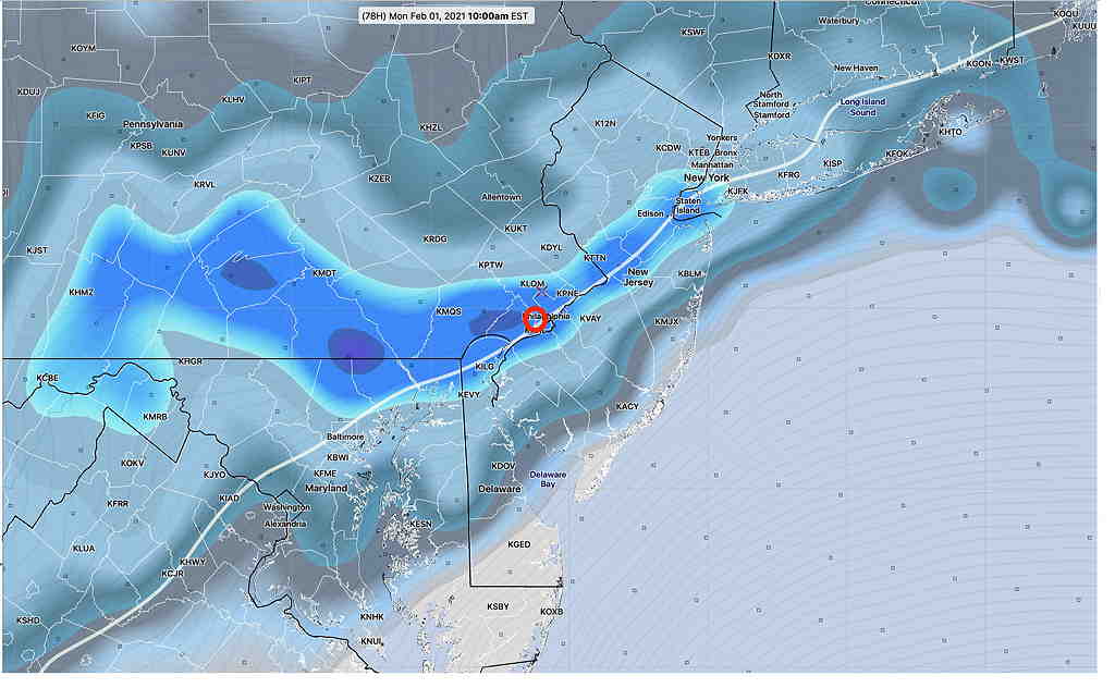
The coming snowfall for the Philadelphia area is now looking to be significant.  All models have snowfall starting Sunday afternoon and lasting into Monday evening as a warm front approaches, followed by a secondary coastal low pressure system.  Most models have all snow, but the GFS has a mix with some rain late Sunday night into Monday morning before changing back to all snow. 

The majority of the accumulation is expected during the day Monday.

The latest GFS model snowfall amounts are—

GFS snowfall forecast by Monday evening  (Click on image for a larger view.)

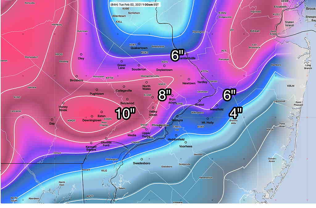
I’m posting the GFS because it probably best captures the snowfall range of all the models.

However, I think that these model-calculated snowfall totals may be the low end of the spectrum and it assumes that some of the precip will be mixed with sleet/rain for a period of time increasing compaction.    If there’s no mix to rain, the snow amounts could almost double in some areas.  Indeed, a straight QPF to snow calculation gives many areas over 12″   Many models are forecasting QPF values of over 1-1.5 inches of water.

The ECMWF, ICON, NAM, SREF and other models are similar, although they each have their snowfall maxima at somewhat different locations. 

I’ll be updating through the weekend.  Stay tuned.

FRIDAY’S SNOW UPDATE

Usually, I update this blog with the ‘the latest model runs’ and the forecast trends.  

As the time frame of the Sunday-Monday storm comes into the range of the higher resolution models, this  potential snow storm is presenting a higher level of variation and  uncertainty with each model addition rather than a clarification of the likely storm snowfall.   Usually, I’d supply some snowfall maps, but it’s a waste of time right now.  Here’s why:

  • First, the European model has backed off of its extreme snowfall amounts for our area. 
  • However, the German ICON model has gotten extreme with its totals. 
  • The GFS has remained somewhat consistent with a mix with rain on Monday. 
  • The Canadian Global and Regional GEMS remains colder with only snow, no rain mix
  • The NAM has come into forecast range and it has a mix with rain/sleet.
  • The SREF forecast has come into range and it’s somewhat higher with snow totals.

Rather than present snowfall maps, I’m going to present maps that capture the current uncertainty—

ICON Statistical Ensemble model showing large variations in the possible position of the coastal low. (Click on image for a larger view.)


Here’s the Short Range Ensemble Model (SREF) showing high spread in standard deviation of the surface pressure. High spread suggests high uncertainty in the low pressure position .

SREF ensemble Pressure/standard deviation Monday 10 AM  showing high spread in pressure values in the NE quadrant of the storm.  This could suggest faster movement or uncertainty in position/configuration of the surface low.  Equally uncertain is the high pressure in NY State.   (Click on image for a larger view.) 


All this said, here’s the large scale “Snow-Liquid” forecast from the SREF suggesting the statistical areas where highest snowfall is expected—

SREF snow-liquid forecast (correlates with snow totals)  This suggests where the highest snow accumulations will be.   I’m intentionally not putting numbers on the graphic.  (Click on image for a larger view.)


So, the takeaway is that we’re getting several inches of snow, starting Sunday afternoon and running through Monday; high uncertainty about specific snow totals in any one specific area.   Sometimes, the best forecast information is to indicate what we don’t know.

I’ll take another attempt at specific snow forecast this evening, when we have today’s model runs to review.   Stay tuned.