
- Saturday— Clouds move in around noontime Saturday.
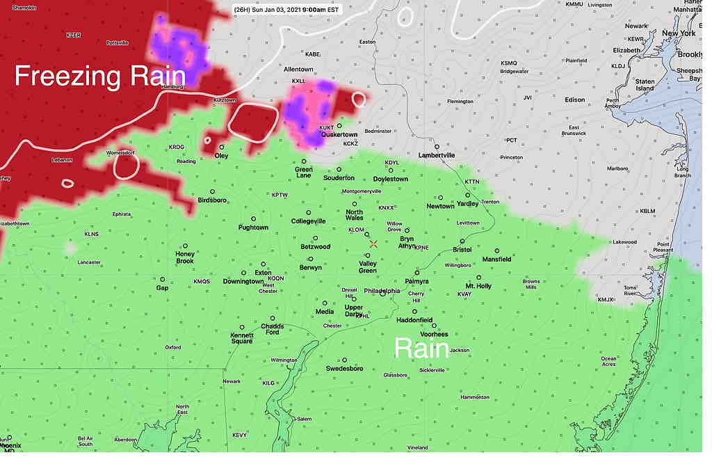
- For Sunday, precipitation starts between 7 and 8 AM with some areas north and west of the city getting freezing rain to start, then a change to rain.
NAMNEST 8 AM Sunday RED=Freezing rain White line 32º (Click on image for a larger view.)
User Feedback Requested:
Users, would you like to see all updates posted to Twitter or just the major new posts (as currently done)? Thanks!
[yop_poll id=”1″]
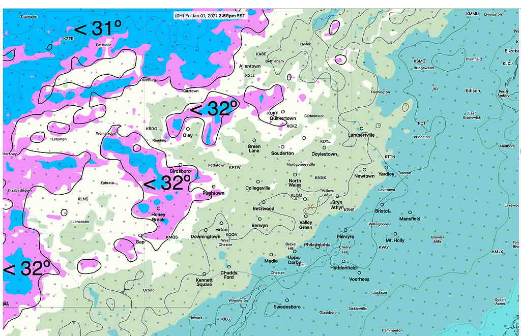
Our area saw rain today, on schedule between 12- 3 PM, although some areas far to the west and north had a wintry mix, as temperatures remained below freezing. The mix did not occur as close to PHL as forecast. Here’s the surface temperatures at 3 PM today—
For the weekend—
Saturday, a strong flow of relatively mild air moves in. Original forecasts showed significant sunshine for Saturday, but the latest GFS suggests considerable cloudiness, a period of sun mid to late morning, then a mix of clouds and sun at times in the afternoon. There’s high uncertainty about the cloud cover Saturday, as captured in this NBM graphic—

With more clouds forecast, the high temperature looks to be 51.4º (NBM) and 49º (GFS) (Seasonal average high is 40º)
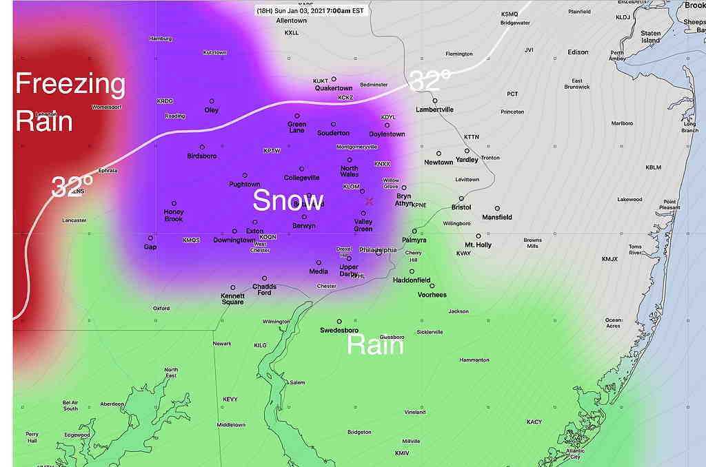
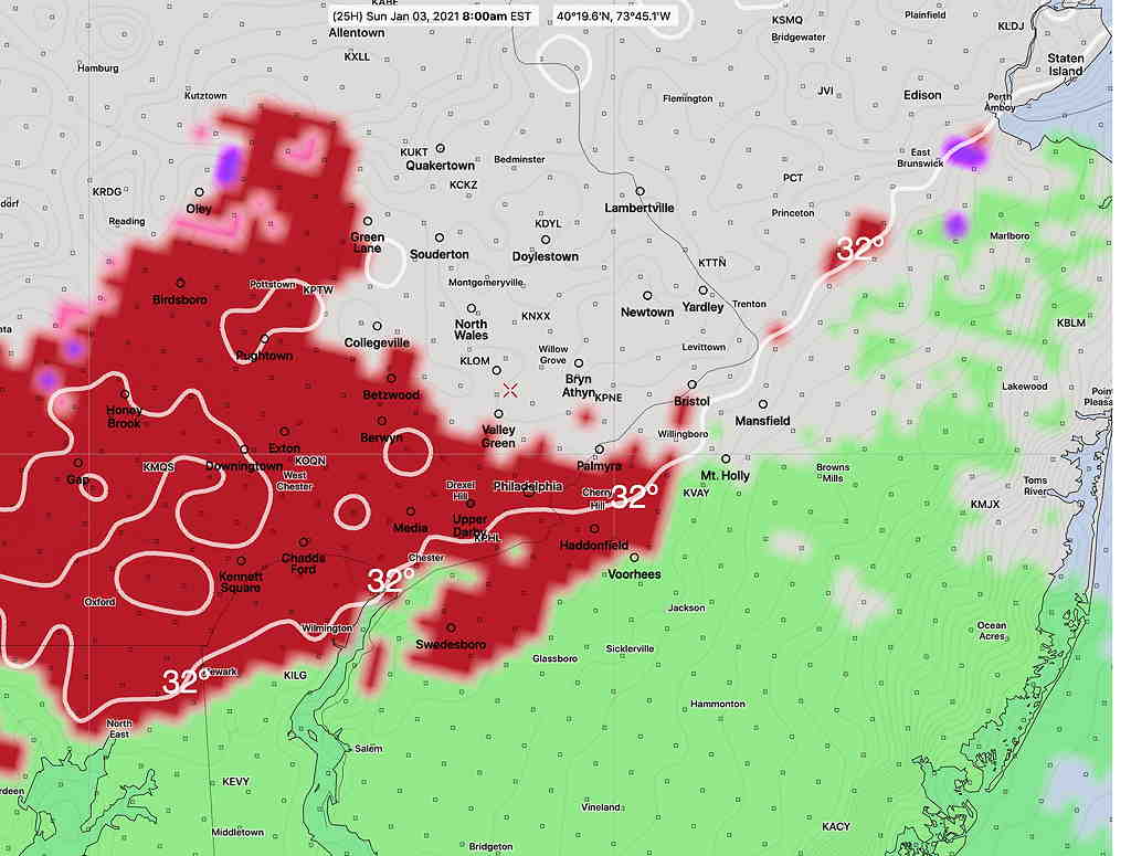
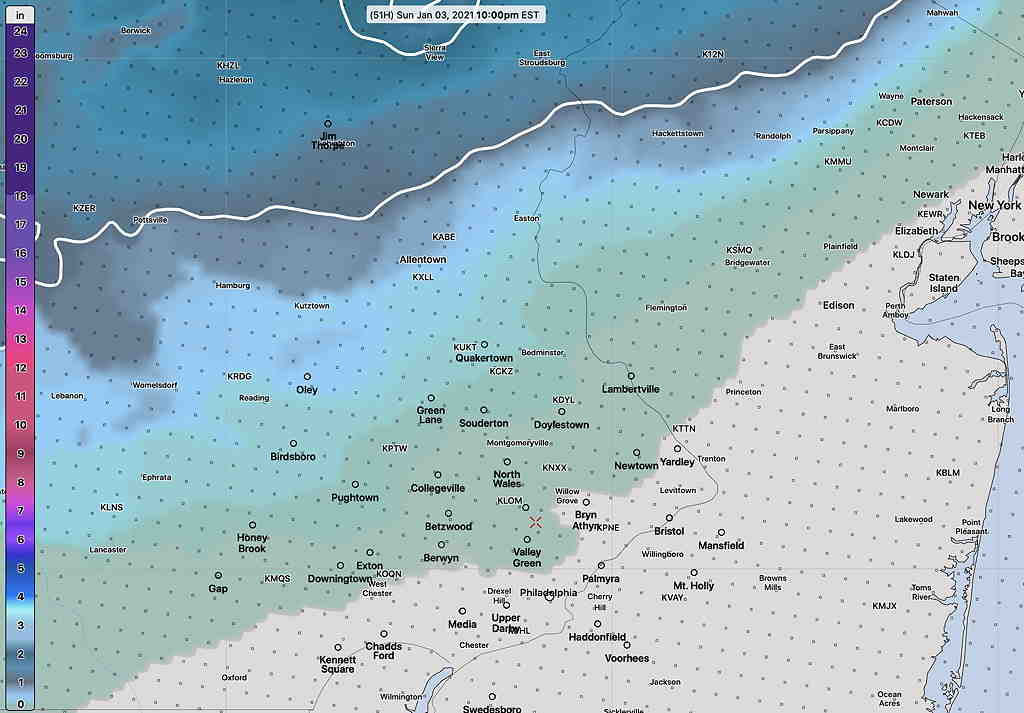
For Sunday, a secondary low forms off of Virginia. Precipitation moves in between 7 and 9 AM, starting as light snow or a rain mix. Changes to rain for most of the immediate PHL area. A change back to light snow is possible Sunday evening, with a coating at most.
(It appears that the new GFS may have a cold bias and the snow totals posted yesterday are incorrect and over-done.)
Any other winter, we’d have snow, but a lack of cold air to our north will keep it mostly rain.