SATURDAY SNOW (?) UPDATE

Updated Wed 07:40PM — Today’s models continue with the idea that some light rain may graze us early Saturday morning.  No snow.

GFS Simulated Radar 8AM Saturday

The NAM has backed off of last night’s snow forecast and shows only light rain showers possible before daybreak Saturday into Saturday morning.

NAM simulated radar forecast for 3 AM Saturday morning. Critical temp lines (blue) for snow too far north (arrows)

What’s fascinating about this weather event is how far apart different models are with the development and location of the low pressure system at this point in time.  Here’s the Canadian Global model:

Canadian Global Precipitation forecast Saturday 8 AM

…from Wednesday morning—

So, things seemed very clear last night with the forecast for Saturday.  Most of the models had the storm well east and south of us, barely affecting us. The Canadian and ECMWF are still south and east, with no precip here.

That’s also still true of the GFS and GEFS, but not so clear cut with the  higher resolution NAM that has just come into forecast range (84 hours is the max forecast horizon for the NAM).

The NAM runs from last night and early morning have the storm side-swiping our area with a coating to an inch of snow early Saturday morning:

NAM snow depth forecast 10 AM Saturday

The German ICON ensemble model has a somewhat similar snow depth of less than an inch further west:

ICON Ensemble Model snow depth forecast Saturday

The GFS, showing no snow,  has done the best this year.   I’ll keep an eye on it.

SATURDAY SNOW (?) OUTLOOK

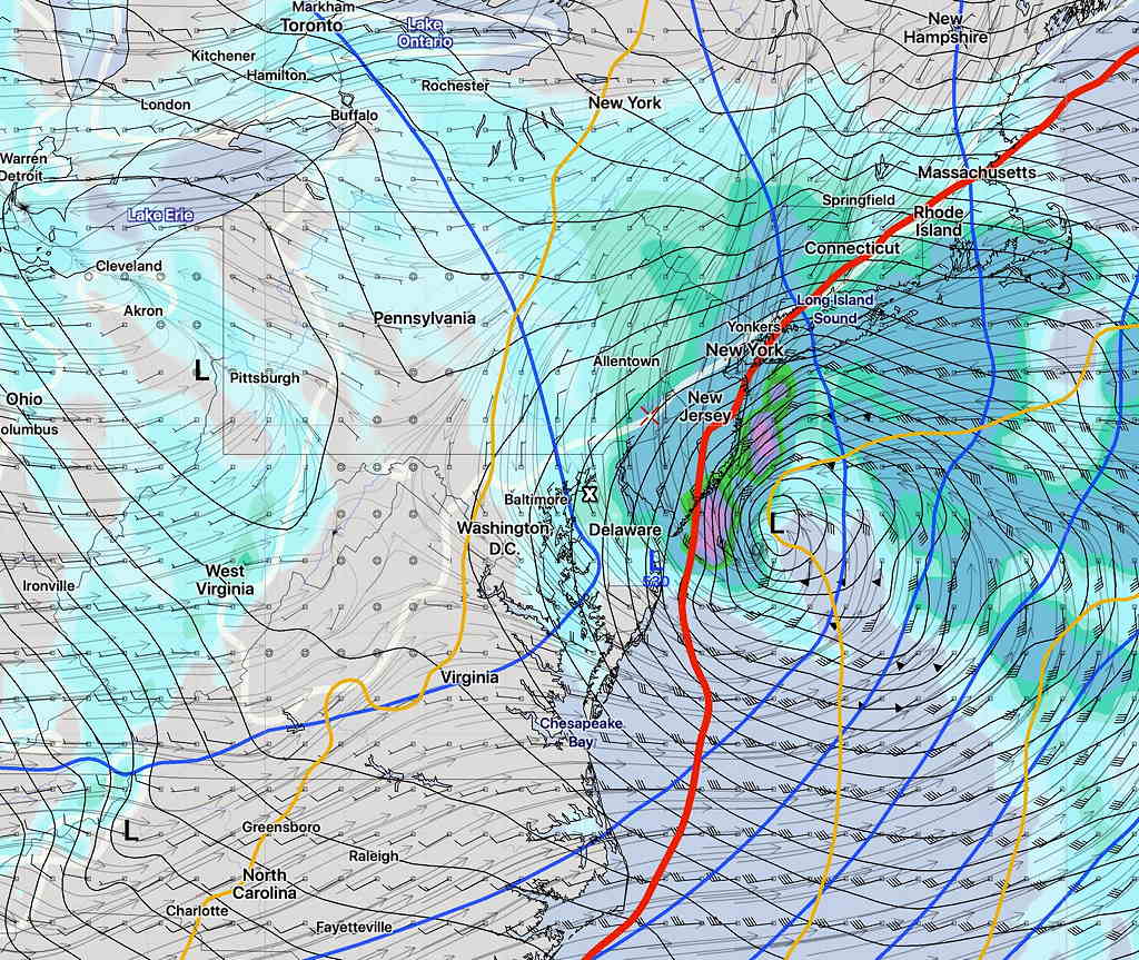
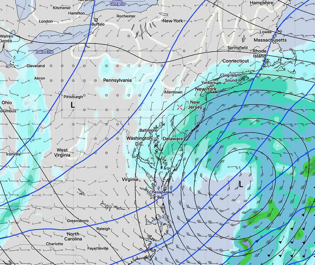
Updated Tues 08:24 PM—  Today’s models continue with the trend of the system moving faster past us (early Saturday) and mostly missing our area.  Any precip falling will be light and will be rain. The latest GFS and GEFS have it missing us entirely.

GEFS Forecast 5 AM Saturday. The path of the storm will follow the blue upper air contours.

From earlier Tuesday—

I took a fast look at the GFS before I went to bed last night and thought things had changed.  Too fast a look.  Things on the surface appeared to have changed to more snow, but not really.

This morning, I had a chance to look at the GFS, GEFS, Canadian, German ICON (yes, a new model for me) and ECMWF.    Here are the trends:

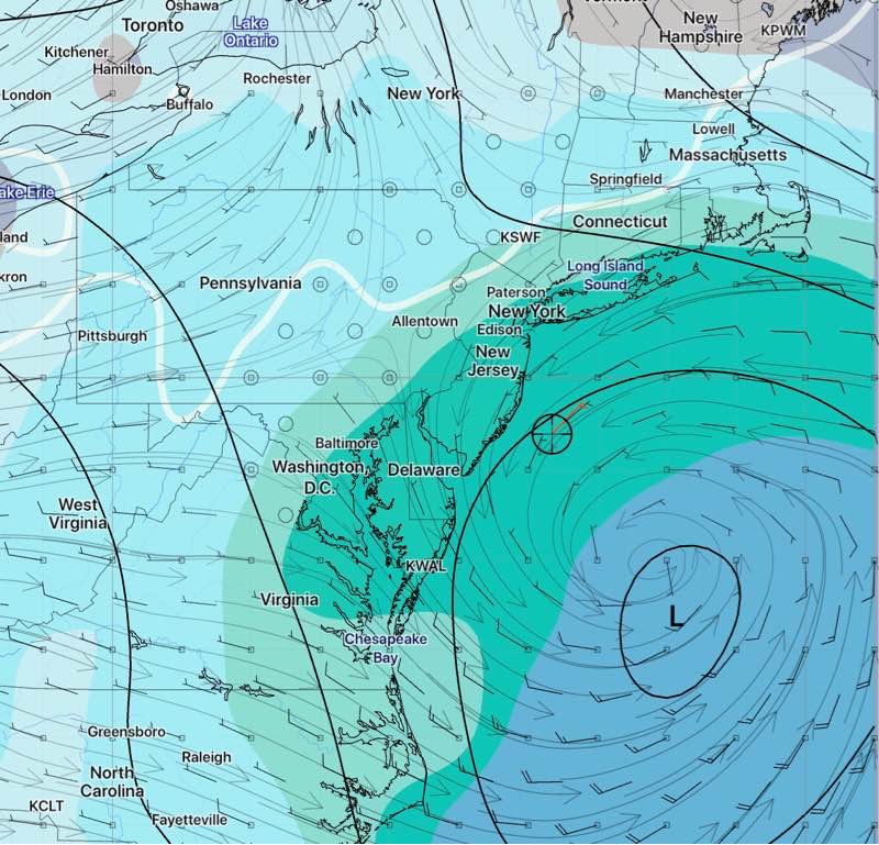
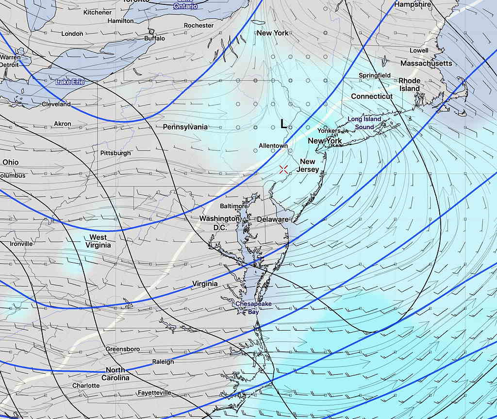
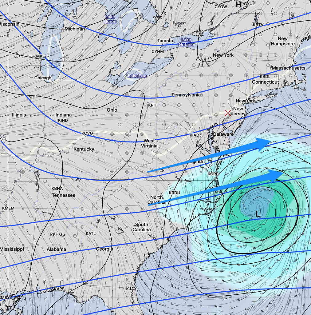
The GFS has taken a more westward track but is faster and warmer aloft.  So the new GFS gives us some rain here Saturday morning, but no snow.

GFS simulated Radar Saturday 9:30 AM  The blue line (critical temp for snow) is too far north.

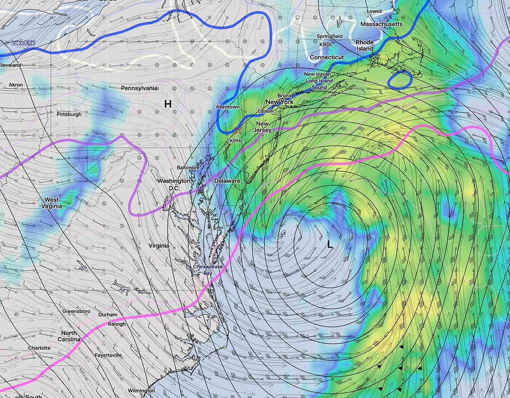
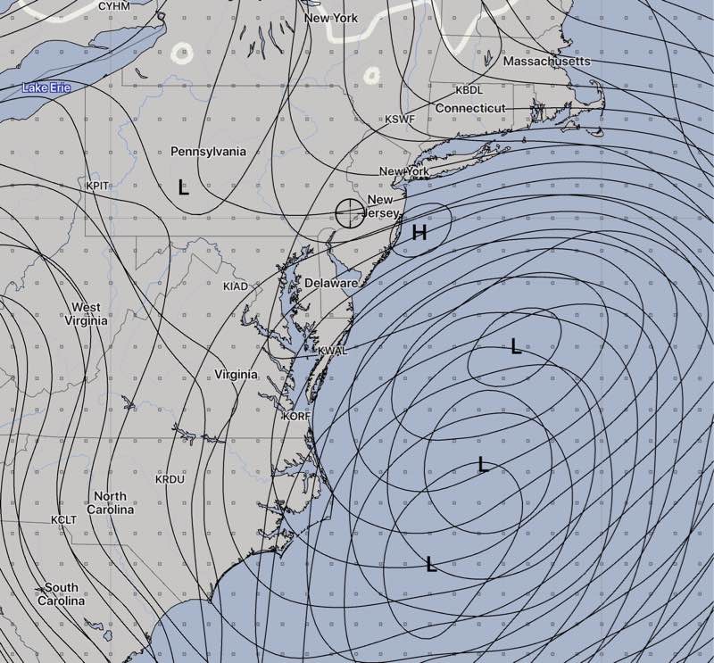
The ECMWF, the Canadian and GEFS have different timing, with the Canadian having two separate centers, both  too far off-shore.  The other models’ placement is too far east.

ICON Ensemble Model forecast 1 PM Saturday- Surface Pressure percentiles

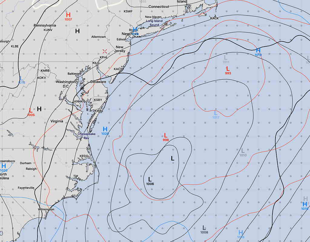
The ICON ensemble shows low pressure systems possible in various timing and locations, based on 10, 50 or 90 percentiles of possibilities.  All far to our east.

So the models show a storm that’s too far east, too under-developed or too warm or combinations of the above.  It doesn’t look like a snow storm for our area.

Getting back to my comment about storm tracks last night:  The “track” of a storm and its structure/speed/moisture/intensity/dynamics are inextricably connected.

To use the “track” analogy, when a storm is forecast to take a different track, it’s no longer same train on a different track.  It’s an entirely different train.

Using the expression “it depends on the track of the storm” dismisses the complexity and dynamics of weather systems.