6:20 PM : Latest GFS and NAM show almost no snow accumulating in Philadelphia and much of NJ. Areas north and west of Allentown may have more than an inch.
Latest GFS snowfall forecast
12:35 PM: Latest Canadian and NBM models show decreased QPF and temps too warm to accumulate near Philadelphia. This supports the new GFS. Some light snow falling, but not expected to accumulate. A coating, at most. The earlier NAM and NAM Nest are now outliers.
10:43 AM: Latest GFS just available has less than 1/2 inch for most of our area. Too warm! The HRRR has almost nothing.
Last update before I head out the door. So many models, so little time!
Latest NBM, NAM-NEST and WRF-ARW available. I’ll cut to the chase:
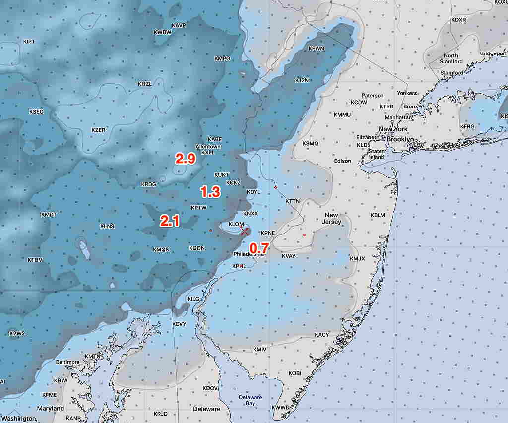
This morning’s NAM NEST high res snow depthThis morning’s lower resolution NAM snow depth
I think the NAM-NEST is the best bet and supported by the NBM.
Last night’s models (they’re re-run again at 1AM, EST and become available between 3 AM and 6AM) had a wide range of snow totals.
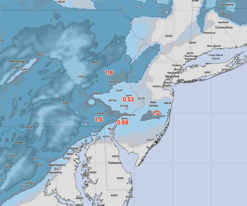
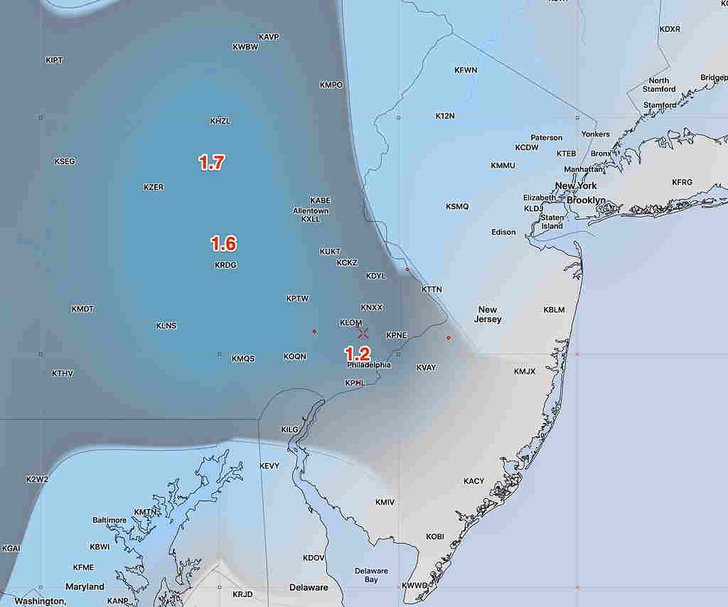
The NAM had extremely high QPF values, which I think is an outlier, although in the ‘old days’ of doing my forecasts I would have taken it more seriously, The high resolution NAM NEST had the following snow totals by 11 PM tonight—
NAM NEST Snow depth forecast- click for larger image
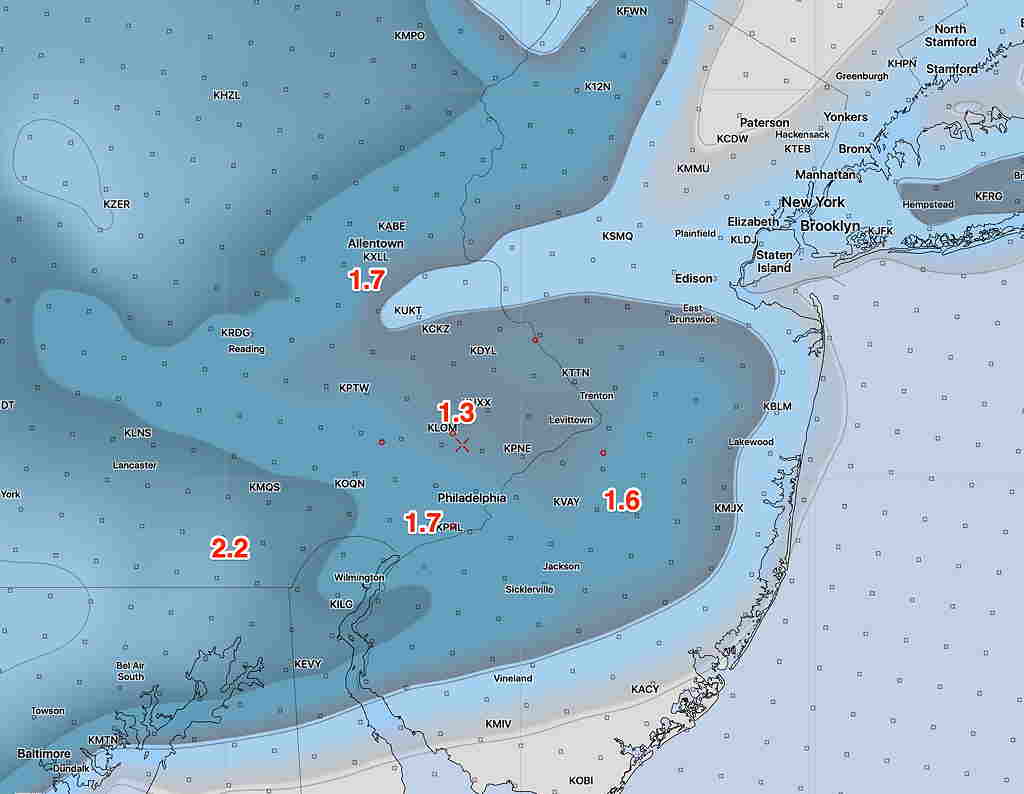
The statistical version of the GFS, the GEFS, which is a lower resolution model had the following—
GEFS snow depth forecast.
Last night’s European (ECMWF) had a similar map as the NAM NEST above, with a coating in the city.
I’ll be posting some of the latest models from this morning (HRRR and NAM NEST) when they become available, before I head out the door for work.