We’ve moved into the forecast range of some of the shorter-range, higher resolution models. Sometimes, things fall into the category of “too much information”; this may be one of them.
Start time varies by model. I still think snow starts between 10 and 12 PM, with some earlier patches of flurries possible. Some models have it starting about 12-1.
Mixing or changing to sleet possible as early as 3 PM. As mentioned yesterday, dynamic cooling may bring the snow back in the picture if precip rates increase enough.
Snow/sleet/rain ends early evening.
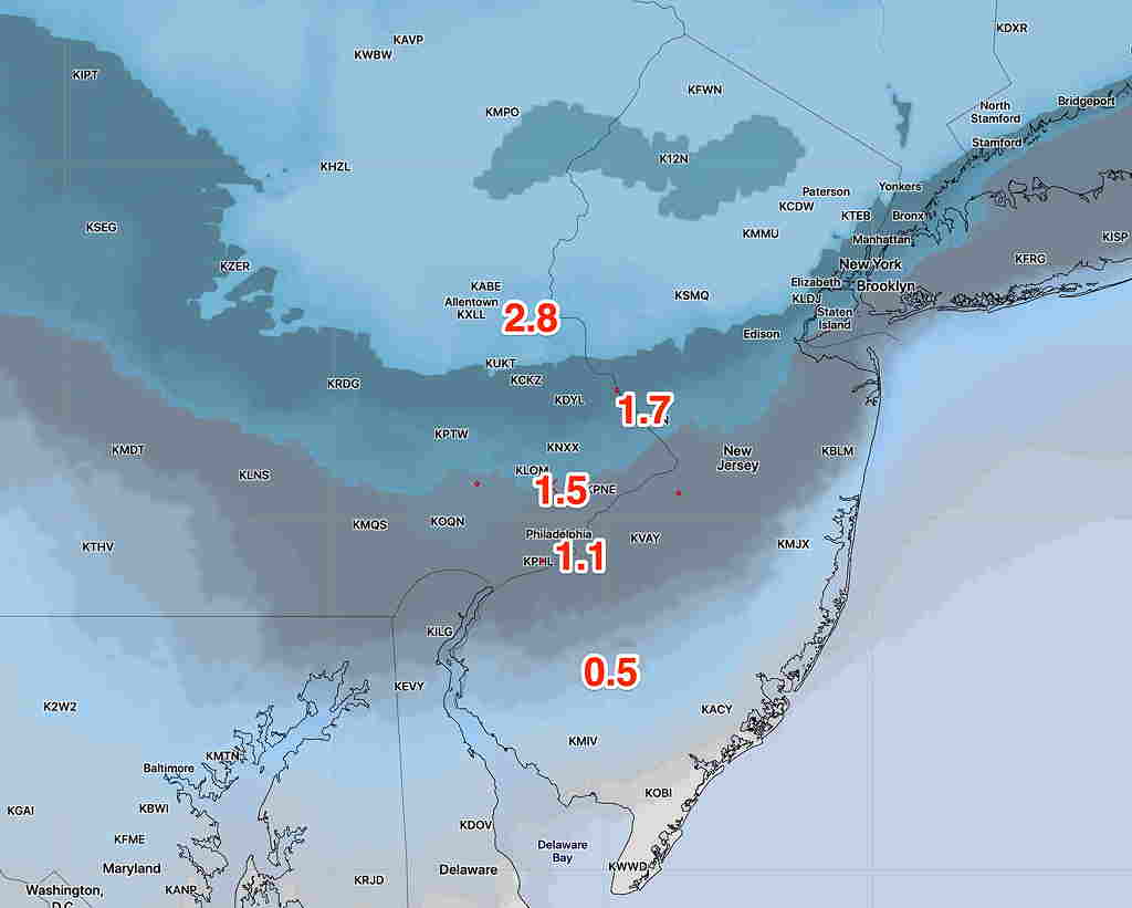
For snow totals, this how things are sorting out—
The shorter range models (NAM and NAMNEST) have it warmer aloft, have less total precip in their afternoon runs and more sleet. Here’s their latest snow totals at 6 PM Saturday:
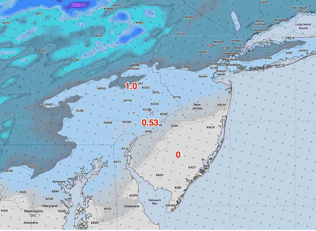
More consistent on the higher range has been the GFS model, shown below:
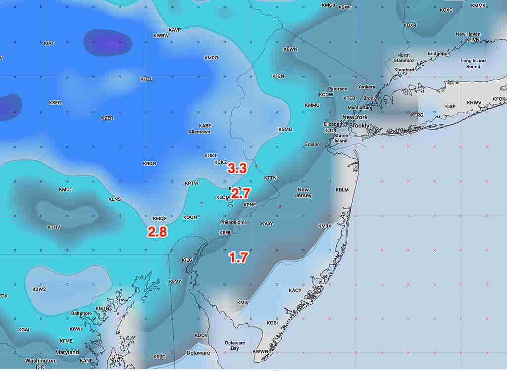
The Canadian is closer to the GFS, the European model is closer to the NAM.
So, let’s turn to the National Blend of Models (NBM). Here’s the current blended forecast:
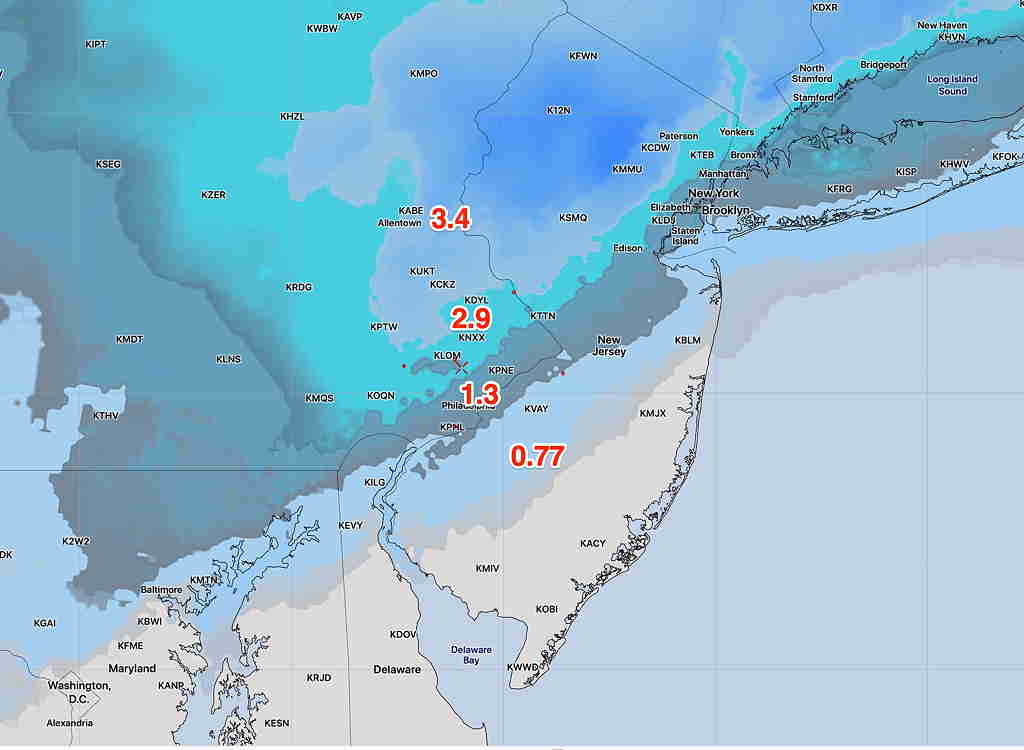
The NBM is my current choice for snow totals with this storm.
Just an aside: There are problems currently with NOAA weather data centers right now: Here’s a message that was sent out earlier:
“NOMADS users,
We are experiencing a critical failure in one of our data centers that is forcing us to shut down NOMADS entirely. FTPPRD will still be accessible for both FTP and HTTPS access, but full file download from nomads.ncep.noaa.gov as well as grib filter and openDAP services will be down.
We have no ETR at this time and will send frequent updates on status.”