
#weather #paweather #wx #pawx #philadelphia #phillywx
Friday
Update Fri 04/07 @ 9:46 AM — Perhaps you notice last night that I didn’t attempt a forecast for today (Friday) — “I’m not all that confident about Friday’s forecast”.
This morning’s radar shows why—
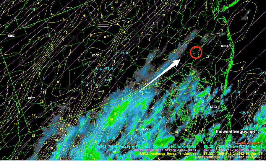
There are light shows this morning streaming up towards us that are not forecast by the HRRR or RAP models. It appears that we will have cloudiness for most of the day Friday with even a chance of a very light sprinkle in a few areas.
The models, as incredible as they are, often do poorly with stalled or slowing fronts. Not applicable here, but they also do poorly with closed mid-level and upper air lows that become somewhat stationary.
[note note_color=”#bceaed” text_color=”#333333″ radius=”3″]Thu 8:30 PM Forecast Review — You know the model forecasts were bad when MLB postpones the season home opening game for anticipated thunderstorms but not a drop of rain fell during the afternoon.
Postponing the game was a very reasonable decision, based on all available model forecasts yesterday. Even today, each model run was a little later with the storms and and little further east. Here’s the current radar at 8:15 PM—
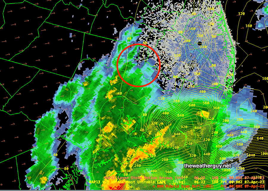
The front is expected to stall to our south tonight. Some cloudiness may linger in southern areas tomorrow and some high cirrus may affect the Philadelphia area. But with such poor model performance with this system, I’m not all that confident about Friday’s forecast.
The weekend looks nice, but much cooler.
[/note]
Yet Another Update
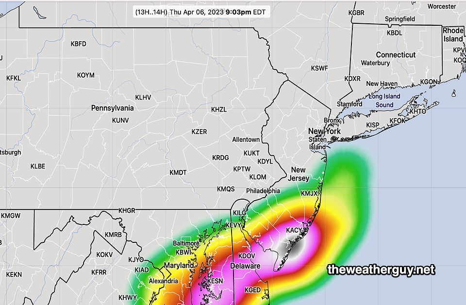
Update Thu 04/06 @ 4:42 PM— This forecast has been a moving target. It appears that minimal thunderstorm activity will occur in the immediate Philadelphia area. Here’s the latest CMC HRDPS showing thunderstorm probability—
We’ll still have some showers between 6-9 PM. (Maybe that will change too.)
Thursday Forecast Update
Update Thu 04/06 @ 9:53 AM—
It appears that the Phillies opening game didn’t need to be postponed today.
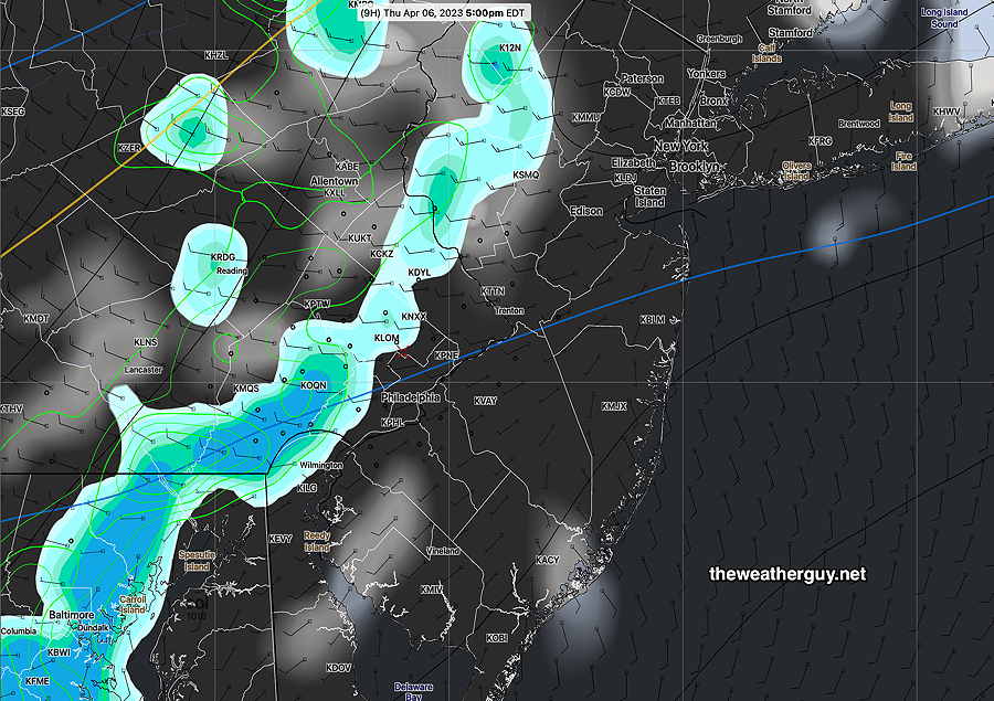
The thunderstorms are likely to move in after 4-5 PM based on the latest 12z RAP and HRRR models. The RAP and HRRR are somewhat different, due to different physics parameterization, different resolutions, and use of different data assimilation systems.
HRRR—
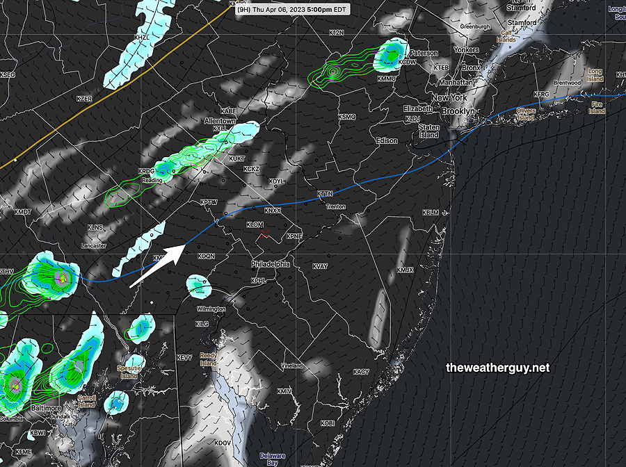
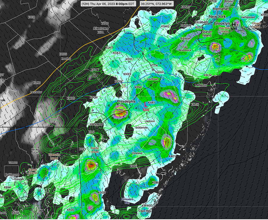
RAP at 5 PM —
The main storms develop dynamically in-place between 5 PM and 9 PM
| Sept 1 , 2021 Tornado Outbreak (example of highly severe) | Past April 1st 2023 Tornado Outbreak HRRR 12z | Today’s 12z HRRR Forecast | Impact |
| CAPE 3500-4200 Joules/kg | 2100 | 550 | ⚐ ⇩ |
| Helicity 1350 m^2/s^2 | 655 | 460 | ⚐ ⇩ |
| Vertical Shear 40-46 | 40-45 | 25 | ⚐ ⇩⇩ |
| Precipitable Water 2.7″ | 0.83” | 1.1″ | ⚐ |
| Lifted Index minus 6º K | minus 9.3º | minus 2.3 | ↓ ↓ |
| HRRR Hail Parameter 1.9 | 1.4 | 1.3 | ⚑ |
| Peak Wind Gusts 40-50 | 40-50 | 35-40 | ⚐ |
| Aligned Storm Motion and Shear Vectors- ~ 90º | Almost aligned | non-aligned | ⇩ |
| Jet stream level – wavy | Highly cyclonic | wavy | ⚐ ⇩ |
| Jet Stream 250 mb Speed – 63 | High 135 | 94-100 | ⚐ ⇩ |
⚐ indicates Possible Severity
↓ indicates works against Severity ⇩ Significant, but less impact
Based on the above, hail and heavy rain with strong wind gusts are possible. Greatest likelihood in east into New Jersey and South Jersey.
Thursday Forecast Change
Update Thu 04/06 @ 8:51 AM — Today’s forecast (Thursday) continues to change. Last night’s models (with the exception of the Canadian GEM and HRDPS) have the storms developing later in the afternoon with the most activity from Philadelphia and eastward into New Jersey. Start time is likely 4-7 PM.
The trend is that tornadoes are unlikely on Thursday and we’ll have somewhat heavier rain in some areas (NJ) with less severe winds than our storms last Saturday evening .
I’m waiting for the new 12z models and will update before 10 AM
Thursday Forecast Update
Update Wed 04/05 @ 9:45 PM — What appeared to be a clear-cut forecast this afternoon has changed with tonight’s 00z models. (Due to Daylight Saving Time, only the new RAP and HRRR are available at this hour.)
Here are the changes. It looks like showers begin to break out closer to 2-3 PM in the northwest suburbs.
This will NOT be a line of storms moving through like last Saturday, but instead, showers and thunderstorms will dynamically form directly over our area as an upper air energy moves in aloft from the southwest.
The main action will now occur later, closer to 4-5 PM. The strongest storms will be directly over Philadelphia and later eastward.
I’m going to hold off on the severity table I promised in my earlier update until tomorrow morning; there are too many changes in the forecast to hang my hat on anything this evening.
But a general sense is that tornadoes are unlikely on Thursday and we’ll have somewhat heavier rain in some areas with less severe winds than our storms last Saturday evening . Updates tomorrow morning.
Thursday Forecast Update
Update Wed 04/05 @ 5:44 PM — As expected, temperatures today just north of Philadelphia didn’t get out of the low to 60s (and even lower further north). The airport reached 72º later in the afternoon. The front that was hung up over us will return as a warm front tonight and temperatures on Thursday will reach the low 80s!!
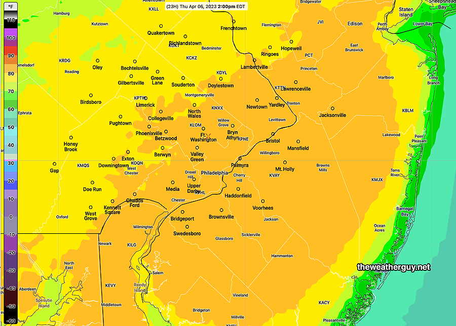
Forecast highs on Thursday (NBM model)—
Some scattered showers in some areas expected tonight with the warm front.
A cold front moves through Thursday afternoon. Most models are suggesting the expected thunderstorms to be most extensive in NJ.
Thunderstorms: Based on the NBM, showers and thunderstorms may develop as early as 2-3 PM in northwestern suburbs and then move through the city before they really blossom in NJ in the late afternoon and evening.
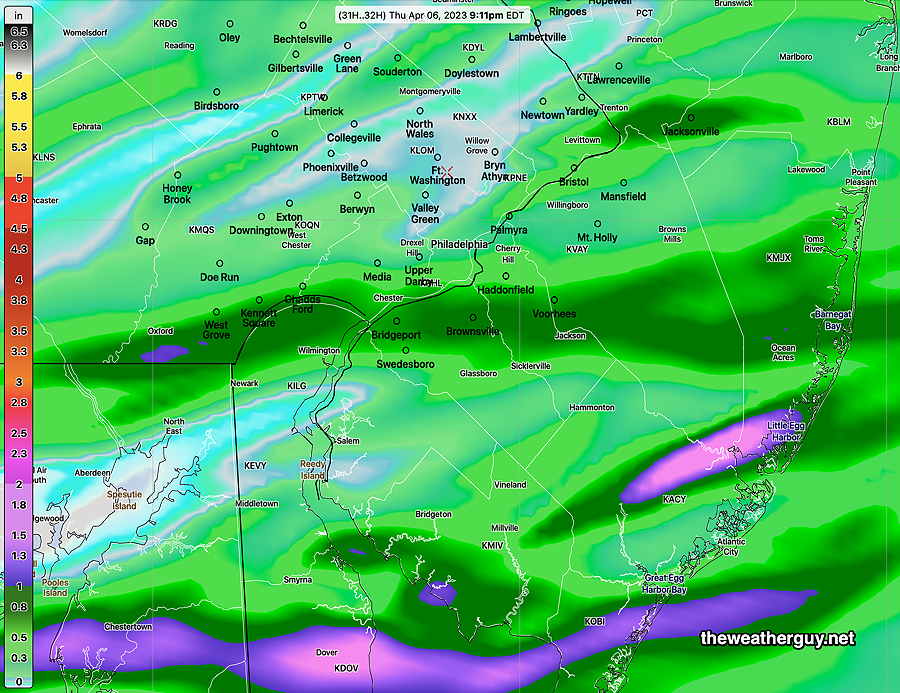
I think the total rainfall forecast captures the forecast of the storms ‘missing’ some areas and concentrated in others—
Some areas may see severe storms. I’ll be updating with my severe parameter chart later tonight, likely before 10 PM.
Wednesday Forecast Update
Update Wed 4/05 7:20 AM — Despite some TV weather people last night depicting the Wednesday situation as a warm front, it’s really a stationary front becoming somewhat of a ‘back door’ cold front; the colder air will prevail for most areas today, except South Philadelphia and southward. It will then become a warm front tonight. It looks like the clouds may break this afternoon.
Wednesday Forecast Change
Update Tue 4/04 9:46 PM/10:34 PM — Tonight’s models continue to suggest a large temperature gradient cutting through Philadelphia on Wednesday. Areas in South Philadelphia may approach 80°, but Bucks and northern Montgomery County may just be in the low 60s. There is some model spread/uncertainty about where the front stalls and where the gradient sets up. The NAM-NEST keeps considerable low clouds around in the afternoon.
I mentioned Sunday evening that a change in trajectory of the disturbance passing to our north might alter our forecast on Wednesday. It looks like that’s going to happen, as a backdoor cold front moves through in the morning Wednesday with clouds and and light scattered showers possible, especially northern areas.
The location of the front is easily seen with the wind convergence and large temperature gradient that sets up right through Philadelphia —

So Wednesday is looking cloudy to begin with some light showers in the morning, but sunshine should break out in the afternoon.
Still keeping an eye on Thursday. Thunderstorms likely in the afternoon, as early as 2 PM but most likely 3-6 PM.