#weather #paweather #wx #pawx #philadelphia #phillywx
Update Sat 04/22 @ 5:11 PM — The storms are moving in somewhat ahead of schedule of the HRRR and RAP models—

The Phillies game may just finish ahead of the storms. It’s going to be close.
Update Sat 04/22 @ 10:18 AM — The latest 12z NBM, HRRR, RAP and NAM-NEST models have become available.
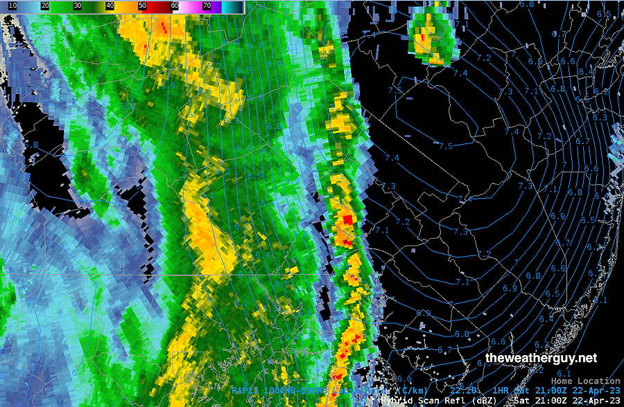
Here’s the trends. Storms move in between 6 PM (western suburbs areas) and 8 PM.
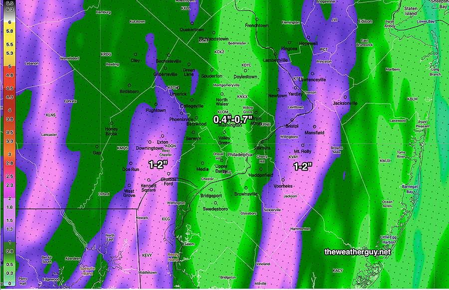
Heaviest rain in western suburbs and in New Jersey. The immediate PHL area appears to fall into a lull in activity of the storms.
Heaviest rain—

As for severity, below is my HRRR Severity Table—
Based on this table, I see tonight’s storms as typical thunderstorms with a chance of locally severe.
I don’t see tornadoes as likely. Largest hazard will be possible localized hail and strong straight line wind gusts.
I should indicate that the latest NAM-NEST has much higher CAPE and helicity values than the HRRR. I’ve found that the HRRR is more reliable for these sort of events and I’m going to ignore the more severe NAM-NEST forecast at this time.
| Sept 1 , 2021 Tornado Outbreak (example of highly severe) | Past April 1st 2023 Tornado Outbreak HRRR 12z | Today’s 12z HRRR Forecast | Impact |
| CAPE 3500-4200 Joules/kg | 2100 | 550 | ⚐ ⇩ |
| Helicity 1350 m^2/s^2 | 655 | 460 | ⚐ ⇩ |
| Vertical Shear 40-46 | 40-45 | 25 | ⚐ ⇩⇩ |
| Precipitable Water 2.7″ | 0.83” | 1.1″ | ⚐ |
| Lifted Index minus 6º K | minus 9.3º | minus 2.3 | ↓ ↓ |
| HRRR Hail Parameter 1.9 | 1.4 | 1.3 | ⚑ |
| Peak Wind Gusts 40-50 | 40-50 | 35-40 | ⚐ |
| Aligned Storm Motion and Shear Vectors- ~ 90º | Almost aligned | non-aligned | ⇩ |
| Jet stream level – wavy | Highly cyclonic | wavy | ⚐ ⇩ |
| Jet Stream 250 mb Speed – 63 | High 135 | 94-100 | ⚐ ⇩ |
⚐ indicates Possible Severity
↓ indicates works against Severity ⇩ Significant, but less impact
Update Sat 4/22 @ 8:09 AM — Quick update. Last night’s models show the following trends: A further increase in CAPE and some areas of moderate helicity, especially in Delaware and areas north of Trenton. Some areas with strong to severe storms now appears possible.
The line of storms moves in between 6 PM and 8 PM, about an hour or so later than forecast last night. (Earlier in western suburbs.)
I’ll update later this morning before 10:30 AM with this morning’s 12z models.
Update Fri 4/21 9:52 PM — With tonight’s HRRR just becoming available, I want to underline the possibility of a one or two widely scattered pop up storms during the mid afternoon due to increased instability.
The timing of the main line of rain and storms is mostly unchanged. The HRRR also shows a modest increase in severity parameters. Updates tomorrow morning after 10:15 with the new HRRR and NAM-NEST.
Previously Posted Fri 7:55 PM —
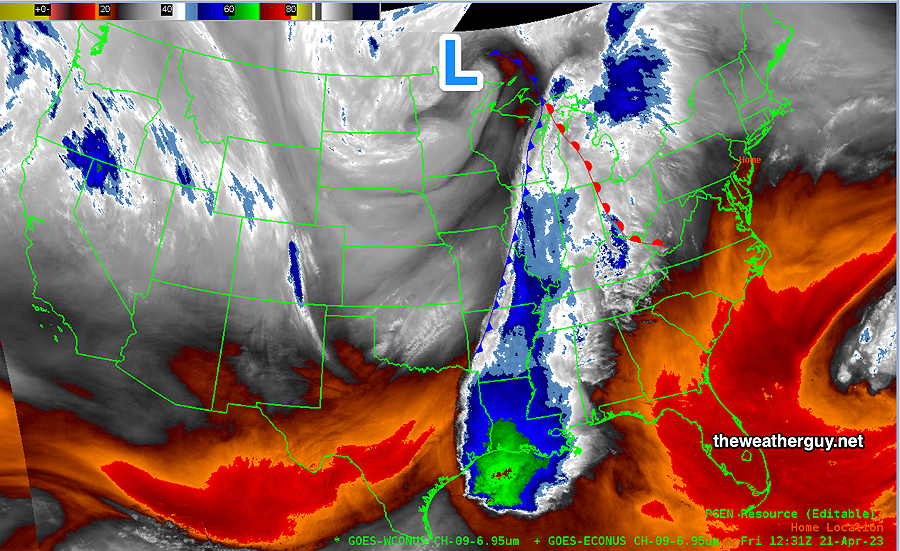
A strong cold front will move quickly through our area Saturday night with showers and possibly some thunderstorms. Cooler high pressure builds in for Sunday. (Average highs this time of year are 66º-67º)
Satellite water vapor shows the position of the front and upper level low this morning—

Saturday
The clouds associated with the approaching cold front will move in during the early afternoon. Thickening clouds by 4 PM. It will become fairly windy and gusty in the afternoon.
It is possible that a few stray sprinkles may break out during the mid afternoon, ahead of the main line.
The main line of showers and possibly some thunderstorms moves in between 5 and 6 PM, earlier far western suburbs. Wind gusts near 30 mph. Greatest coverage of thunderstorms- western Chester County. Severity parameters are only in the moderate range.

While any thunderstorm can produce locally heavy rain and strong wind gusts, no extreme weather is expected with these storms at this time.
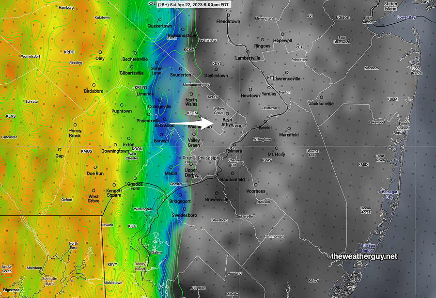
NBM Wind/Gusts Forecast—

The line of showers and storms will be fast moving and precip should end about 2 AM. Total rainfall about 0.5 -1”, greatest amounts in far western suburbs.
High temperature 77º sd 1º ( NBM model location Blue Bell, PA)
Sunday
Becoming sunny and breezy.
High temperature 64º sd 3º ( NBM model location Blue Bell, PA)
