#weather #paweather #wx #pawx #philadelphia #phillywx
Update Sat 04/08 @ 10:23 AM — So far, my forecast of “Variable amounts of sun through high cloudiness” seems to have verified, but this morning’s early models are still forecasting more in the way of cloudiness this afternoon as moisture from the stalled front that’s south of us spills up aloft as cloudiness here.
Here’s the latest NAM-NEST cloud forecast for 2 PM—
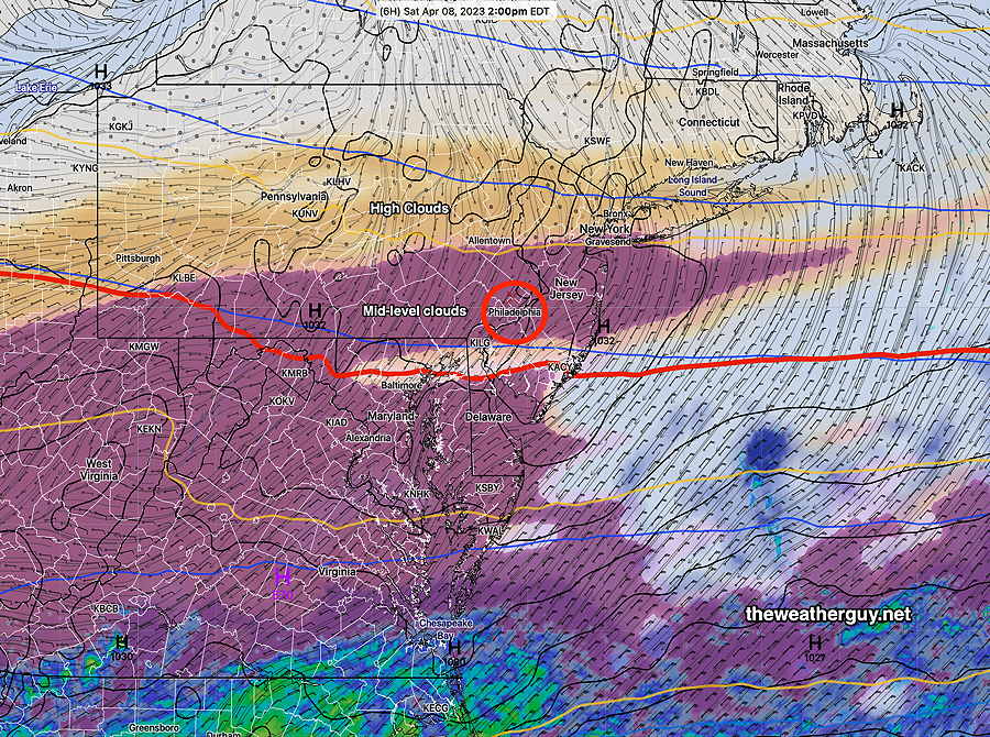
I should mention that the Canadian HRDPS has much less cloudiness for us.
Previously Posted Fri 5:50 PM —
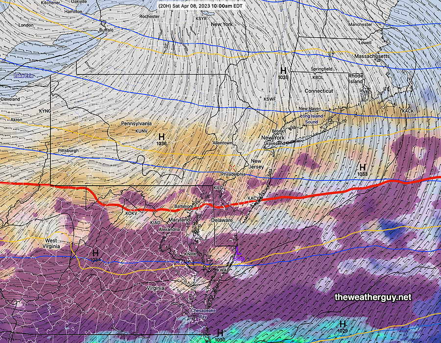
The stalled front to our south will gradually sink further south on Saturday as high pressure moves in from the north. A low pressure system on the same front will push some moisture aloft towards us on Saturday, causing high level cloudiness.
The high pressure system will bring much cooler (actually colder) weather Saturday night before temperatures rebound next week.
Sunday
Sunny and a bit milder.
High temperature 57.2º sd 1.2º ( NBM model location Blue Bell, PA)
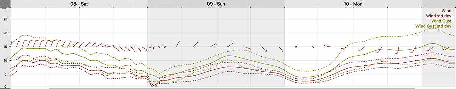
Winds