
#weather #paweather #wx #pawx #philadelphia #phillywx
Sunday Forecast Update
Update Sat 4/15 10:00 PM — Lingering clouds Sunday morning, breaking for periods of sunshine and clouds by late morning or early afternoon. Clouds move in towards evening and showers expected with a cold front after midnight. High temperature 78° but we may reach 80° with enough sunshine. Noticeably cooler Monday.
Update Sat 4/15 5:56 PM — Many areas did not receive any rain or storms today. The models are never able to predict exactly where storms will form and scenarios like today’s where the forecast is contingent on the position and track of an upper air low often result in the least exact precipitation placement forecasts.
Here’s what was happening at 5 PM—
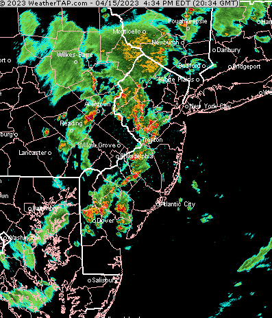
Update Sat 04/15 @ 11:46 AM — It should be apparent that today’s weather is not going as forecast. The position and track of the upper air low is further north and west of what was forecast yesterday. As a result, the lcoation and timing of the showers and thunderstorms will be different than forecast. Current trends suggest that the heaviest showers and thunderstorms will be further north of our area. In fact, the precip in the immediate PHL area is looking fairly light.
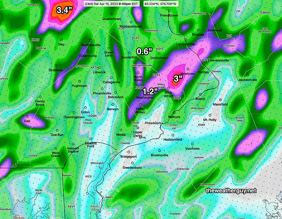
Update Fri 04/14 @ 10:01 PM — The latest HRRR has become available and it gives a good idea about the scattered nature of the rain tomorrow and expected accumulations—
Previously Posted Fri 9:04 PM —
Saturday Forecast
As mentioned in this morning’s update, the upper low that been bringing heavy rain to the southeastern US will be moving directly over Pennsylvania on Saturday. Showers and thunderstorms are expected as early as the mid morning hours Saturday and showers and thunderstorms will become more widespread during the afternoon hours.
Any storms are NOT expected to be severe, but localized moderate to heavy rain is possible for some locations. The exact locations depends upon the location of the upper low’s circulation, something the models aren’t perfect at doing.
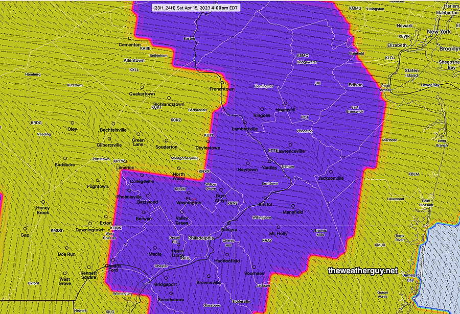
The new NBM model v4.1 has a new forecast parameter, “thunderstorm coverage”. Here’s the NBM’s prediction for the greatest density of thunderstorm coverage tomorrow—
High temperature on Saturday 72º sd 2.2ª (Blue Bell, PA)
Sunday
As for Sunday, clouds lingering in the morning. Some sunshine by afternoon.