#weather #paweather #wx #pawx #philadelphia #phillywx
Rex Block Takes Shape
Update Tue 04/11 @ 4:37 PM — We had a layer of high cirrus clouds move in today and they should move off to our northeast on Wednesday.
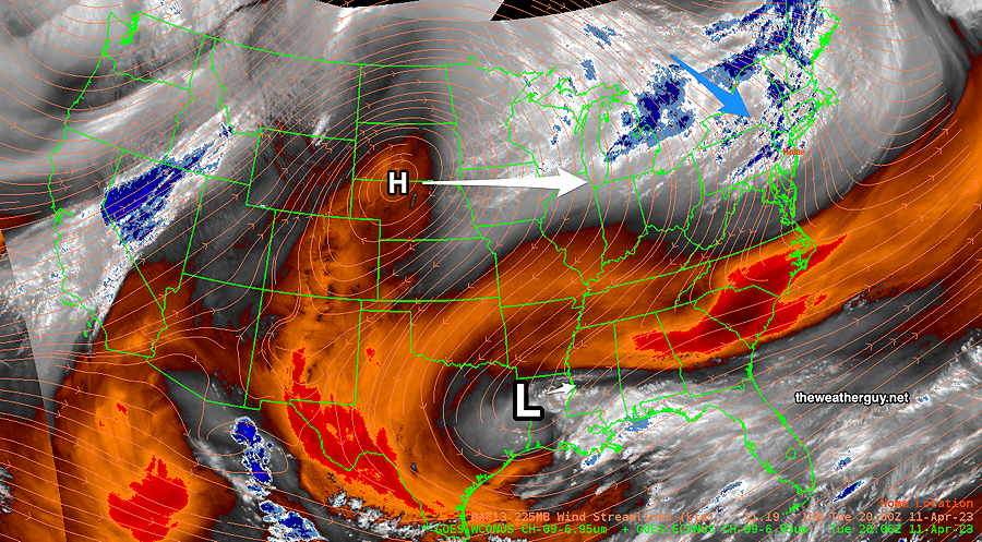
The Rex block is taking shape in the middle of the country. Here’s the current Water Vapor Satellite image —
Update Mon 04/10 @ 8:04 PM — Continued beautiful weather through Friday. Very warm but low humidity.
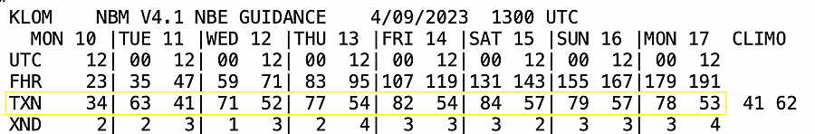
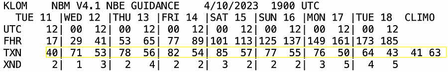
NBM High-low temperature forecast (see below for interpretation)—
A warm front moves through Saturday with some showers, clouds and an increase in humidity. A cold front moves through Sunday with thunderstorms.
Previously Posted Sun 5:06 PM —
“Rex Block” Will Keep Things Quiet This Week
A recognized upper air pattern for Spring (and Fall), is setting up for this coming week and it will keep our weather quiet for all of the week with increasingly warm temperatures.
A “Rex Block” (named in the 1950s for a meteorologist, Daniel Rex) will develop in the middle of the country and the jet stream will be sending any disturbances far to our north. The Rex block, with an upper level high just north of an upper level low, tends to be a stable configuration and blocks any west to east movement of the usual dips in the jet stream.
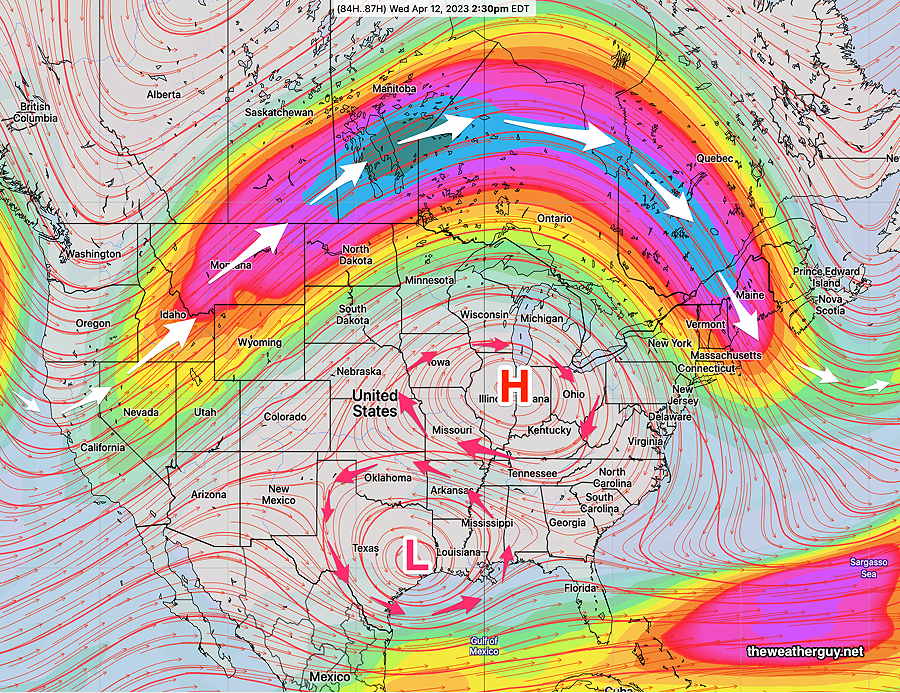
Here’s the GEFS model forecast for Wednesday afternoon of winds at the 250 mb level (jet stream level). The upper circulation is notated with red arrows, while the main jet flow (white arrows) is well to our north—
Temperatures- NBM Model Text Output Products
Here are the high/low temperatures expected this week from the NBM model. You can use this link to get your own data— NBM Model Text Output—