
#weather #paweather #wx #pawx #philadelphia #phillywx
Eye on Thursday
Update Mon 04/03 @ 8:38 PM —Very nice and unseasonably warm weather through early Thursday.
A cold front will move through on Thursday afternoon. Current timing is about 3-4 PM, but that will undoubtedly change. Some strong thunderstorms are possible at that time. We won’t really have a handle on the specifics until Wednesday night and Thursday morning. The weekend looks good!
Stay tuned.
Previously Posted Sun 9:39 PM —
Following last night’s storms, an uneventful period of weather will be in store for us through late Wednesday.
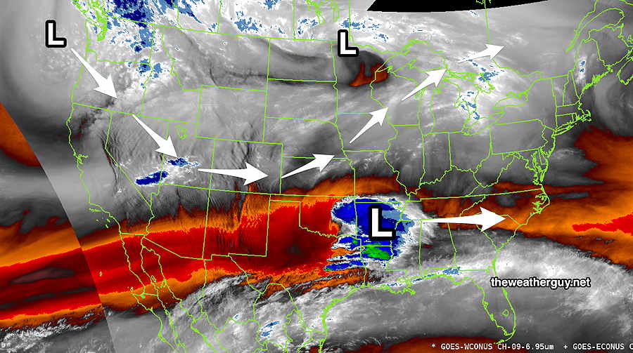
Current water vapor image (Sunday eve) shows low pressure over Mississippi that will move to our south, low pressure in Wisconsin that moves to our north and low pressure off the Washington coast that will dive down and develop in the middle of the country.
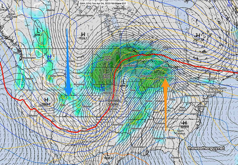
By Tuesday, a warm flow develops in the East and a colder flow in the West, captured in this NAEFS surface forecast map for Tuesday evening—
Temperatures will move into the 60s tomorrow (Monday) and the 70s on Tuesday and Wednesday.
The only thing to keep an eye on: some disturbance will be moving north of us, from west to east. Showers are currently forecast in New York State and northern Pennsylvania. We may get some clouds at times with these disturbances. Should the current trajectory change, we’d see some showers late Wednesday.
The cold front associated with the storm in the central US will move through Thursday with showers and likely some thunderstorms.