
#weather #paweather #wx #pawx #philadelphia #phillywx
Weekend Outlook Update
Update Fri 4/14 7:30 AM — Upper low pressure, part of the Rex Block pair, will move up over us on Saturday and spawn a weak surface low pressure system off the coast. Showers and thundershowers are expected early Saturday morning and will increase in coverage during the afternoon.
The weak low pressure system is expected to linger Sunday. It should be dry but the GFS is forecasting considerable cloudiness on Sunday. I’m thinking that Sunday will be have more sunshine than currently forecast.
I’ll be posting my regular Weekend Weather Forecast later today where I’ll try to nail down the the thunderstorm potential for Saturday and the Sunday’s weather.
Previously Posted Wed 5:56 PM —
Weekend Outlook
The Rex Block that has given us this extended period of beautiful weather has moved into its full position as forecast earlier this week—
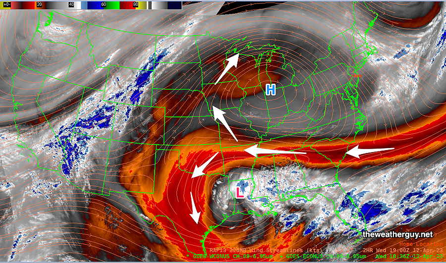
The upper level low approaches from the southwest on Friday. The upper winds shift from westerly to southwesterly and we’ll have an increase in upper level moisture.
There will be a noticeable increase in high cirrus cloudiness during the day on Friday.
The upper low moves up over us early Saturday morning and a warm front is expected to move to our north with an increase in dew points and humidity. (Dew points are currently in the dry 40s. On Saturday, they’ll be in the low 60s.
Showers and even some thunderstorms are looking likely on Saturday.
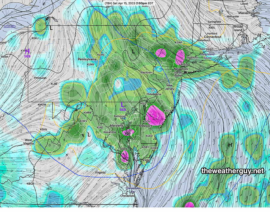
There are model differences in the forecast position of the upper low on Saturday. Here’s the current ECMWF foreast at 2 PM—
A cold front approaches later on Sunday. The forecast timing has been changing with this front and it looks like it will move through closer to Sunday night into Monday.