
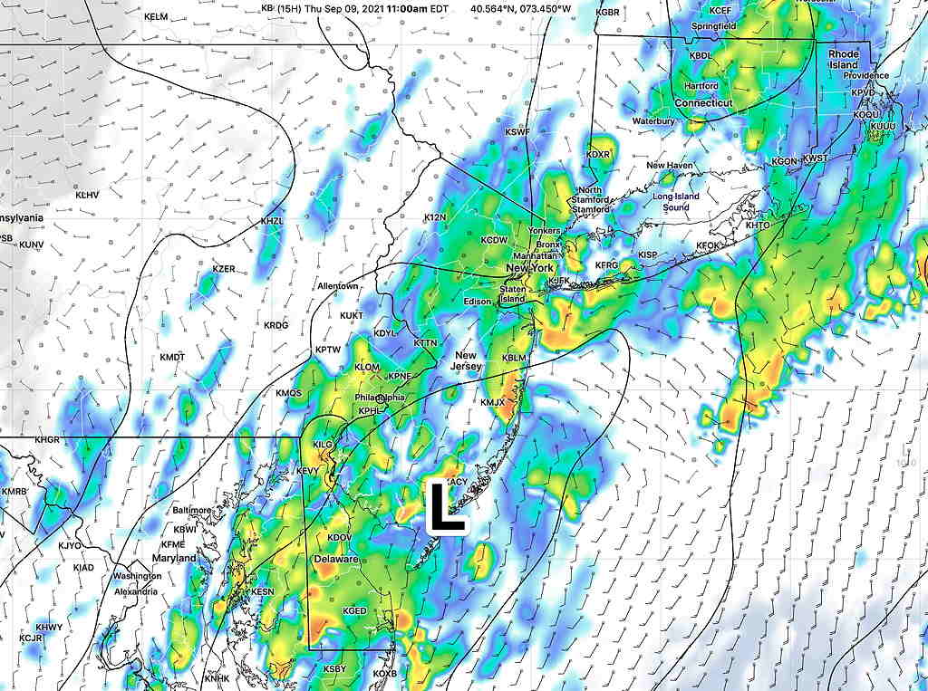
Last night’s early models that prompted my “Huge Forecast Change” update, the HRRR and RAP, were a little too far west with the rain that developed this morning. The later NAM and HIRESW models did a better job with the westward extent of the rain.
I was off-duty by the time these came out.😉
UPDATE 9:50 PM – HUGE FORECAST CHANGE: Tonight’s 00z models are becoming available. (The 00z models is one of the two model daily runs that include direct upper air measurements done with weather balloons [radiosondes].)
If you’ve been following the forecast, the timing of the frontal passage has been pushed further up with each model run. The latest HRRR and RAP 00z models shows the front significantly stalling as it tries to move through the Philadelphia area tonight.
The latest: low pressure is expected to develop along this stalled front and move up over Philadelphia and southern NJ overnight and through tomorrow. Most of the thunderstorm activity may stay to our west overnight or just make it into Philadelphia about 1-3AM.
Additional rain expected to develop with this low pressure system over our area in the early morning hours and through much of tomorrow. The forecast has changed significantly. Too early to put it all together. But the RAP and HRRR area forecasting rain for much of early Thursday! (This afternoon’s GFS had hinted at this change.)
The higher resolution HRRR keeps the heavy storms just to our west tonight. The RAP (which uses GFS input data), has the storms making it to PHL, followed by significant rain on Thursday.
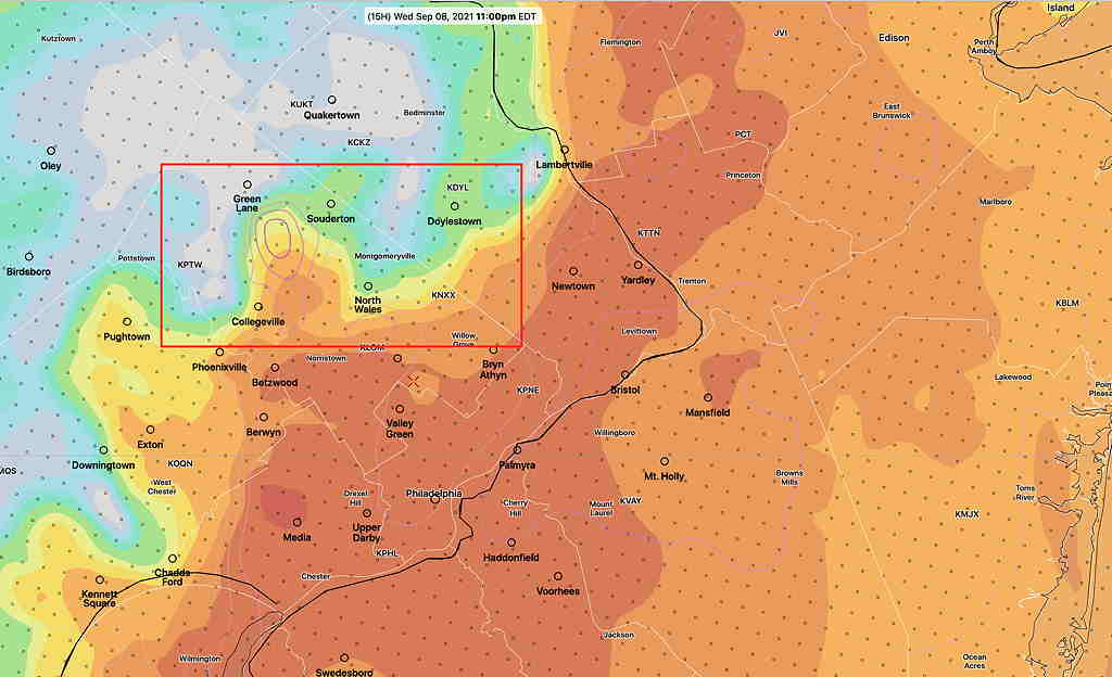
Update Wed @ 3:53 PM — Latest HRRR 18z available. Forecast still on track. A couple of isolated storms late this afternoon. Rain and thunderstorms, possibly severe, move into the immediate PHL area around 11PM – 2 AM, earlier north and west, in line with this morning’s NAM and HIRESW models. Rain and storms last through the night. Helicity and shear values lower than previous model runs, making the chance of tornadoes in our area unlikely. Still strong/severe storms possible with total rain amounts somewhat higher, near 1 inch, possibly 2 inches.
Strong storms are expected tonight. Most of the forecast remains unchanged from last night’s post. As usual, there are differences in the models from this morning.
To make things easier, I’m going to do a straight HRRR model forecast and then indicate where things don’t all agree.
Most of the thunderstorm activity breaks out between 9 PM and 1 AM with the maxima around 11-1 AM. (The latest HRRR does not show much activity in the afternoon, BUT the HIRESW models continue to show scattered storms this afternoon after 3 PM.)
The difference in forecasts between having strong/severe thunderstorms and extreme events like tornadoes are physical dynamics that are parameterized as helicity and vertical shear in numerical weather prediction models.
During the period between 9 PM and 2 AM, the HRRR has notable areas of moderately high helicity and high wind vertical shear. (As per my post last night, the helicity values are 350 m2/s2 compared to last week’s 1000 m2/s2 values; these are significantly less.) My personal feeling is that strong/severe thunderstorms are likely, but tornadoes are possible but not likely.
As for wind shear, there is a concerning level of high vertical shear about midnight in areas north of the city. This would translate into severe thunderstorms with high straight line wind gusts, hail and heavy rain.
While I have boxed in the area of highest shear, strong storms could form in other areas.
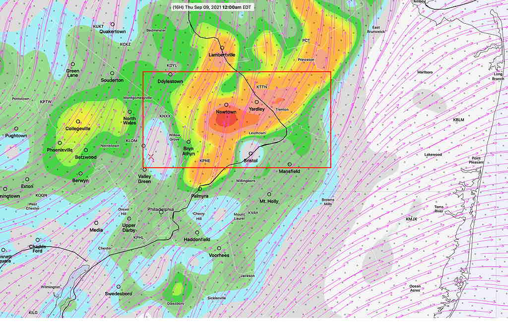
Heaviest rain areas—
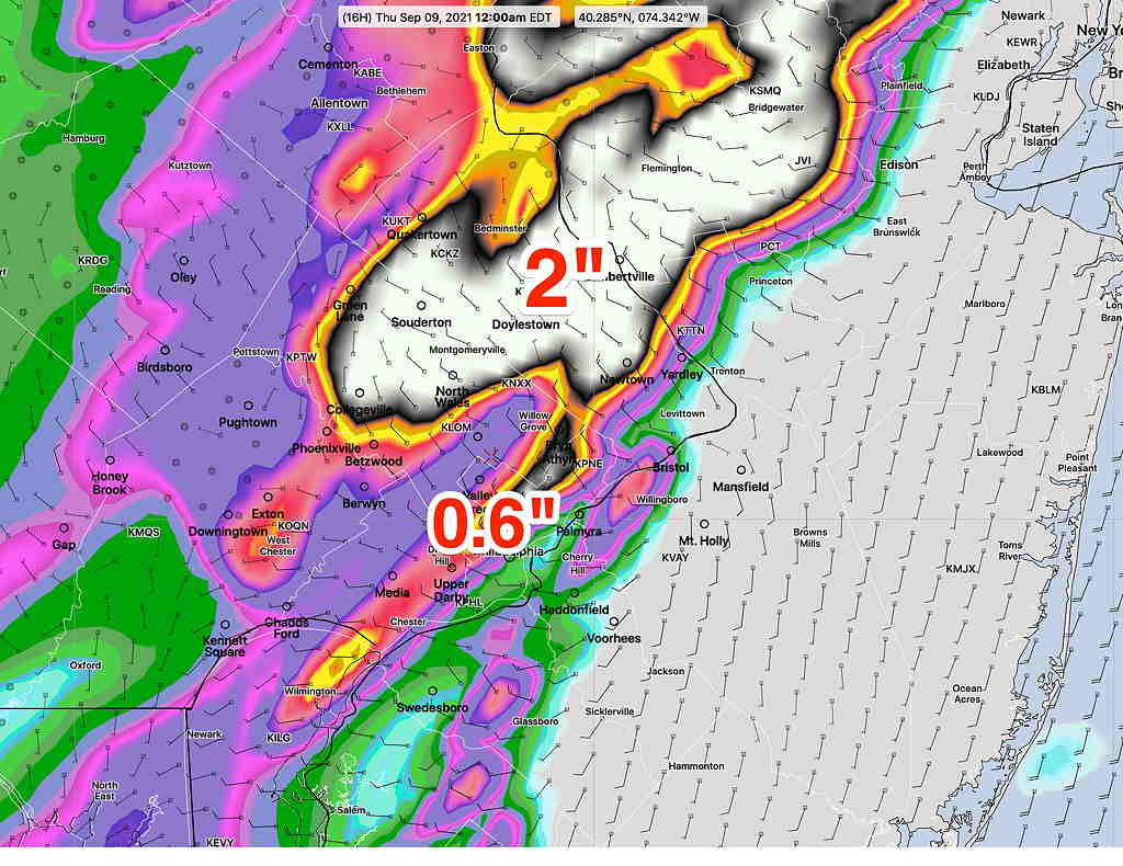
It should be noted that the NAM and HIRESW version models don’t agree on the above HRRR forecast. The principle differences for these models is that they have the heaviest rain and storms staying mostly to our north and west and have weaker showers/thunderstorms moving in after midnight and continuing until about 3-4 AM in the PHL area. They also have some scattered storms in the late afternoon today.
Stay tuned.