
Update Wed 7:45 AM— Good news. Last night’s models have backed off on the helicity values. Risk of tornadic activity low. Other changes: the first “wave” of scattered storms in the afternoon (described in main post) has reduced in likelihood. The main area of showers/thunderstorms moves through around midnight to 1 AM. CAPE values are further reduced at that hour of the night. So extreme weather less likely. Still strong storms expected. Rainfall about 0.6-1.2” possible, locally higher. Wind gusts about 30 + miles per hour. I’ll update later this morning when the newest models become available.
Update Tue 10:25 PM —Forecast below remains on track. Peak helicity about 8 PM [far] northwest of the city. Second wave of thunderstorms closer to midnight.
A strong cold front will move through after midnight on Wednesday. Thunderstorms, some very strong or severe, will be preceding the frontal passage.
The current models suggest that scattered thunderstorms, some severe, may break out earlier than the main batch of rain. So the storms will come in two waves.
First wave: Widely scattered storms will develop as early as 3-4 PM in areas from Philadelphia north and west. These widely scattered areas of storms ahead of the main front may continue through about 7 PM.
The second wave, the main batch of storms and rain, comes through from about 9 PM through 1 AM. (Remember, I use Blue Bell, PA as the model location grid point.) Rainfall may be heavy in some areas: 1-2 inches of rain.
Following last week’s devastating tropical rain and thunderstorms (and tornadoes) , it’s important to see current model differences between last week’s severe weather and tomorrow (Wednesday).
CAPE values are much higher tomorrow compared to last week, but within range of typical strong/severe storm events.
Regarding tornadic activity, peak helicity values tomorrow are currently forecast less than 350 m2/sec2, significantly below last week’s storms.
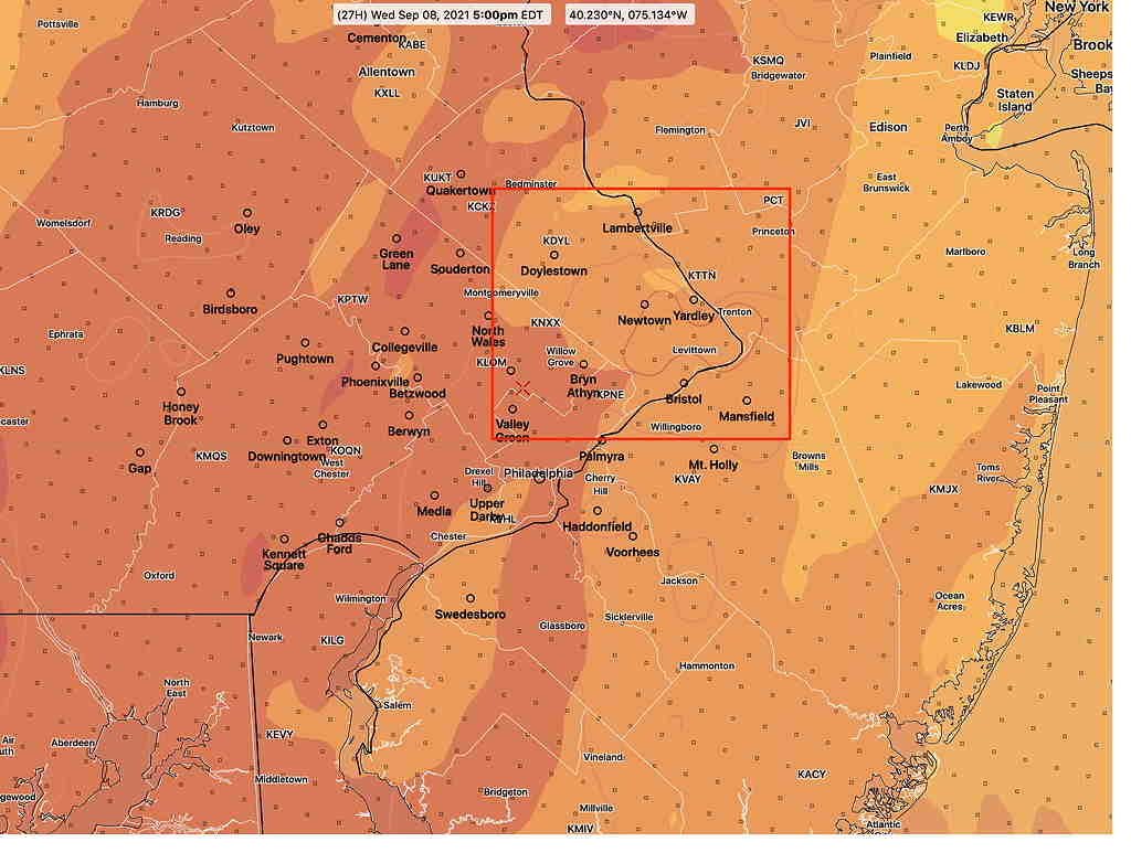
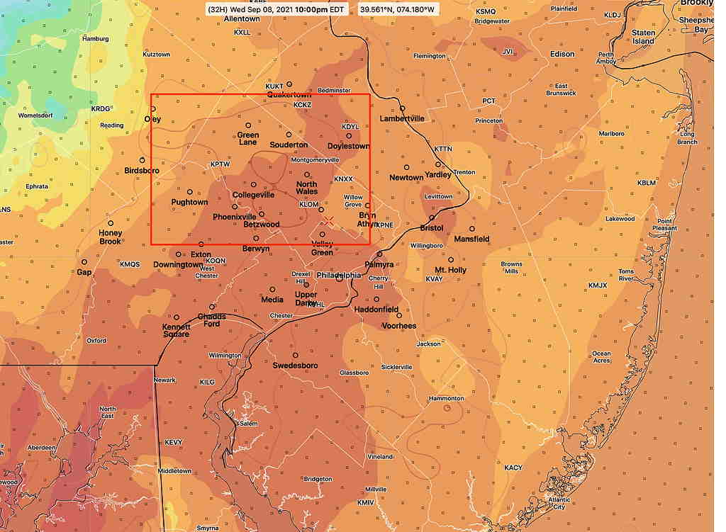
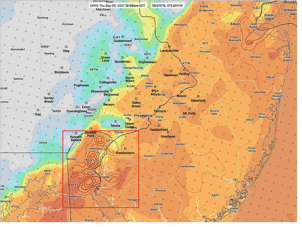
(Last week’s tornadoes were developing at helicity levels more than two to three times as high: 800-1000 m2/sec2.) Peak helicity values occur with the second batch of rain and thunderstorms, although there is some significant helicity at 5 PM north of the city. Again, these helicity values are 1/3 that of last week’s Ida event.
I’m providing the following CAPE/Helicity graphics as examples. The location and timing are likely to change in future model runs. Don’t take these locations too literally.
Tornadic activity, if any, will be late afternoon or early evening, with the first batch of energy and again with the second batch of energy, in the 9PM to midnight time frame. But since we’re dealing with life-threatening possibilities, always follow the warnings of the National Weather Service.
I’ll be updating this info tomorrow morning. The next HRRR model run of consequence will become available around 9:35 AM. I’ll try to update then.