WEEKEND WEATHER FORECAST

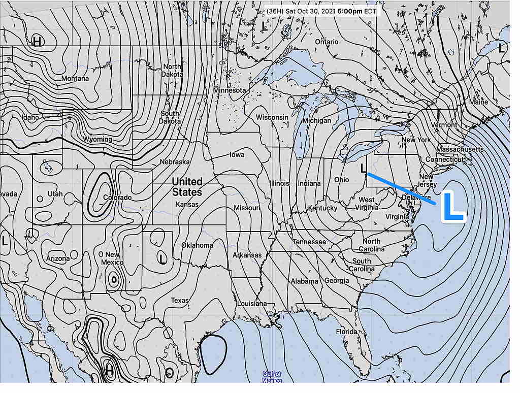
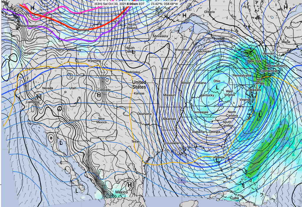
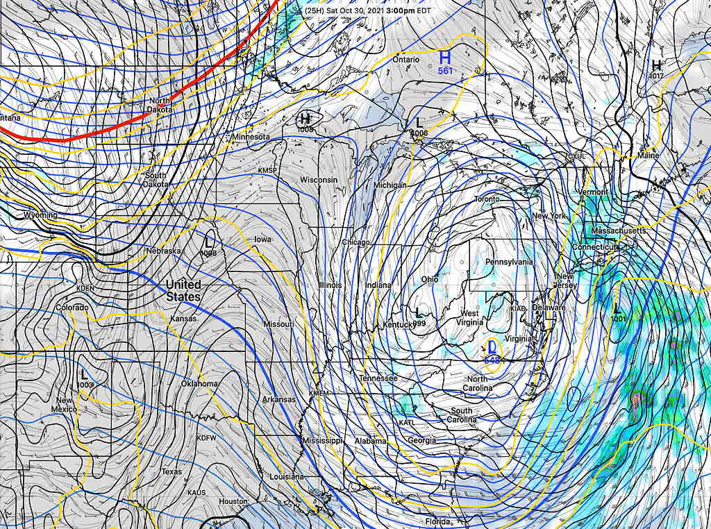
Deep low pressure in the mid and upper levels of the atmosphere will move over western Pennsylvania on Saturday as it spawns a secondary coastal low pressure system at the surface. Several other low pressure systems will rotate around thia main upper low. The systems will slowly exit through Sunday.

GFS forecast 3PM Saturday. (Click on image for a larger view.)

Saturday

Update Sat @ 9:42 AM — This morning’s first 12z models have become available. For the immediate PHL area, it looks like it will be dry today. Sunny with periods of clouds. The new HRRR has significant cloudiness in the afternoon. Areas just to our east (Delaware river and east) may have some scattered showers from the coastal surface low later this afternoon and evening.

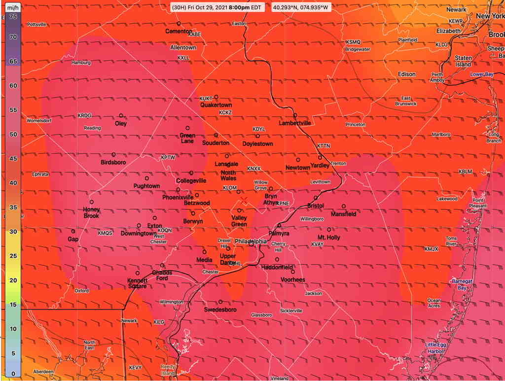
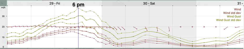
Following high winds and fairly heavy rain Friday night, the upper level low and main surface low to our west will develop a dry slot early Saturday over our area.

Clouds will give way to periods of sunshine during Saturday morning and early afternoon.

The strong upper cyclonic flow will result in instability cloudiness Saturday afternoon, while the secondary coastal system throws back moisture westward.

Some scattered showers possible late Saturday afternoon or Saturday evening, most likely west of Philadelphia.

Hi temp still above seasonal average of 65.3º sd 1.7º NBM model Blue Bell.

The upper air low will depart Sunday afternoon, but the upper air trough will swing through causing considerable cloudiness during the mid day hours.

So some sun in the morning then cloudy, then clouds breaking for some sun late afternoon.

Hi temp still above seasonal average of 62.6º sd 1.0º NBM model Blue Bell.
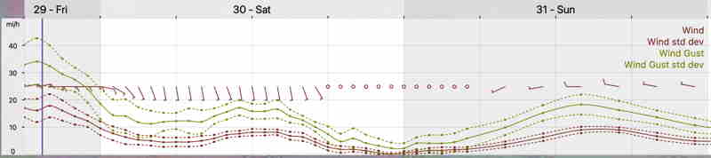
Winds
NBM Wind meteogram for Blue Bell PA (Click on image for a larger view.)

Temperatures begin a chill down starting Monday with relatively cold temps by Thursday or Friday.

HIGH WINDS FRIDAY

Update Fri @ 2:54 PM—The forecast is on track with rain moving in shortly. The winds will continue to increase to 40-50+ mph as we approach the evening hours. Highest wind gusts about 8 PM. Rainfall still predicted to be about 1 inch, more to the west.

The models have been increasingly suggesting the development of a secondary coastal low pressure system—

SREF for Saturday 5 PM showing secondary coastal low. (Click on image for a larger view.)

This system, along with the slow-to-exit upper low may prolong the chance of showers on Saturday.


Update Fri @ 7:21 AM— Last night’s models continue with wind gusts approaching 50 mph later Friday afternoon and evening. Heavy rain. Rainfall starts about 2 PM, moving from the southwest.

Rainfall totals about 1 inch, with about 1.5 inches west of the city by Saturday morning.

Showers with breaks of sun on Saturday. Will try to pin down timing later today.

I’ll be updating with my regular Weekend Weather Forecast later today.


The deep low pressure system that is currently affecting the Ohio River Valley will bring rain to our area Friday afternoon through early Saturday morning. About 1 inch of rain is expected by Saturday morning.

The strong pressure gradient with this deep low will bring high wind gusts to our area Friday afternoon and Friday evening. Wind gusts as high as 40 to 50+ mph are being forecast by several models.

Here’s the current GFS model wind gust forecast for our area—

GFS wind gust forecast for 8 PM Friday evening (Click on image for a larger view.)

The NBM wind meteogram for Blue Bell has somewhat lower forecast wind gusts, still impressive—

(Click on image for a larger view.)