WEEKEND WEATHER FORECAST

Updated on Sat 9:12 AM highlighted below


The cooler, less humid air mass that moved in will continue to influence our weather on Saturday. Two weak fronts will move in Sunday.

Saturday will be partly sunny. Return of moisture aloft may result in some cloudiness in the afternoon with a slight chance of an isolated shower far ahead of an approaching warm front. High temperature 86.0º ± 1.3º NBM model Blue Bell. Dew points in the upper 50s to near 60º.

UPDATED NBM thunderstorm/rain probabilities timing meteogram for Blue Bell, PA; MOST OF THE ACTIVITY IS STILL FORECAST TO REMAIN JUST TO THE WEST OF PHILADELPHIA SUNDAY EVENING. (Click on image for a larger view.)
Latest NBM precip forecast 8 PM Sunday. (Click on image for a larger view.)

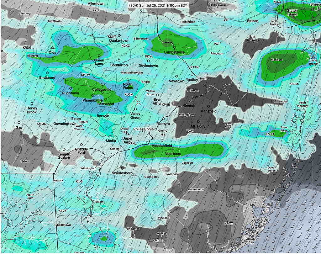
A weak warm front will move in before daybreak on Sunday. Some scattered showers before daybreak. Clouds early will break for sunshine by afternoon.

As a result of this warm front, Sunday will have noticeably higher humidity (dew points) than Saturday. Dew points will move back into the uncomfortable 70º range. High temperature 87.0º ± 2.2º NBM model Blue Bell.

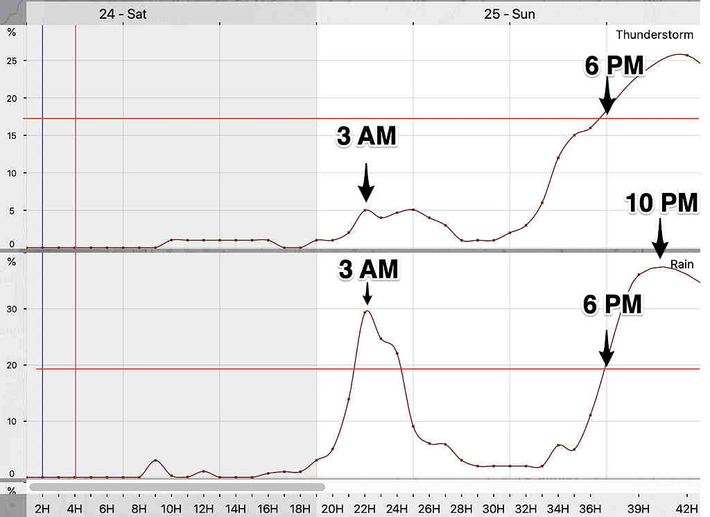
A weak surface trough may move through on Sunday evening with scattered showers and maybe some thunderstorms especially in western suburbs.


Outlook

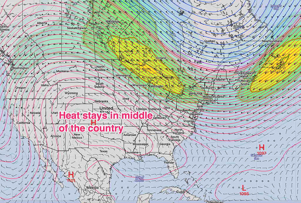
While we’ll be moving back into the 90º+ range by Tuesday, the extreme heat being forecast for the middle of the country does not appear to make it into our area because we’ll still be a slightly different upper air situation—

Jet stream level flow on Friday. Extreme heat is kept from our immediate area. (Click on image for a larger view.)

THUNDERSTORMS WEDNESDAY

Updated on Wed 7:49 AM highlighted below:

The latest NBM continues to show the highest probability of thunderstorms from Philadelphia eastward at about 4 PM.

NBM Location of highest probability at 4 PM Wednesday. (Click on image for a larger view.)
NBM 1 hour Thunderstorm probability for Blue Bell PA

Updated Tues 10:35 PM with HIRESW highlighted below

A cold front will move through Wednesday afternoon and evening. The actual upper trough is not very sharp and the energy of the front will come through not as a single punch.

Prior to today, the models were showing very little in the way of thunderstorms. Today’s models have changed somewhat with some activity being forecast by most models.

The HREF shows scattered areas of strong vertical motion between 12 PM and 4 PM. Peak time as early as 2 PM Main activity currently appears to be north and east of the city.

HREF Vertical Velocity, jet stream level, at 3 PM Wednesday. The areas with the darkest coloration have the best chance of thunderstorms. (Click on image for a larger view.)
NBM Thunderstorm 1 hour probability Blue Bell. Anything more than 18% is a good probability.

Precipitable water (1.4″ to 1.7″) is not as high as recent past thunderstorms and CAPE levels are in the 1100 J/Kg range. Enough for some strong storms but right now, it doesn’t look like a major storm event for most areas.