Updated Monday forecast, Mon 07:40AM, highlighted below
“exact forecasts with an upper closed low are fraught with difficulties, inaccuracies and uncertainties.”
A mid-level upper air disturbance rotating around the upper low, unpredicted by most of the earlier models today, caused the scattered showers Sunday afternoon. I don’t think weather models, as good as they can be, can do any better with forecasts and upper air closed lows.
Looking back at this morning’s models, the HIRESW-ARW2 did predict the showers, but it didn’t become available until after 10:20 AM. Had I actually looked at the HIRESW-ARW2, I don’t think I would have updated my forecast; there were too many models not showing showers.
Updated Saturday forecast, Sat 08:00AM, highlighted below
Updated Saturday forecast, Fri 11:10PM, highlighted below
Our weather early this weekend will be affected by a cyclonic flow of air around an upper closed low pressure system. This flow and the upper closed low pressure system’s cold air aloft results in instability clouds and showers.
As my regular readers know, exact forecasts with an upper closed low are fraught with difficulties, inaccuracies and uncertainties. Such may be the case this Saturday. The upper low’s effects are expected to diminish by Sunday.
(Today, Friday, is a perfect example. Some areas are having showers and some areas have sun breaking through clouds. This morning’s models have been unable to pinpoint the proper timing and placement. )
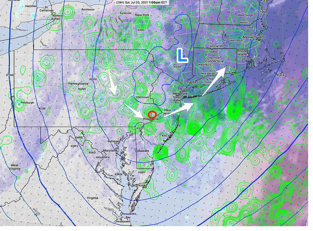
I’ve compared current radar with six different models run this morning. The HREF has had the highest skill in the forecast location of the current rain this afternoon. So I’m going to lean on that model for Saturday.
Here’s the current HREF forecast for Saturday at 1 PM (there’s a chance of showers in many areas) —
So, it looks like considerable clouds and showers develop Saturday afternoon. It won’t be raining all afternoon.
The upper low moves away on Sunday and Monday, but still a low chance of showers Sunday late afternoon.
Considerable cloudiness, perhaps some sunny breaks at times with scattered showers, especially in the afternoon. Breezy. High 73.2 ± 3.2º (NBM Blue Bell)Update:Tonight’s models have reduced the showers Saturday afternoon. Following morning clouds, look for considerable sunshine in the afternoon, except far western suburbs.
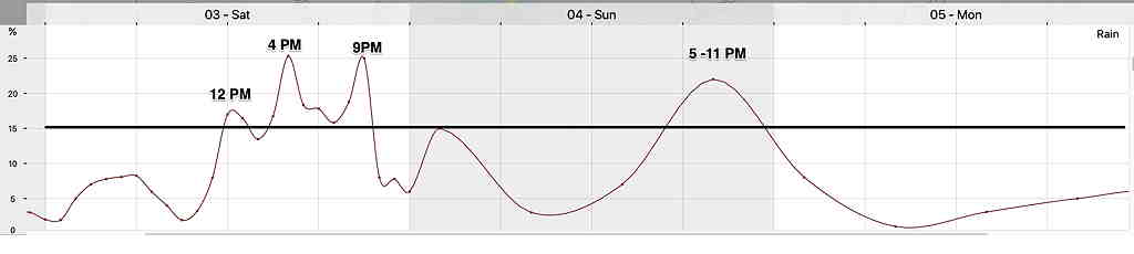
Sat Morning Update: Despite my optimistic update from last night, the early morning model runs (06z) have reverted back to the original forecast of plenty of showers developing throughout the day, especially late afternoon.
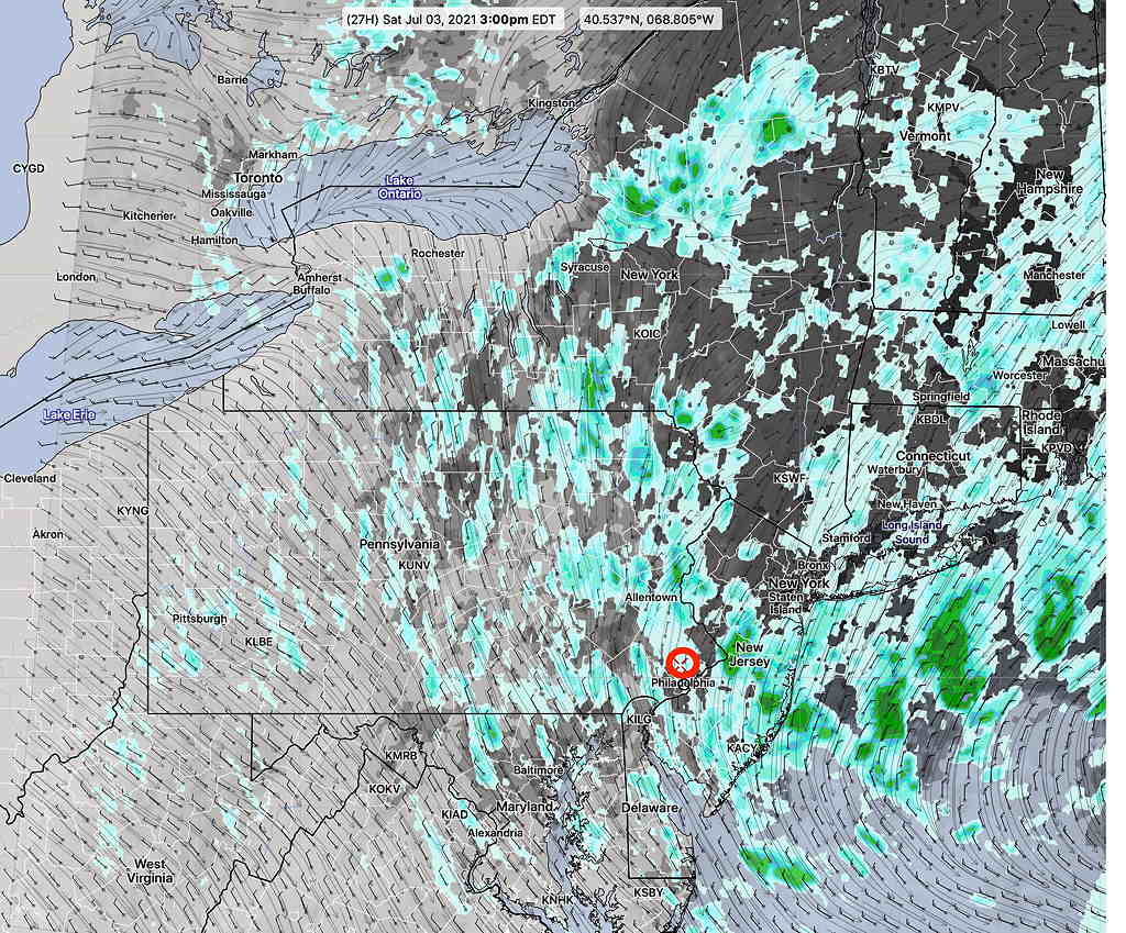
NBM 1 hour rain forecast Saturday 3 PM—
The upper low moves off. Some cloudiness in the morning, breaking way to a mix of sun and occasional clouds. A chance of a shower late afternoon. . High temp 78.4 ± 2.1º NBM Blue Bell
Sunny and warmer. Some models show widely scattered showers between noon and 3 PM, although this may be model noise. High 86.0º ± 3.1º (high spread!). High 87.6º ± 1.6º NBM Blue Bell.