Wed 09:39 PM — The westward path of Elsa, as indicated in Monday’s post (“If-Else(Elsa), then Rain”) continues to hold. Latest models have 1.5-2.5 inches of rain for areas in Philadelphia and NJ. More info tomorrow…
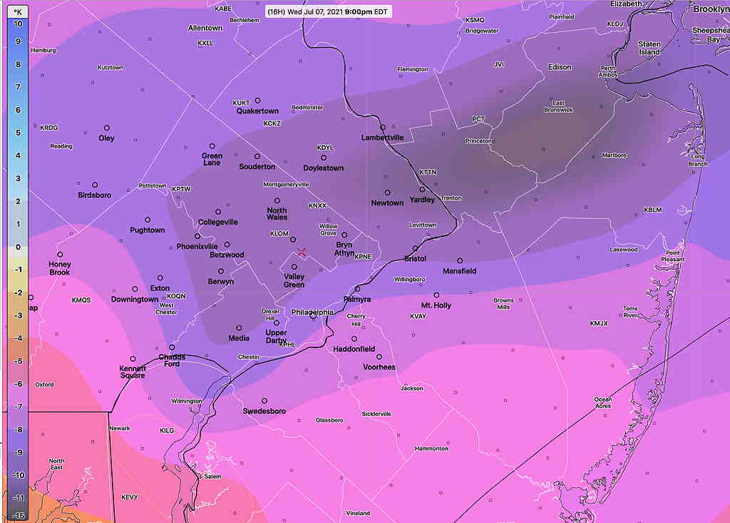
Wed 05:55 PM Forecast Comment — So why little thunderstorm threat today vs yesterday? Despite high predicted CAPE and hugely negative Lifted Index values, there is little vertical upward motion trigger today in the upper atmosphere. Wind flow in the upper half of the atmosphere is slightly anticyclonic today, resulting in sinking airflow compared to yesterday’s cyclonic flow. Some widely scattered storm activity is possible, but nothing like Tuesday night.
Updated 1:08 PM highlighted.
This morning’s models have the strongest vertical motions and dynamics from Allentown northward. While some scattered storms are possible in this area, the heaviest activity will be in the Allentown area.
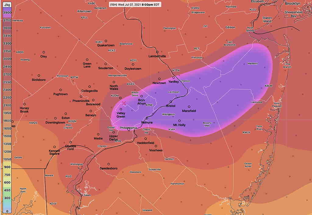
Another quick post- Last night’s models show significant instability and CAPE values between 5 PM and 11 PM Wednesday evening. Thunderstorms, heavy to severe, will likely develop again this evening from 5 to 11 PM. (GFS timing shows peak about 10 PM)
The NBM and GFS keep the heaviest activity to the north and west, but the higher resolution models forecast some impressive numbers in our area. Here’s the latest RAP model—