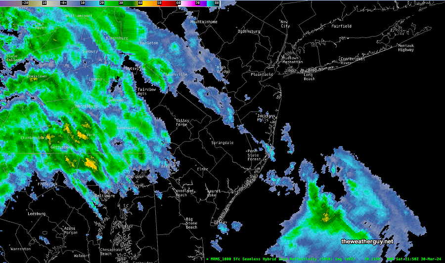
Sat 6:07 PM —Forecast Review —A few sprinkles moved in as early as 3:30 PM, earlier than I had forecast. The ECMWF was noteworthy as having predicted this. The main area of showers is poised to move in as originally expected after 6 PM. The showers appear to be somewhat heavier and further south than forecast.
MRMS radar image at 6 PM. Showers poised to moved in soon. (Click on image for a larger view.)
Saturday: A clipper system near the Great Lakes will move just north of our area this evening. Upper air support is not favorable for intensification and only very light showers will move in after 6 PM, mostly (but not exclusively) north of the Philadelphia area.
Before the light showers, cloudiness increases from the west, becoming mostly cloudy after 3 PM.
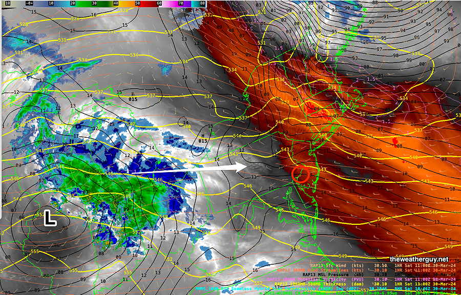
Here’s the current satellite water vapor image—
Current satellite water vapor image with superimposed RAP model 500-1000 mb thickness lines (yellow), Mean Sea Level Pressure isobars (black contours) potential vorticity (fine violet contours) with superimposed MRMS RADAR. Area of rain at 7 AM is 425 miles from here, corresponding well to the latest GFS forecast.
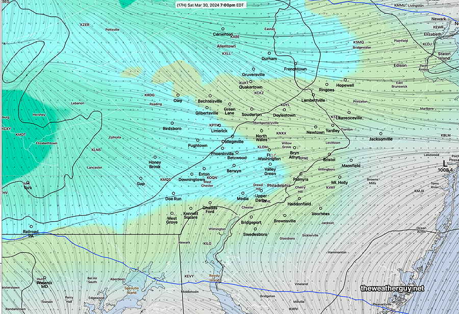
Here’s the latest HRDPS which is the most aggressive with the showers in our area—
Canadian high resolution 1 hour precip forecast at 7 PM. (Click on image for a larger view.)
Sunday: Periods of sun and clouds. Mild Showers move in during the late evening hours. High 63º
Rain moves in after midnight Sunday for a rainy Monday.