
While extreme heat will continue to bake the middle of the country, the Philadelphia area will trend towards cooler temperatures by the end of the week. (The pattern that will set up is similar to the less humid, pleasant weather that we experienced last Thursday through Saturday.)
The dip in the position of the jet stream can readily be seen on the GEFS model position of winds at about 31,000 feet (250 mb). The red arrows overlay the ‘jet streaks’, areas of higher winds within the overall flow—
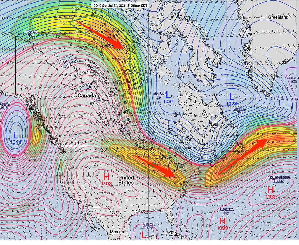
The position of the jet stream is important, but equally important is the location of the jet streaks.
Areas on either end of the jet streaks are referred to as the “entrance and exit regions”.
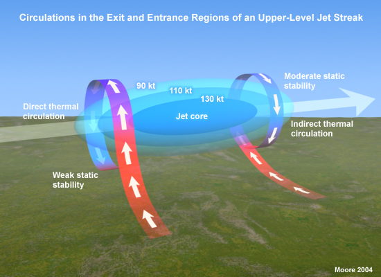
On the side of these regions you will find rising or falling vertical motions, causing rain, clouds, or nice weather. While the winds in the jet stream move in excess of 100 mph, the jet streak areas move along at a much slower speed.
Next Saturday looks to be very nice. We’ll be in the right exit region of the jet streak, with downward vertical motion.
Next Sunday, we’ll be in the right entrance region of the jet streak. A surface trough will develop and will move through next Sunday evening with possible showers/thunderstorms.