Things have changed since this morning’s models and a review of this afternoon’s models and tonight’s early evening models suggest the following trends:
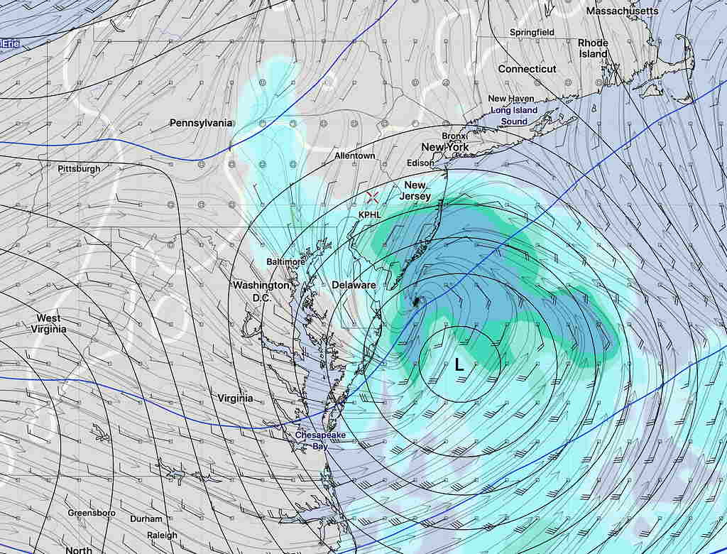
The low pressure system will move slower than previously forecast and the precipitation shield will have a further westward extent. Total QPF in the city will be about 0.35 inches water, mostly falling late afternoon through about 10 pm.
Most of the precip will fall as rain—>wet snow, but some of it falling will accumulate, possibly as much as 1-1.5 inches when it ends.
The latest GFS, just available, supports the same.
[su_note note_color=”#defcdc”]Mon 6 PM Update: Today’s model runs continue with the forecast that the low pressure system’s precipitation shield will stay mostly east of Philadelphia. Little if any precip expected west of the Delaware river.
Mon 7:12 PM Update: I just checked the latest GFS model run from 1 PM. It has expanded the precipitation into the Philadelphia area and is showing 1.3 inches of snow by 8 PM. None of the higher resolution models support this. I will update later this evening with this evening’s model runs. The new GFS will be available about 10:45 PM.
[/su_note]
…from this morning—
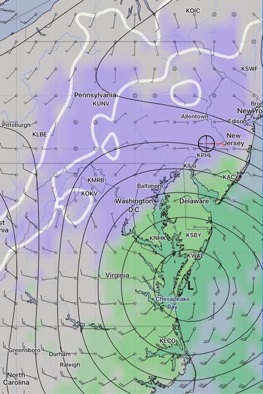
There has been a consistent forecast for a low pressure system to move to and develop along the coastline near NJ with the current time frame being Tuesday afternoon and evening. The track and amounts of snow/rain have clarified in the past day.
The (new) GFS has been the most consistent with this forecast track and intensity— the low develops late in the process and moves mostly eastward rather than up the coastline.
Last night’s 1AM (06 UTC) run of the GFS captures the event with accumulating precipitation barely making it into Philadelphia —
GFS Precipitation forecast 4:30 PM Tuesday
The other models, (NAM, CMC GDPS, ECMWF, etc) have joined in with the GFS forecast track and show similar precipitation coverage and amounts.
Some wet snow showers or flurries possible in Philadelphia and just north and west. Some of the models forecast a light coating of snow (< 0.5 inches) in central and eastern NJ.
Yesterday’s cloud base did lift and thin, but we never saw the degree of clearing that was forecast by the HRRR or NAM-NEST models. Showers moved in, as expected, about 5 PM, but the northern-most extent and their duration into the evening hours was greater than predicted by any model.
For today, (similar to last Sunday), several upper air disturbances are causing the cloud deck right now. Sun should break out later this morning, but another upper air disturbance is expected about 4 PM (not talking about the Eagles here.) So, another period of cloudiness possible later.
The coastal storm for mid-week mentioned in last Friday’s post remains difficult to forecast. The NAM and Canadian GDPS have 1-2 inches of snow (less in the city) late Tuesday afternoon into evening. The GFS shows less development and a coating at most. The GFS has done the best this season with these storms. This storm is still beyond the range of the shorter range models. Stay tuned.