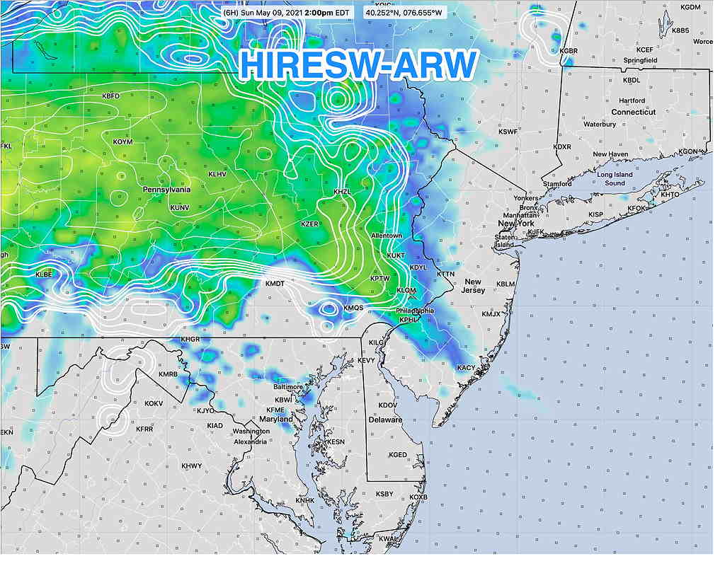
Sun 07:55 PM Forecast Review — The HIRESW-ARW did the best with this forecast.
Sunday
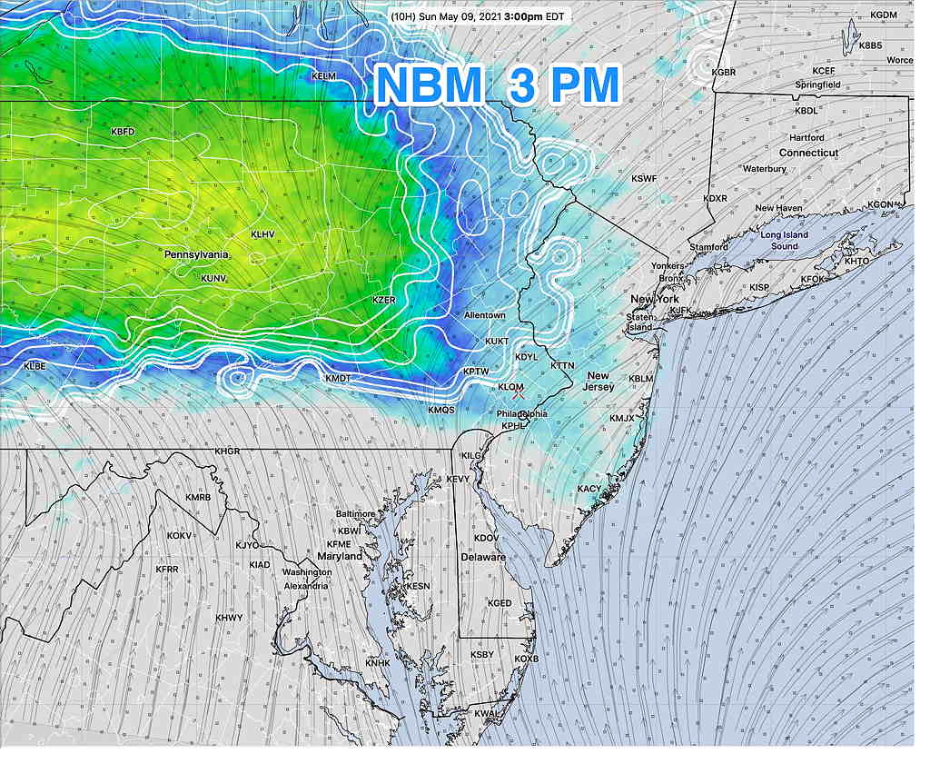
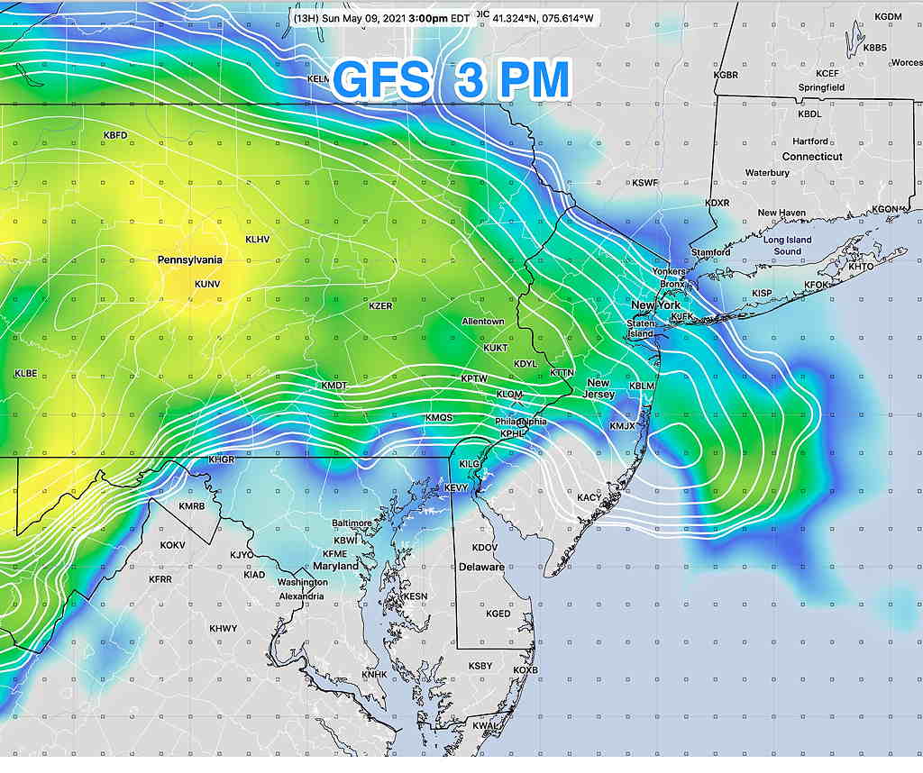
Considerable spread continues in the model forecasts today with the amount of rain/showers Sunday afternoon.
Many of the higher resolution models have only some sprinkles, mostly northwest of our area. The model blend has virtually nothing in the immediate PHL area.
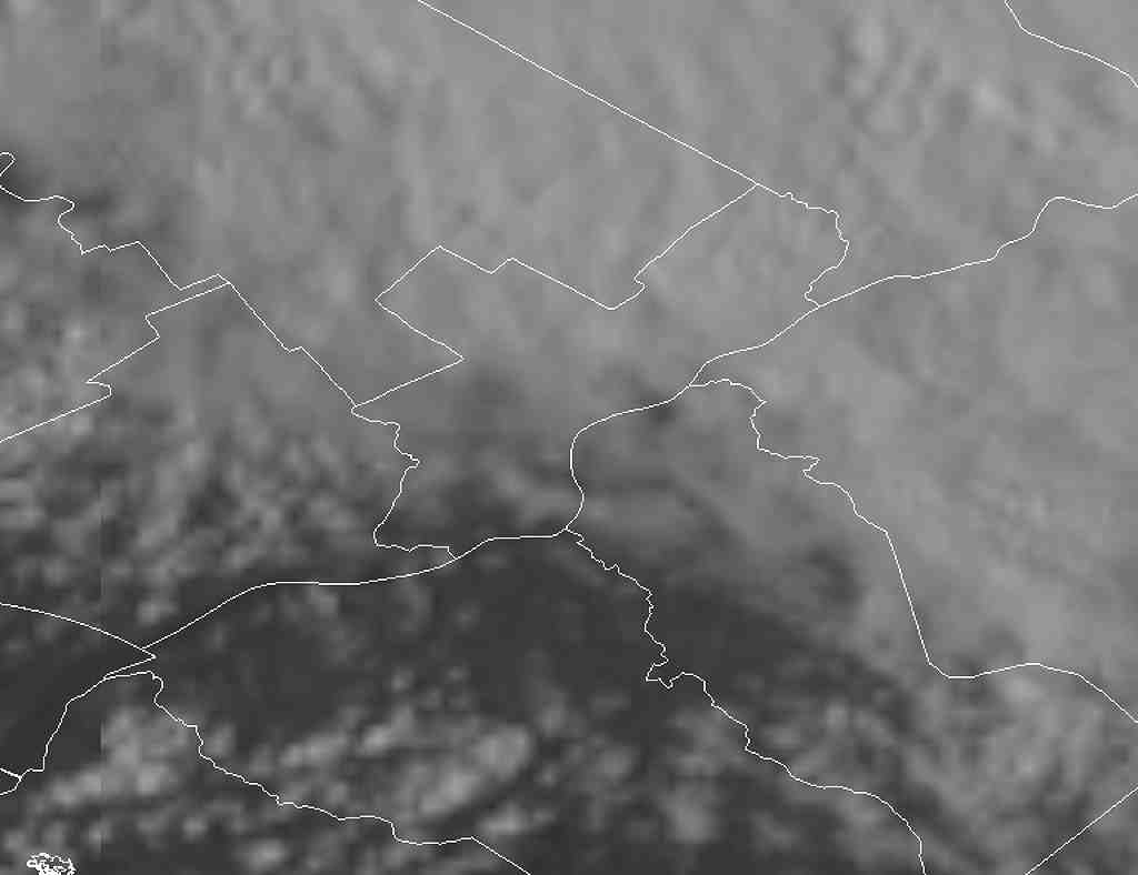
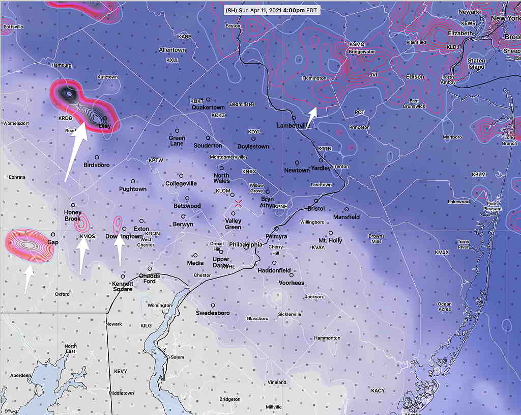
Sun 05:25 PM Forecast Review — An overly optimistic forecast. I can’t blame this on the models. I just bet on the wrong horse (HREF). This is as close as the clearing got to us this afternoon —
Visible Satellite at 4:45 PM
Areas of Chester and Delaware counties had clearing, but I use Blue Bell as the forecast focal point. The clearing may make it a bit further north as low pressure has begun to develop over the Delaware border . Showers and possible thunderstorms still expected later this evening and tonight.
Going with the latest HREF (High Resolution Ensemble Forecast) model forecast.
Here are the current conditions:
Current Conditions at noon (Click on image for a larger view.)
HREF forecast: Showers taper off noon- 2 PM. Clouds thin and break for some sun between 3-5 PM.
HREF forecast showing clouds thinning by 3-4 PM with developing areas of vertical motion to our west with residual activity to our far north. (Click on image for a larger view.)
More showers and thunderstorms between 9 and 11 PM
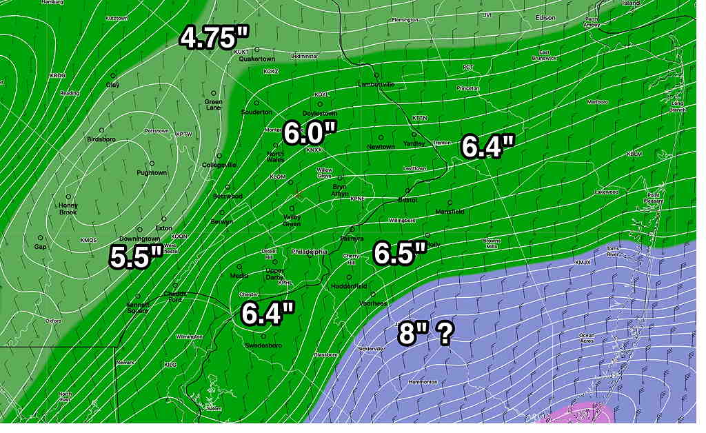
Sun 1:45 PM Forecast Review — What would have been my forecast if I had used last night’s NAM for the snow totals (which I did not)? —
NAM from 7 PM Saturday; Snow forecast based on accumulated precip converted to snow at 1:10 ratio. The 8″ amount is questioned because the snow was expected to mix with rain.
Every storm is different and a learning experience. The Model Blend (NBM) is supposed to do all the heavy lifting for a forecast, but it hasn’t been too good at blending or there’s bad info going into the blender.)
One more thing. Official Final Snow totals DO include compaction. (We have 4 inches at 12:24 PM.) If you shovel away 3″ of snow and you measure another 3″, the total snowfall isn’t necessarily 3+3=6. Official snow totals are measured immediately after the snow stops and the model algorithms assume compaction based on PTYPE, temperature, density.
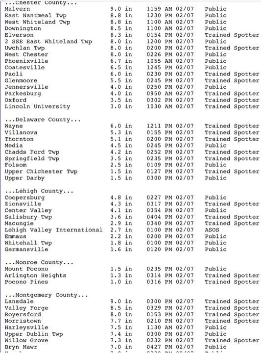
Forecast Updated Sun 11:20 AM — We have an interesting comment from Downingtown that they have gotten six inches on metal surfaces, 4 inches on driveway.
The latest GFS model run from 7 AM just became available at 10:38. Incredibly, it only show 4.3 inches of snow (for Downingtown!). Here, I have about 3.0-3.5 inches at 11 AM.
Only the NAM has (may have) gotten this right, with about 5-6 total inches consistently forecast for the PHL area. While I mentioned the NAM model’s higher totals each previous post, I discounted it in favor of the NBM. It’s all a learning experience. (Interestingly, the NAM had much more sleet and much less snow during our last 48 hour storm. Go figure!)
The latest hourly HRRR has snow ending about 3 PM ± 1 hour.
Forecast Updated Sun 9:33 AM — This morning’s models have become available. The main heavier axis of precip (rain/snow) has shifted east into NJ. The complicating issue in predicting snow accumulation is that the temperatures in NJ for the heaviest snow are forecast to be 35º and some precip will mix with rain in NJ.
Temperatures near ground are a bit warmer than forecast, allowing considerable snow compaction, lowering final totals in some areas.
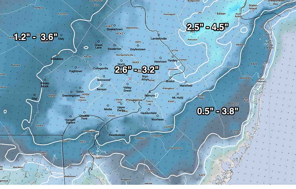
Here’s the latest Model Blend (NBM) from 12z (7AM)
NBM (7AM model run Snow forecast.) I’ve gone to the higher range of percentiles. Notice the range in NJ is much larger than in Philadelphia indicating higher uncertainty.
I’m still working on this forecast. Posting it as incomplete at 9:33
Forecast Continued Sun 10:02 AM — The RAP continues to forecast about 4 inches of snow for the immediate PHL area.
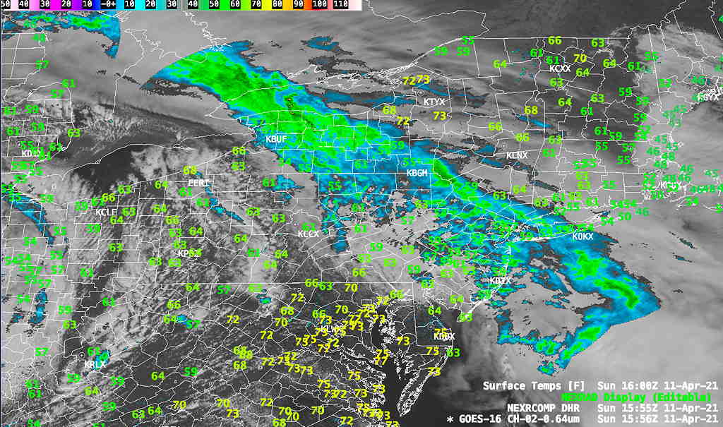
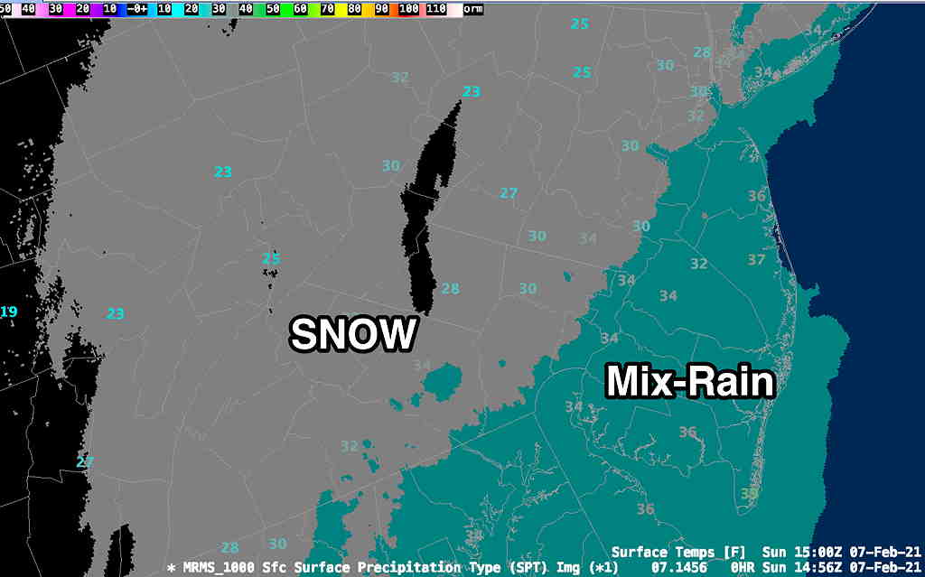
Here’s the real-time NWS MRMS (Multi-Radar Multi-Sensor) precipitation type and temps at 10AM—
NWS MRMS Live data capture at 10 AM, showing transition to mixed in NJ which current temperatures are above 32º