
Yet Another Nicole Update
Update Fri 11/11 @ 1:49 PM —
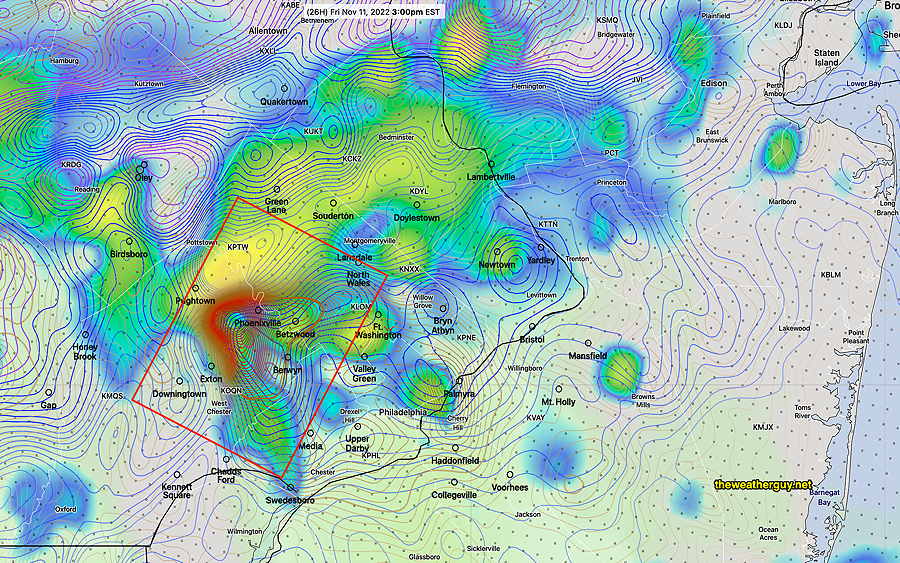
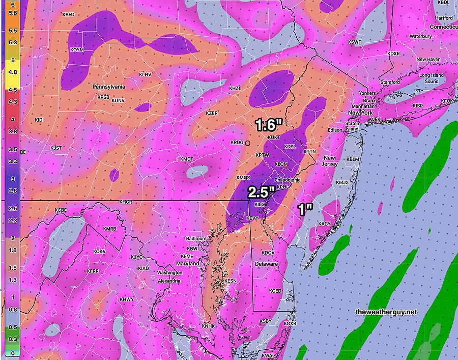
The latest HRRR has reverted back to a wetter and stormier forecast for the immediate PHL area. Rainfall amounts now forecast to be in the 1-2 inch range here—
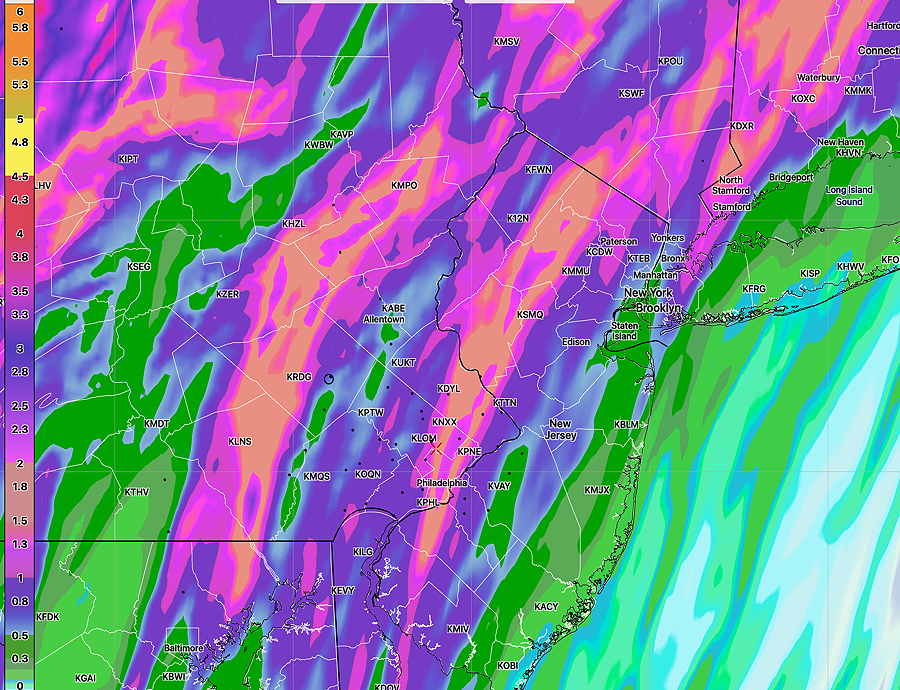
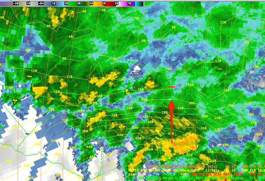
Indeed, the 2-5 PM time frame (mentioned in last night’s update) may include some very strong thunderstorms and rain, as CAPE values are currently approaching 600 J/kg2—
Nicole Update
Update Fri 11/11 @ 10:24 AM —
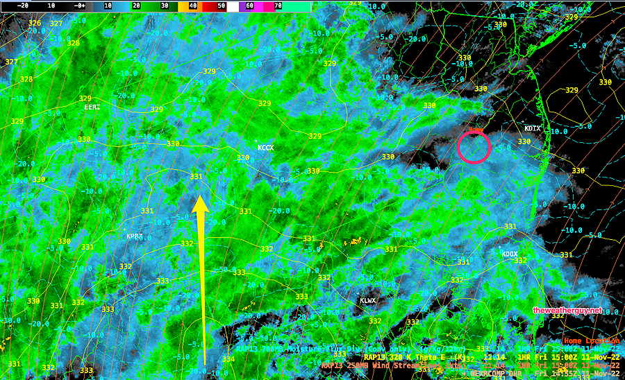
Current radar is consistent with the previous forecast of the heaviest rain moving off to our west—
The latest HRRR does NOT show any of the severe helicity and elevated vertical shear between 3-5 PM as it did last night.
However, the latest HRDPS shows the possibility of some heavier showers/thunderstorms between 1 and 5 PM, especially in New Jersey.
Winds increase during the afternoon and evening, but the NBM is not showing as strong wind gusts as it had forecast previously (about 35 mph) .
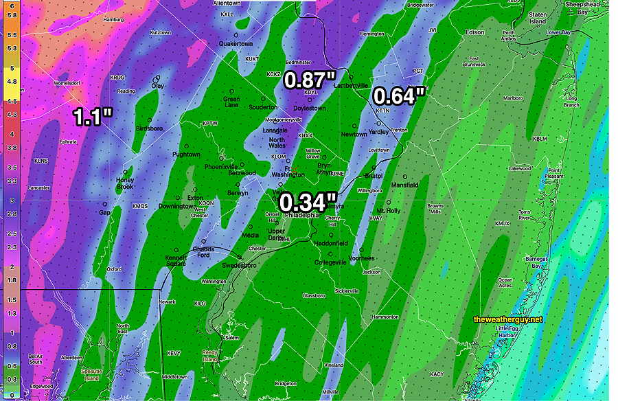
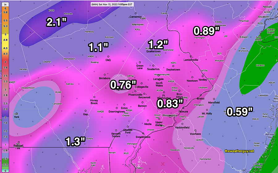
The HRRR has reduced its rainfall totals, but the NBM and especially the NAM-NEST has somewhat higher local totals.
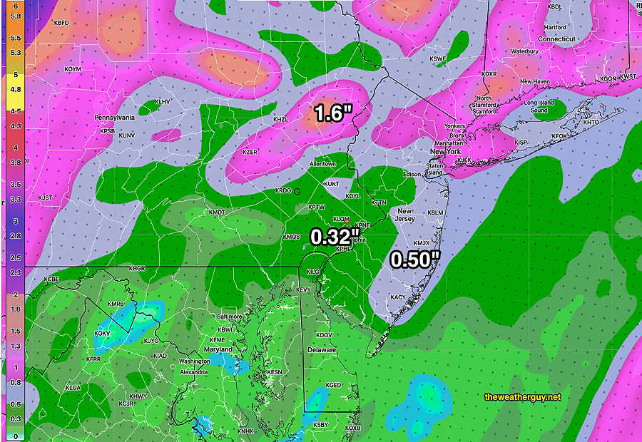
Total rainfall based on the latest HRRR (which may be a on the low side)—
Interesting Weather Possible Friday
Update Thu 11/10 @ 8:13 PM —
The basic trend has been for the heaviest rain and activity to be west of the immediate Philadelphia area but close enough that areas of Chester county and upper Montgomery county may be affected by higher rainfall.
As the system departs after midnight and before daybreak Saturday, highest winds will be from Philadelphia, eastward into NJ.
I’ve been looking over this afternoon’s models and two interesting periods stand out Friday into Saturday, based on the HRRR and Canadian HRDPS model.
First is an area of very high helicity and relatively high vertical shear around 3-5 PM Friday in our western suburbs—
Combining this model with the Canadian High Resolution model suggests some heavy weather between 3 and 5 PM Friday.
Another period to keep an eye on is 2 AM Saturday morning—
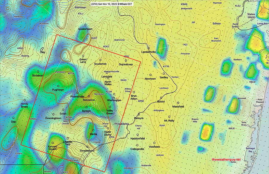
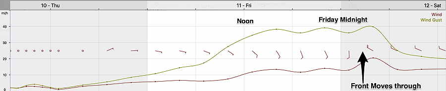
Tonight’s 00z NBM just became available. It shows increasingly windy conditions through the afternoon until about 4 AM Saturday—
Less Rain from Nicole here
Update Thu 11/10 @ 9:49 AM —
The timing for the arrival of the rain from Nicole is essentially unchanged. Rain starts here about 7-8 AM Friday morning (earlier to the south and west) and ends about 7 AM Saturday morning. Sun breaks out Saturday, but some cloudiness increases during the afternoon as a secondary front moves through.
Wind gusts are expected to peak during Friday evening and the over-night hours. Peak wind gusts 35-40 mph.
As is almost always the case, the distribution of the rain has changed [considerably], with our area now forecast to receive less than 1 inch—
Nicole Remnants to move Faster
Updated Wed 11/09 9:45 PM —
Tonight’s NAM-NEST continues to show an earlier arrival of the rain from Nicole. Some showers as early as daybreak Friday, and the system exits before daybreak Saturday with sunshine early morning.
Tonight’s NAM total accumulated rain forecast has moved closer to the NBM model forecasts of recent days—
Nicole Remnants to move Faster
Update Wed 11/09 @ 8:47 AM —
The remnants of Tropical Storm Nicole (or remnants of possible Hurricane Nicole) will move up the Appalachians and affect our weather Friday morning. Rain moves in between 7 and 10 AM here and will end early morning Saturday as late as 10 AM, but possibly earlier. Some sun possible around noon Saturday.
Currently, there are large differences in the rainfall totals here for Nicole. The model blend (NBM) continues to crank out 2.5 inches, but the NAM and GFS show much lower amounts here, with greater amounts far western areas.
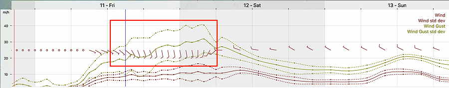
It will be windy. Here’s the NAM wind meteogram for Blue Bell, PA
As for Sunday, the models are leaning towards that low pressure being off the coast instead of giving us showers on Sunday morning. Only the ICON model has showers Sunday morning for us.
Remnants of Nicole to Affect our Weather Friday into very early Saturday
Updated Tue 11/08 9:32 PM —
A quick update. The GFS and ECMWF continue with rain starting Friday morning and ending Saturday morning. The NBM has the rain ending somewhat later, in the early afternoon. The rainfall amounts have been in the 1-2” range for the GFS and ECMWF. The NBM cranks out 3” in our area.
Another development: A weak low pressure system is now forecast to develop along a secondary cold front Sunday morning with light showers here and light snow showers in western PA.
Remnants of Nicole to Affect our Weather Friday into very early Saturday
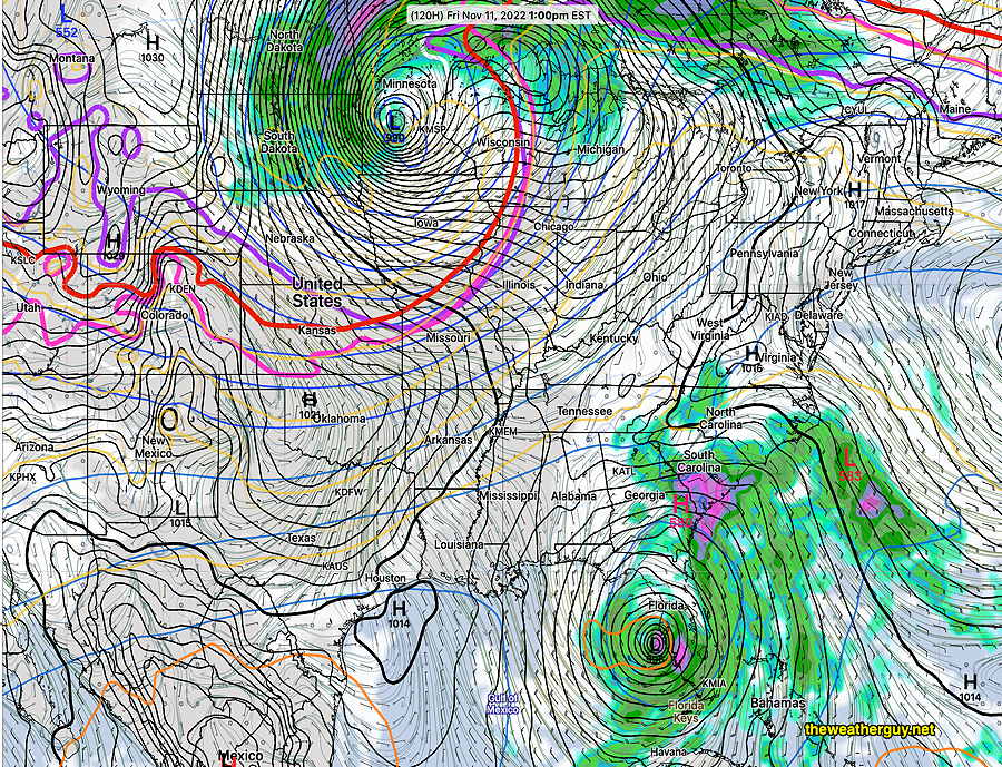
Update Tue 11/08 @ 9:36 AM — The latest GFS and ECMWF show the remnants of Nicole taking a more western track than previously forecast.
Here’s Nicole at 1 PM Friday, with rain just entering our area—
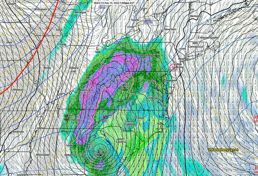
The latest ECMWF has a similar forecast, but a little faster with the onset of the rain —
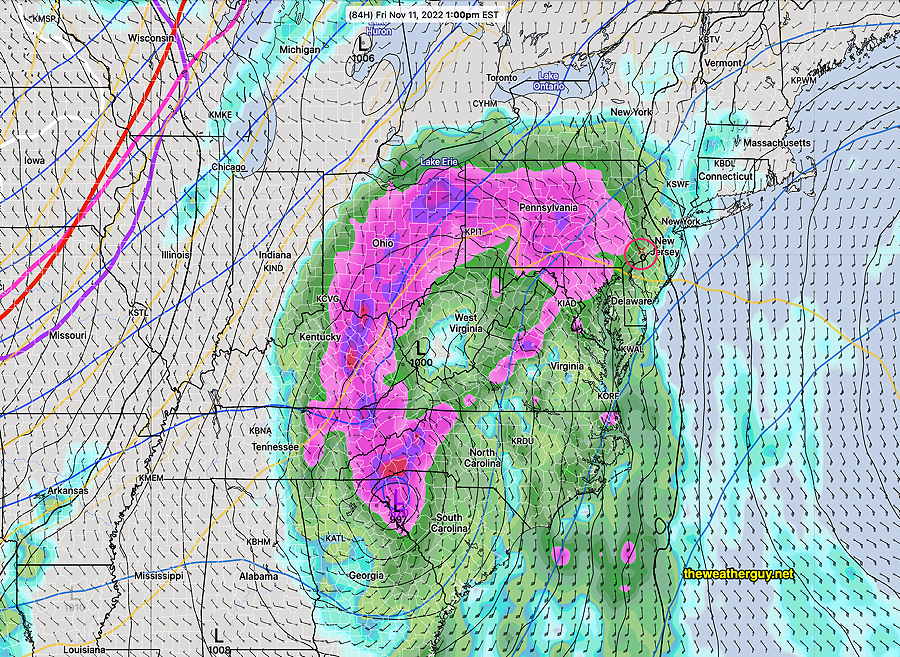
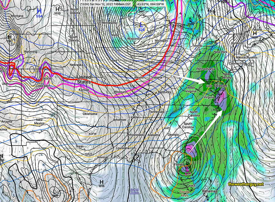
Both models now have the heaviest rain moving off to our northwest, although we’ll still get a good soaking.
The GFS has the cold front sweep the storm into the Atlantic by 8 AM Saturday with sunshine, colder and windy conditions moving in.
Remnants of Nicole to Affect our Weather Friday
Update Mon 11/07 @ 9:17 PM — Latest models have the rain from the remnants of Nicole affecting our area on Friday into Saturday. The latest 00z NBM has rain starting as early as 10-11 AM, but others start the rain in the mid to late afternoon. Rainfall amounts look heavy, with 1.5-3+ inches of rain over our area. Speed of the system varies with some models having it linger into Saturday afternoon. Others have rain ending Saturday morning.
I’ll do an update tomorrow morning.
Wide Spread in Forecast Intensity of Tropical System
Updated Mon 11/07 11:38 AM — The storm to affect Florida and us later this week has been given the name Nicole. This morning’s NAM and GFS suggest strengthening to near or above hurricane strength likely.
Update Mon 11/07 @ 9:07 AM — Significant disagreement in the forecast regarding the strength of the tropical system to affect Florida late Wednesday with the remnants to affect our weather late Friday into early Saturday.
The ensemble forecasts (GEFS, NAEFS, SREF) and the ECMWF have all reduced the strength of the tropical system to affect Florida—
The new GFS v 16.3 has forecast an increased strength of the system at the same time period—
The track of the storm towards us on Friday to Saturday also varies considerably from model to model.
The general consensus is that the system will be at its peak here 1AM Saturday morning with some possible clearing during Saturday afternoon.
Previously Posted Sun 9:15 PM —
I’m still getting past Sunday’s forecast disappointment, but some interesting weather changes are in store for us this week.
The front that went through today had little upper air support, but cooler air will gradually filter in over the next couple of days on easterly and northeasterly winds.
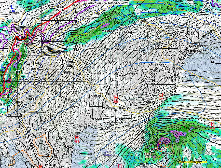
Of great interest is a tropical system (possible hurricane) that is taking shape near Florida. Below is the scenario predicted by the latest GFS v 16.3.
I expect that this forecast scenario will change in track and timing as the week progresses but here’s the latest GFS forecast—
System approaches Florida Thursday morning–
By Friday morning, the GFS takes this across Florida as the system will interact with a very strong cold front that will move towards us from the Midwest—
The system moves back across Florida and the moisture moves up the coast as a strong cold front approaches. Things come together over us Saturday morning. Some wild weather possible with such great temperature contrasts and high moisture content—
Stay tuned. The forecast will undoubtedly change as the week progresses.