WEEKEND WEATHER FORECAST


My 2022-2023 Winter Climate Snow Outlook

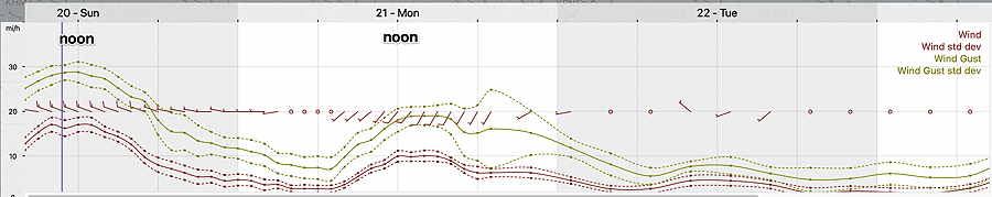
Update Sun 11/20 @ 10:49 AM — As forecast Friday evening, the big story today is the windy conditions. The latest NBM model still has windy conditions for Monday afternoon and evening—

Today’s 12z NBM wind meteogram for location Blue Bell, PA (Click on image for a larger view.)

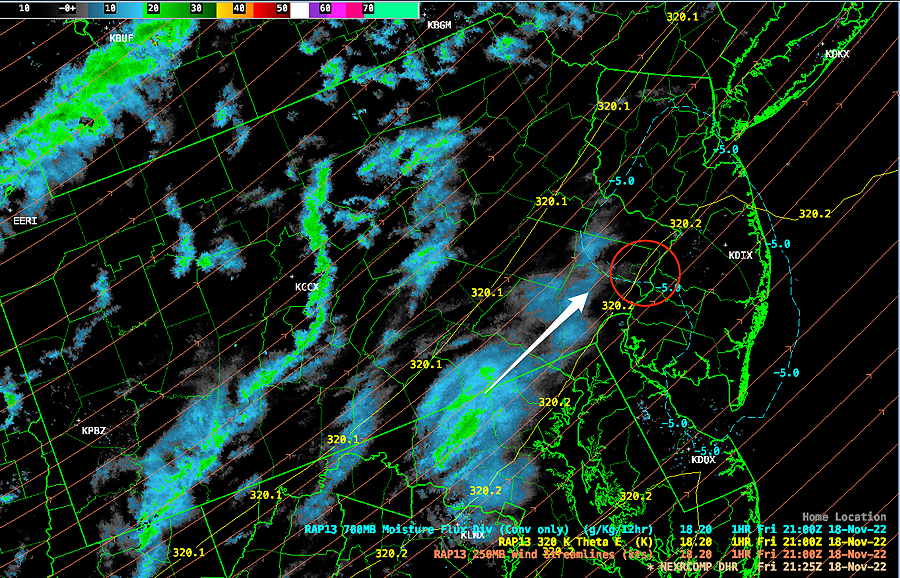
I’ve been keeping my eye on the evolving storm forecast for this Friday. Rain is still forecast for Friday, but the GFS, ECMWF and Ensemble model forecasts couldn’t be more different.

The current trend is towards a more eastward development of the storm and less rain and even minimal storm development. I’ll keep an eye on it.


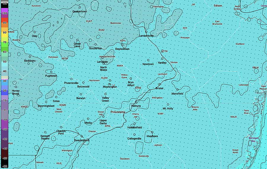
Update Sat 11/19 @ 10:05 AM — Latest NBM model high temperature for today, Saturday—

Today’s 12z NBM high temperature for Saturday. Contours are 2º increments. (Click on image for a larger view.)

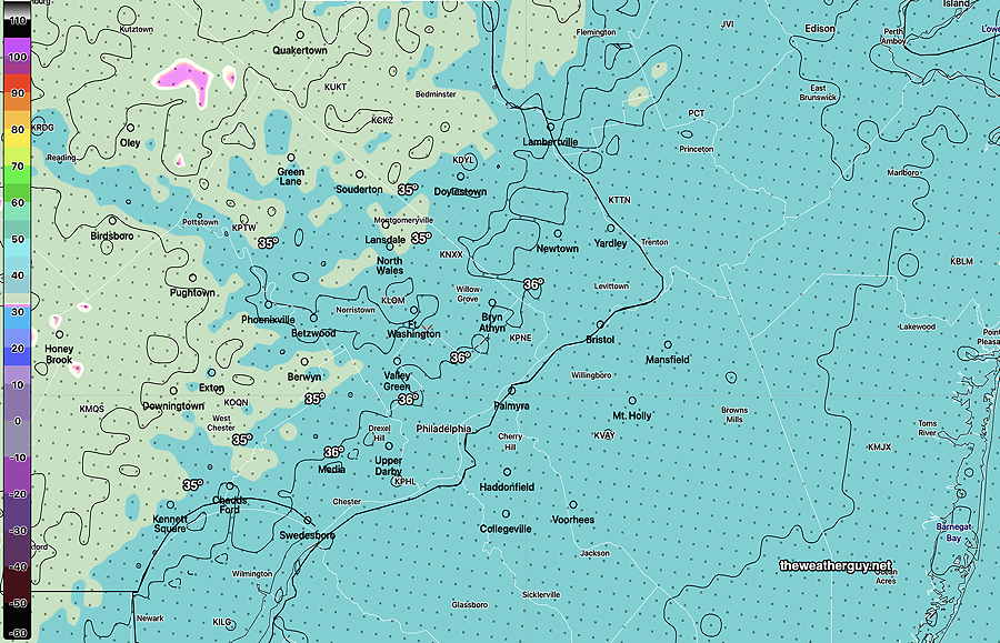
NBM high temperature for Sunday—

NBM model high temperatures for Sunday (Click on image for a larger view.)

Outlook for Thanksgiving Weekend

Thursday: Very nice
Friday: Stormy- rain possibly changing to wet snow at night.
Saturday: Clearing, Windy, Cold
Sunday: Cold


Previously Posted Fri 8:34 PM —

An easy forecast for this weekend. High pressure will maintain very cold temperatures over our area, despite very sunny conditions. It will be windy, especially on Sunday.

Saturday

Sunny and cold. Breezy and windy.

High temperature 39.7º sd 1.3º NBM model Blue Bell, PA

Sunday

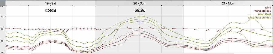
Continued sunny and colder. Windy and very gusty to 30 mph.

High temperature 35.9º sd 1.2º NBM model Blue Bell, PA

Winds

NBM wind forecast for the weekend (location Blue Bell PA) (Click on image for a larger view.)

Interesting Weather Friday Evening


My 2022-2023 Winter Climate Snow Outlook

Update Fri 11/18 @ 4:41 PM — The light snow flurries have begun to develop to our west (despite the surface temperatures being well over 32º) and some of us may see our first snow flurries of the season between 5 PM and 9 PM this evening.

Radar at 4:25 PM shows developing snow flurries to our west—

Previously Posted Fri 11:22 AM —

A strong upper air flow will develop a jet streak over our area this evening between 5 and 9 PM, resulting in an upper air disturbance that will quickly move through.

We will be in what’s called the “right entrance region” of the jet streak where strong upward vertical motion develops. An area of moisture in the lower atmosphere will be lifted. Our first snow flurries of the season are possible at this time. Heavier flurries possible in northern Bucks and Lehigh counties.

Jet streak forecast by the HREF

HREF model forecast Friday evening showing color-coded wind speed at 300 mb (jet stream level) We will be in the right entrance region of the jet streak where upward vertical motion develops. (Click on image for a larger view.)

Temperatures expected to be above freezing. No accumulation is expected with these flurries here. The flurries may be scattered and light. Not every area will see them.