WEEKEND OUTLOOK AND BEYOND

Update Thu 9:30 PM — Today’s ensemble models (GEFS, SREF) (statistical models) suggest that some cloudiness moves in Sunday afternoon and possibly some showers late Sunday afternoon or early evening Sunday. So the blocked good weather pattern may be breaking down somewhat sooner.


Original post
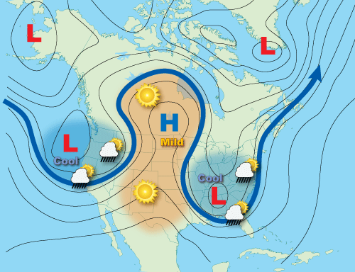
The current “omega” blocked weather pattern, as described in my post from earlier this week, will briefly open up over the weekend. Luckily, we will still be on the favorable weather side of this blocked pattern for Saturday and most of Sunday.

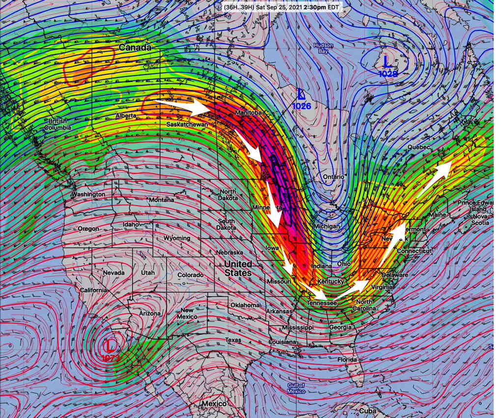
Here’s the current middle/upper air pattern for today, Thursday, with the closed low over Maine—

GFS 500 mb winds today, Thursday. We’re on the northwesterly wind flow side of the low. (Click on image for a larger view.)

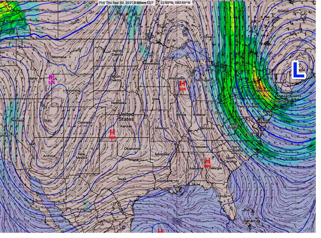
The mid level/ upper closed low in Maine will move northeastward and moisture in the center of the country will approach late Sunday with an increase in cloudiness.

The upper air pattern will briefly unblock over the weekend.

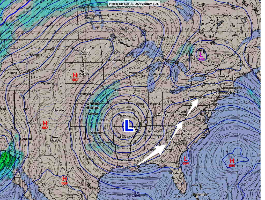
Unfortunately, another closed low is expected to develop over the mid-section of the country, near Missouri on Monday.

While we’ve been on the “good weather side” of the upper low this past week and will be for the upcoming weekend, the location of the new closed upper low over Missouri will place our area on the northeastern side of the closed low with moisture streaming up from the south. Expect clouds and showers for several days next week, starting Sunday night or Monday.

GFS 500 mb wind forecast 2 AM Tuesday showing closed mid-level and upper low over Missouri. A southwesterly flow of moisture will bring clouds and showers to our area much of early next week. (Click on image for a larger view.)

THIS WEEK’S WEATHER

Tues 6:31 PM Forecast Review — Our actual weather today was different than had been forecast by the models. Showers/thunderstorms came through earlier and traveled further east.  The scattered storms forecast for the afternoon didn’t develop, mostly because the atmosphere had been stabilized by the earlier storms. There are some showers and thunderstorms that will move in this evening, but are not widespread and are forecast to affect areas from Philadelphia and southward.  

Update Tue 8:25 AM — Last night’s models show a broad area of scattered showers and thunderstorms through the late morning far northwest of the city and then scattered activity throughout the afternoon in our area.

The HRRR shows the actual cold font moving though about 5-6 PM with more organized thunderstorm activity from 5 PM lasting as late as 7 PM -8 PM in the city.


Update Mon 9:45 PM — Tonight’s early models have some disturbances moving through Tuesday morning. Some showers possible. The forecast CAPE values have increased for Tuesday afternoon along with the thermal instability and upper air support. A broad area of showers and thunderstorms are forecast for much of Tuesday afternoon. Some of these storms could be very strong.


Original post

A somewhat unchanging, blocked upper air pattern had given us the nice weather over the weekend.

A strong, almost stationary closed upper air low pressure system over Maine will rotate a cold front through our area Tuesday afternoon.

Update Mon 2PM: This morning’s models show showers and thunderstorms a bit earlier, starting as early as 1 PM. Showers and thunderstorms are likely between 2-5 PM on Tuesday. (CAPE values will be over 1000 J/Kg, making the possibility of some strong storms. PWAT is in the 1.7″ range )

Cool beautiful weather, Wednesday through possibly Saturday, expected.

The upper air pattern continues to be stationary and blocked with the development of what is an “Omega Block” pattern:

Omega bock (https://www.weather.gov/jetstream/basic)

Here’s the ICON model upper air winds for Thursday showing the omega block—

ICON model 250 mb winds (jet stream level summer months) on Thursday (Click on image for a larger view.)

The blocked pattern may break down over the weekend.