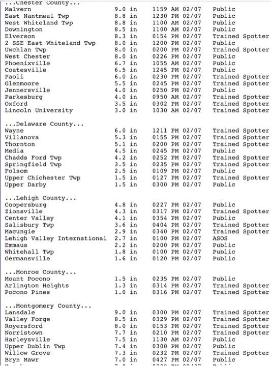
Final snow totals can be seen here.
Every storm is different and a learning experience. The Model Blend (NBM) is supposed to do all the heavy lifting for a forecast, but it hasn’t been too good at blending or there’s bad info going into the blender.)
One more thing. Official Final Snow totals DO include compaction. (We have 4 inches at 12:24 PM.) If you shovel away 3″ of snow and you measure another 3″, the total snowfall isn’t necessarily 3+3=6. Official snow totals are measured immediately after the snow stops and the model algorithms assume compaction based on PTYPE, temperature, density.
Oh…one more thing. I didn’t follow my own axiom that I had shared earlier this week… “it’s never good to ignore the NAM model”
Forecast Updated Sun 11:20 AM — We have an interesting comment from Downingtown that they have gotten six inches on metal surfaces, 4 inches on driveway.
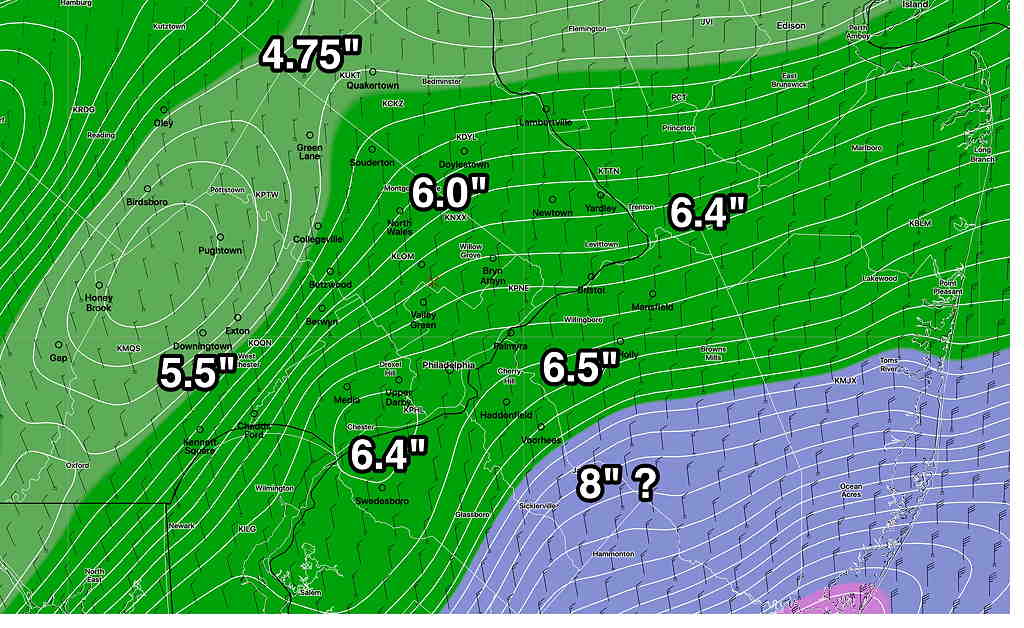
The latest GFS model run from 7 AM just became available at 10:38. Incredibly, it only show 4.3 inches of snow (for Downingtown!). Here, I have about 3.0-3.5 inches at 11 AM.
Only the NAM has (may have) gotten this right, with about 5-6 total inches consistently forecast for the PHL area. While I mentioned the NAM model’s higher totals each previous post, I discounted it in favor of the NBM. It’s all a learning experience. (Interestingly, the NAM had much more sleet and much less snow during our last 48 hour storm. Go figure!)
The latest hourly HRRR has snow ending about 3 PM ± 1 hour.
Forecast Updated Sun 9:33 AM — This morning’s models have become available. The main heavier axis of precip (rain/snow) has shifted east into NJ. The complicating issue in predicting snow accumulation is that the temperatures in NJ for the heaviest snow are forecast to be 35º and some precip will mix with rain in NJ.
Temperatures near ground are a bit warmer than forecast, allowing considerable snow compaction, lowering final totals in some areas.
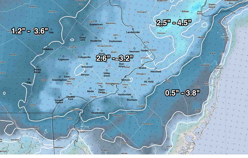
Here’s the latest Model Blend (NBM) from 12z (7AM)
I’m still working on this forecast. Posting it as incomplete at 9:33
Forecast Continued Sun 10:02 AM — The RAP continues to forecast about 4 inches of snow for the immediate PHL area.
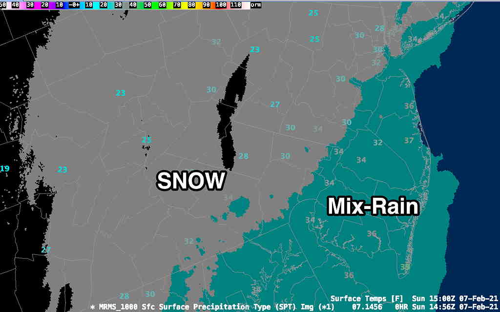
Here’s the real-time NWS MRMS (Multi-Radar Multi-Sensor) precipitation type and temps at 10AM—