There’s a change in the forecast for Sunday, specifically with the timing of the rain and with frontal passage.
The latest models have delayed the cold front passage until 7-9 PM Sunday evening. The clouds and rain will similarly much occur later in the day. More sun will translate into milder temperatures.
The latest NAM-NEST delays the rain until late afternoon or evening— 6 PM or so.) The Canadian models even later.
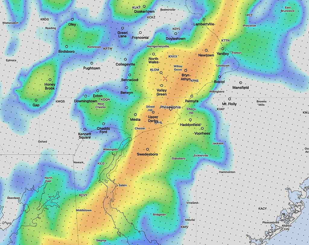
Here’s the latest High Resolution Window (HIRESW) Model (pre-release version) simulated radar at 6 PM EST Sunday.—
The system that moved through Thursday into Friday brought some much-needed rain to the Philadelphia area. High pressure will build in for Saturday before a strong cold front moves through later Sunday.
Saturday will feature sunny skies. Highs will be not far from the average high for this time of year: 53-55º
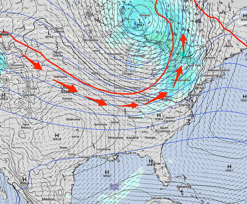
Short Range Ensemble Forecast for Sunday 1 PM showing showers and general jet flow.
For Sunday, it will be mild. A strong cold front approaches during the day and winds will increase. There’s a good model consensus that there will be light rain Sunday afternoon.
Following a very long period of warmer temperatures for November, this weekend will be a transitional time to a broad drop in the jet stream over the eastern half of the US for next week.
Saturday will feature a slight drop in the position of the jet and we’ll have cooler temperatures than we’ve had in the past week. Fair skies will prevail.
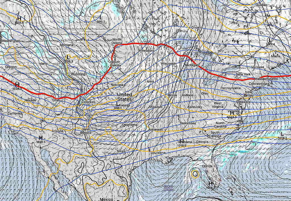
Canadian (CMC) 540 thickness -red line – Saturday afternoon
On Sunday, the upper air flow relaxes and a return of moisture and milder temperatures is expected with a warm front. Showers expected early Sunday.
A cold front later Sunday afternoon will bring additional showers and precede a more pronounced drop jet, with much colder air for Monday.
The timing of these fronts may change by the weekend. Stay tuned.
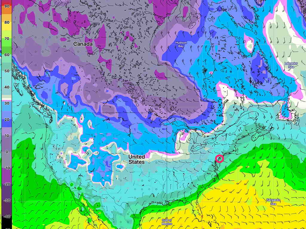
What’s interesting is an ongoing condition that I’m going to refer to as a relative “lack of very cold air” to our north. Of course, it’s still early November, but things just look a little bit warmer than usual to our north—
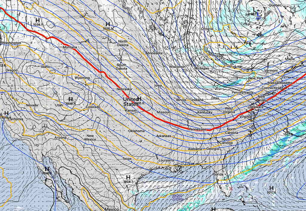
German ICON Model Temperature Forecast for Monday.
While we’ll get some chillier conditions next week, I don’t see a pronounced or extended period of cold weather for us right now.