UNCERTAIN WEEKEND FORECAST

[su_note note_color=”#defcdc”] Updated Fri 05:15 PM —An interesting announcement from NOAA about the strangely large standard deviation on the NBM model today—

“Navy FNMOC updated their data distribution software on Wednesday, and there are some issues that have resulted in values of NAVGEMD being about 40F too cold.
Thus, the large spike in standard deviation fields for NBM that have been seen are caused by that model.
NCO is in the process of removing the NAVGEMD as an input to NBM today so that it can run without this issue over the weekend.”
So, the amount of uncertainty in the forecast  I spoke of today was not real; it was just caused by a large error in one of the updated model inputs.

[/su_note]

The upcoming weekend forecast has a higher than usual level of uncertainty.

First, most of the scattered storms missed the immediate PHL area yesterday, the subject of my previous post about a persistent weather pattern.

So we’re having a conjectured persistent weather “pattern” of having storms repeatedly shear off to the north and west coming against a number of ingredients that add up to potentially moderate to severe thunderstorms for our area Saturday afternoon.

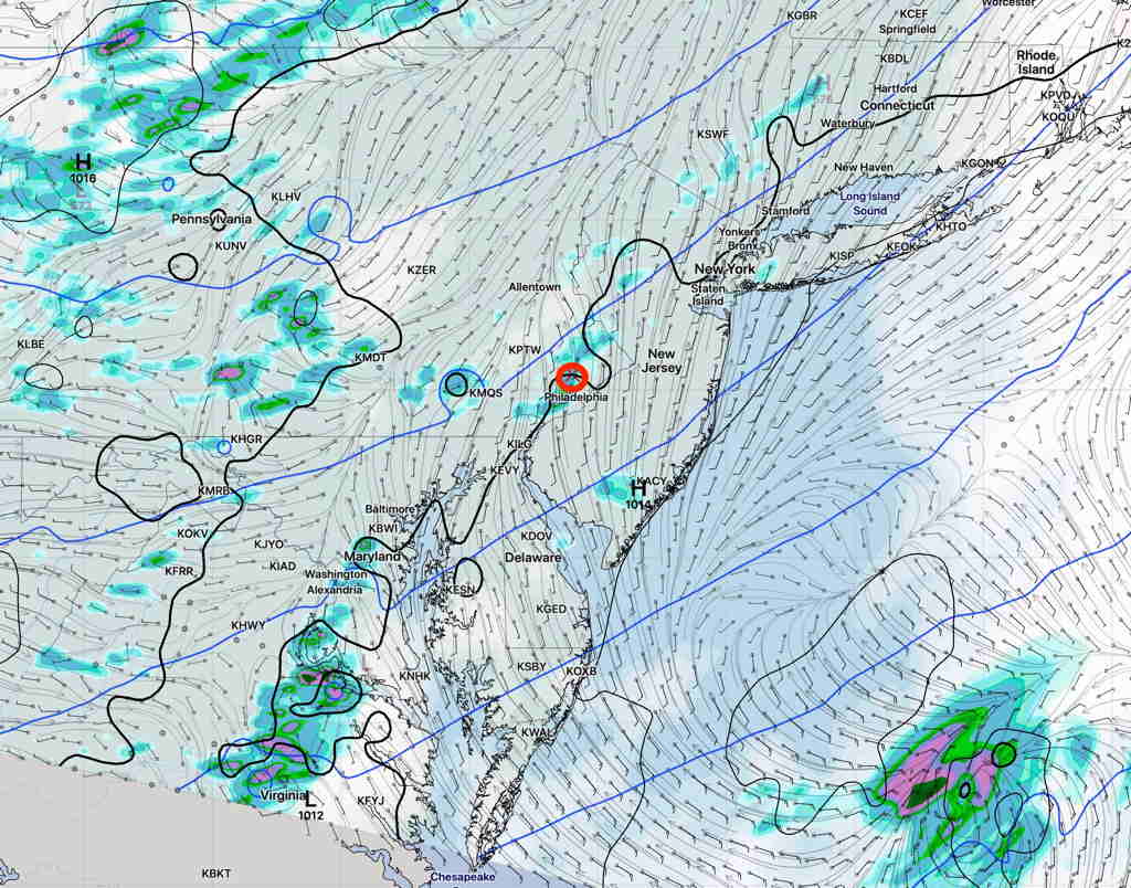
For several days, the statistical models (“Ensemble” models) – GEFS and the SREF – continue to forecast the thunderstorms moving off to our north and west.   The deterministic models, the GFS, NAM CMC, suggest the possibility of moderate to severe thunderstorms making it into the PHL area.

SREF Forecast Saturday afternoon 6 PM
NAM NEST accumulated precip Saturday 8 PM

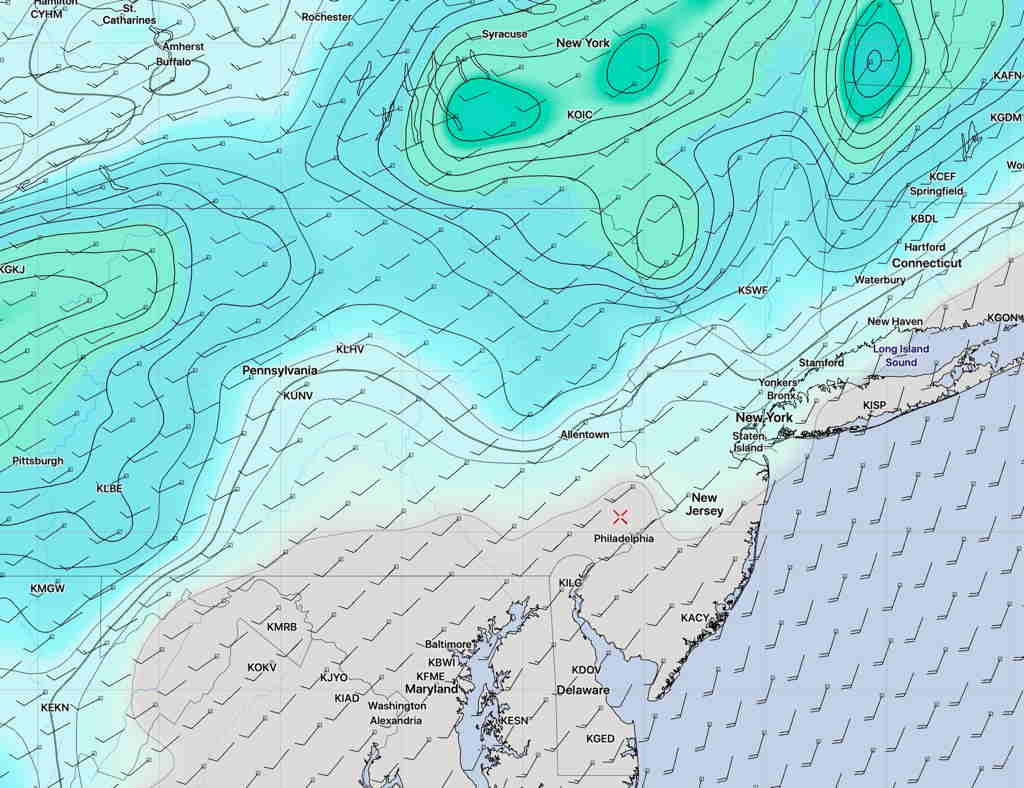
The uncertainty in the forecast is captured by the extremely large standard deviation (sd) in the model blend forecast high temperature for Saturday— 89º sd 10.5º  (this standard deviation of 10.5º is 1 – 2 times the usual spread of 1º or 2º). In fact, I haven’t see the sd as high as this in long while.

So this means there’s a lot of spread in the various model forecasts that comprise the national model blend (NBM).    The two graphics above show the differences in the placement of the storms.

Too early to tell.   I’ll update later this evening.

PERSISTENT WEATHER PATTERN

[su_note note_color=”#ffffff”]Updated Wed 10:30 PM —Tonight’s models have reduced Thursday’s late afternoon showers to light and widely scattered. [/su_note]

[su_note note_color=”#ffffff”]Updated Wed 07:54 PM — Thursday may see some scattered showers and thunderstorms in the Philadelphia area, especially late afternoon, as an upper air disturbance rolls through.  But large scale rain is going to pass us by.

NAM NEST forecast for 6 PM Thursday  (Click on image for a larger view.)

[/su_note]

You may have noticed that our area has been missing most of the organized rain and thunderstorms lately. Yes, we’re getting some  scattered showers and thunderstorms occasionally, but an organized large scale rainstorm or rain with a frontal passage hasn’t materialized in the Philadelphia area and eastward into NJ for awhile. Most organized activity hasn’t been making it past central Pennsylvania.

Last night’s frontal passage dynamics sheared off to our northwest.

We are in a somewhat persistent pattern with an upper air trough bringing little moisture from the northwest.  It’s a significant change in pattern from what had brought recurrent heavy rains over past previous months.

GEFS forecast for Sunday 3 PM

I don’t see any change on the horizon.   Expect mostly dry conditions to continue.

WEEKEND WEATHER SIMILAR TO FRIDAY’S

[su_note note_color=”#ffffff”]Updated Sun 12:15 PM — This morning’s models still maintain the possibility of afternoon scattered showers and thundershowers, mostly north and west of the city. [/su_note]

[su_note note_color=”#ffffff”]Updated Sat 10:50 PM — Little change In the Sunday forecast shown below. Fog and clouds break between 9:30 AM and 11AM. High Temp 84.2° sd 1.2°  Afternoon showers much less likely except in northern suburbs. [/su_note]

[su_note note_color=”#ffffff”]Updated Sat 08:29 AM — Most of last night’s models onboard for showers and thunderstorms between 12 PM and 5 PM.   Two probability maxima- about 1-2 PM and about 4-5 PM.   Some cloudiness moves in about noon. These storm’s main threat will be mostly moderate to heavy rain where they occur. [/su_note]

The upper air cyclonic flow will continue to cause instability as warm, increasingly humid air moves in from the south.  Both Saturday and to some extent  Sunday will be similar to Friday, weather-wise, with scattered showers and thunderstorms.

Tonight’s HIRESW just available shows showers and thunderstorms developing as early as 12 PM.

Saturday —

  • Sunny in the morning, considerable cloudiness after noon time..
  • Scattered showers and thunderstorms develop 12-5 PM.
  • High Temp 83.6º sd 2.1º (NBM). 85.3º (GFS)
  • Dew points- mid 60s
  • Winds very light in the morning, increasing to 10 mph from the south in the afternoon.

Sunday—

  • Cloudy/some fog in the morning, becoming sunny
  • Lower chance of scattered showers in the afternoon.
  • High Temp 82.6º sd 2.5º (NBM) (wide spread)
  • Dew points 67º
  • Winds very light, increasing to 8 mph from the south late afternoon.