An active week, weather-wise, is on tap for Philadelphia.
An upper air high pressure system has set up in the center of the country and disturbances are forecast to rotate around the the edge of high pressure system, moving through our area from the northwest almost every 24 hours.
Following another cool and dry day on Monday, clouds move in Tuesday. The first disturbance approaches from the northwest Tuesday night with showers and thunderstorms. A second and third disturbance is forecast for Wednesday night and again Thursday night.
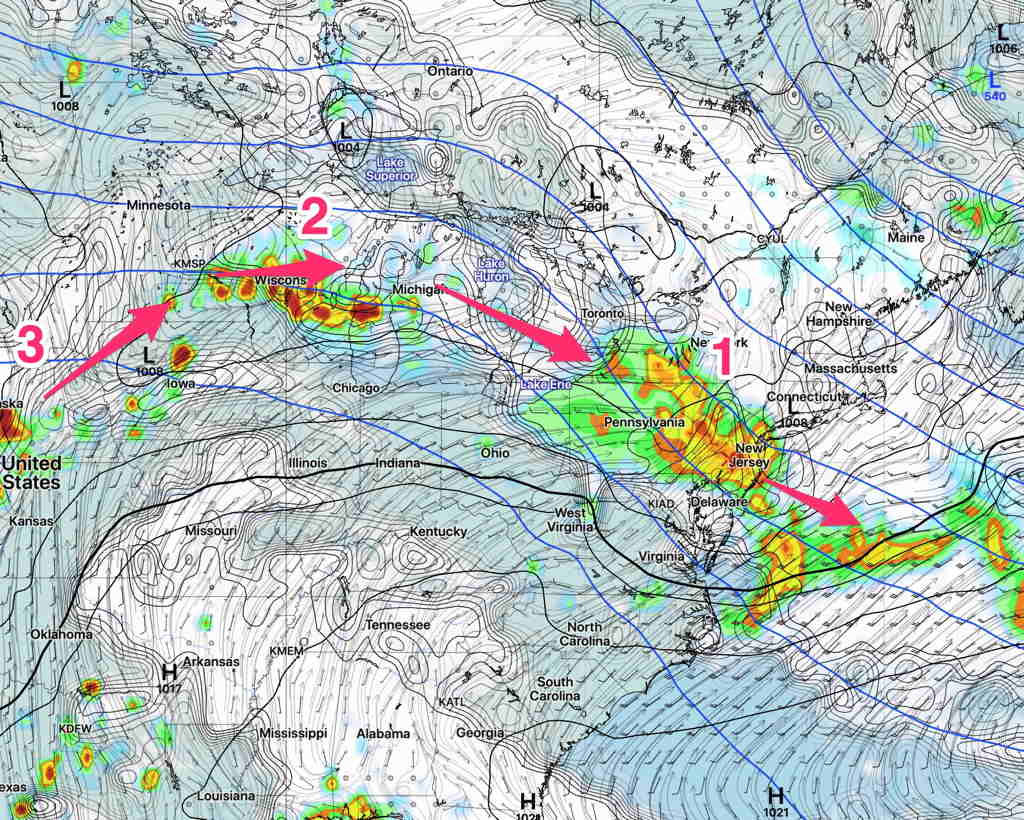
Here’s the current GFS forecast, with the three disturbances shown—
GFS forecast Tuesday midnight. (Click on image for a larger view.)
Expect some changes in the exact track (for instance, the current NAMNEST has the first disturbance moving more to our south) and timing of each disturbance.
A cold front will gradually move through Friday night. The main effect of this frontal passage will be a drop of dew points. Skies will clear after daybreak Saturday.
A secondary cold front moves through Saturday evening. Some sprinkles possible far northwest of the city Saturday evening.
Saturday —
Mostly sunny skies
High temp 81.2°sd 1.6° Dew points drop to the 50s.
[su_note note_color=”#ffffff”]Updated Fri 04:42 PM —The models didn’t shine today. The morning forecast for thunderstorms didn’t pan out. Can we count on the model forecast for this evening? We’ll find out.
The models continue the idea of a line of storms approaching the north and western suburbs early this evening, but falling apart as it moves into Philadelphia.
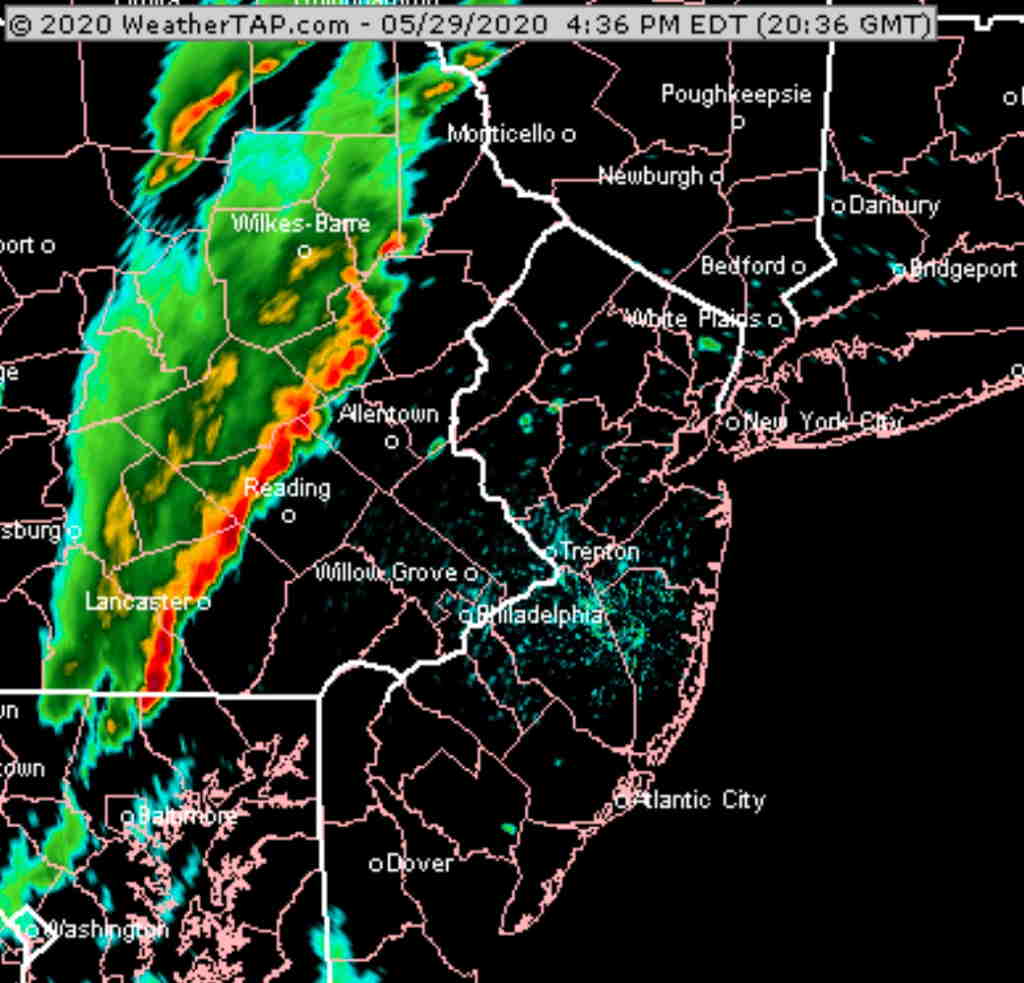
HRRR simulated forecast for 8 PM Friday evening (Click on image for a larger view.)
The above HRRR forecast looks imposing, but much of it falls apart, especially on the southern end, as it moves east into Philadelphia and NJ—
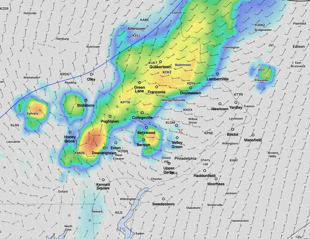
HRRR forecast for 9 PM (Click on image for a larger view.)
So Philadelphia may see some storms, but they’ll be on the decline.
I guess we’ll see. Not a high confidence forecast.
[/su_note]
[su_note note_color=”#ffffff”]Updated Fri 09:55 AM — The 2 AM runs of the models still showed showers/thunderstorms for 10-11 AM, but the latest, shorter range models (HRRR, RAP) just run at 8 AM are not as impressive with the forecast of morning thundershowers this morning.
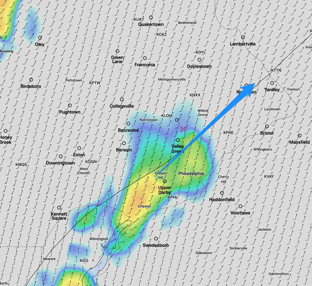
HRRR 12z model forecast for 10 AM Friday morning. with storm movement direction.
It’s almost 10 AM and I don’t see much happening on radar.
This morning’s HRRR model also shows thunderstorms as close as Valley Forge at 8PM, but they don’t make it into Philadelphia.
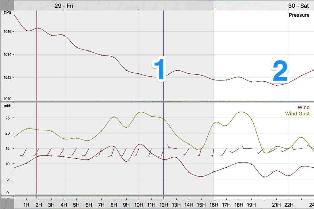
The energy with this cold front is forecast to move through in two waves, 8 PM Friday and 5 AM Saturday. The predicted barometric pressure captures this—
HRRR Adjusted Sea level Pressure and Wind forecast
The models are only so go good with these things. [/su_note]
Tonight’s models, just becoming available, show a line of thunderstorms moving through Friday morning about 10AM. That will signal the actual warm front passage.
Becoming partly sunny warm and very humid.
Another line of storms ahead of a cold front moves through about 9-11 PM Friday evening. Most models have these storms falling apart as they approach the immediate PHL area, but tonight’s NAM NEST have them making it to the immediate western suburbs.