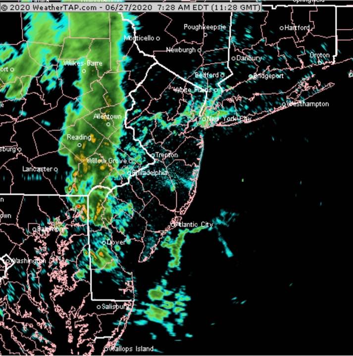
Most of yesterday’s storms only affected the northern parts of our area, from central Montgomery county, Bucks county and northward.
A cold front moves through this evening. The models are again forecasting scattered thunderstorms, this time affecting more of the immediate Philadelphia area including areas not affected yesterday. The storms are expected to be scattered; again all areas won’t receive rain.
The weather parameters that are indicative of severe weather (Helicity, Shear, CAPE) are not as elevated as yesterday.
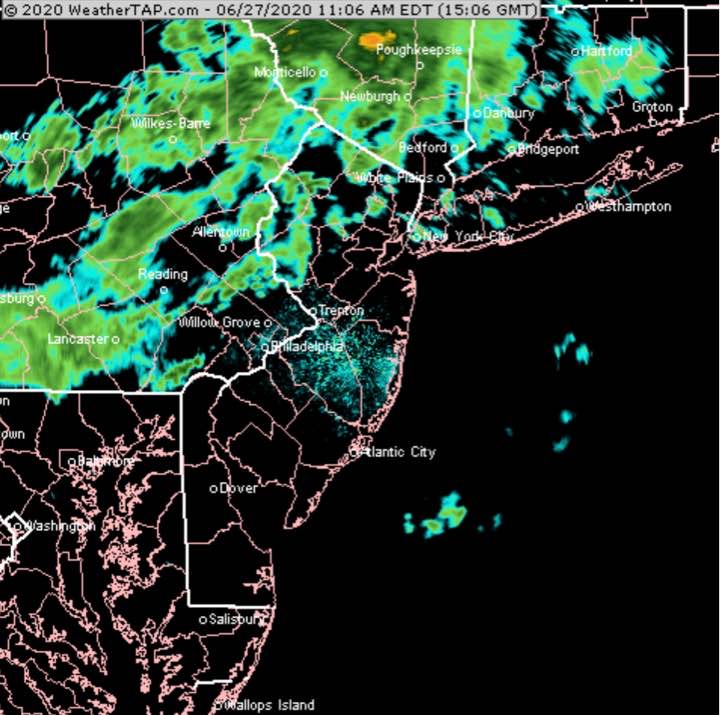
[su_note note_color=”#ffffff”]Updated Sat 11:14 AM — After looking at this morning’s models, I’m trying to get out for a bike ride before the next batch of showers moves in. To my surprise, here’s the current radar—
NEXRAD Radar 11:06 AM courtesy of WeatherTAP.com
I’m looking back at all the models. The Canadian High Resolution (HRDPS) model which isn’t bad but its timing is often not correct, has these rounds of showers moving through during the late morning and early afternoon. [/su_note]
What I meant by uncertainty in the forecast from last night is when we get showers moving through this morning not predicted by last night’s models.
(This morning’s showers WERE predicted by some of the late night models (2AM EDT runs) that became available around 4 AM.)
So what can we expect of the rest of the day? I’m going to approach as a probability forecast, not a deterministic forecast.
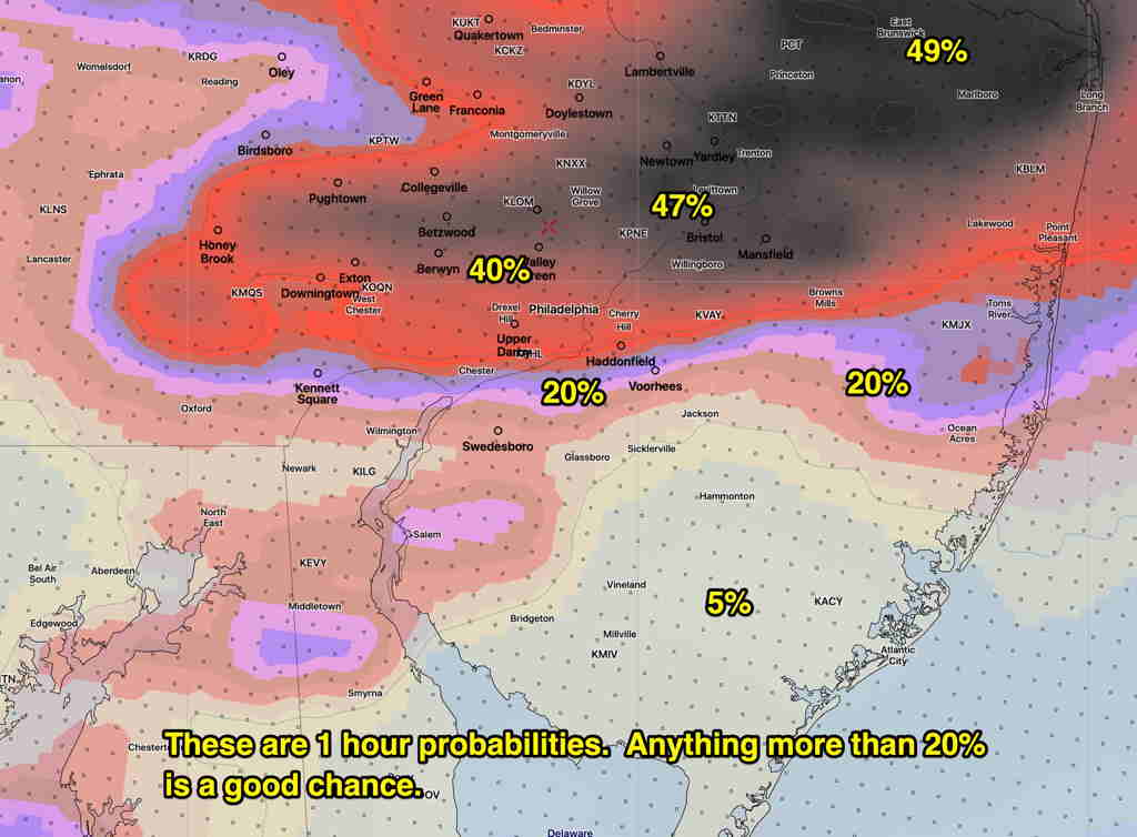
Here’s the latest model blend (NBM) 1 hour rain probability for 5 PM Saturday afternoon—
NBM Model blend 5 PM – 1 hour precip probability (Click on image for a larger view.)
Note that these probabilities are 1 hour probabilities and generally anything greater than 20% is meaningful.
The NAM model just available this morning has showers and thunderstorms developing 2:30 PM northwestern suburbs and moving through between 3 and 6 PM. The NAM’s showers are more widespread.
Southern areas will be least affected today, according the the model blend, but the NAM has a wider area affected.
[su_note note_color=”#ffffff”]Updated Sat 07:20 AM — A fast moving mesoscale complex (thunderstorm group) will be moving through shortly. The complex this morning was not predicted by the models last night!
It appears to be weakening as it moves eastward.[/su_note]
There’s been uncertainty about the forecast for this weekend with most of the models from Friday continuing to show most of the energy and precipitation shearing off to our north.
An upper air disturbance will move through on Saturday, setting off thunderstorms.
Tonight’s models (HRRR,RAP) just becoming available suggest that the dynamics are there for thunderstorms to develop and move through anytime between 2 PM and 6 PM on Saturday. Parameters that forecast severe weather are sufficiently elevated that a cluster of moderate to severe thunderstorms may move through with an elevated likelihood about 5 PM.
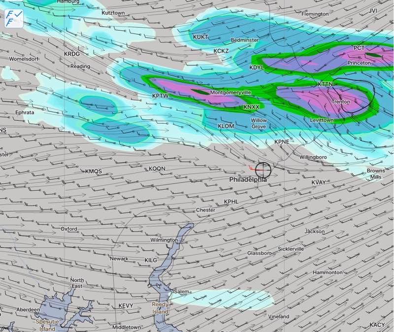
Tonight’s HIRESW and the NAM NEST models still have the storms moving just north of Philadelphia, from west to east. So uncertainty still exists.
NAM NEST Saturday 6pm 1hr precipitation forecast
Saturday —
A mix of sun and clouds in the morning, considerable cloudiness developing by mid afternoon.
High temperature 90.7° sd 1.7° dew points near 68°
Fast moving thunderstorms developing between 2 PM and 6 PM
Winds 8 to 10 mph becoming gusty to 30 mph in thunderstorms
Sunday –
Considerable cloudiness especially in the afternoon
High temperature 89.3° sd 1.8°
An elevated risk of thunderstorms and showers during the afternoon.