[su_note note_color=”#ffffff”]Updated Sun 07:03 AM — Late night models have backed off of the cloudiness in PHL, but keep the morning cloudiness prediction from Norristown, west and north. [/su_note]
[su_note note_color=”#ffffff”]Updated Sat 11:13 PM — Tonight’s models have considerable mid-level cloudiness Sunday morning, more sun in the afternoon .[/su_note]
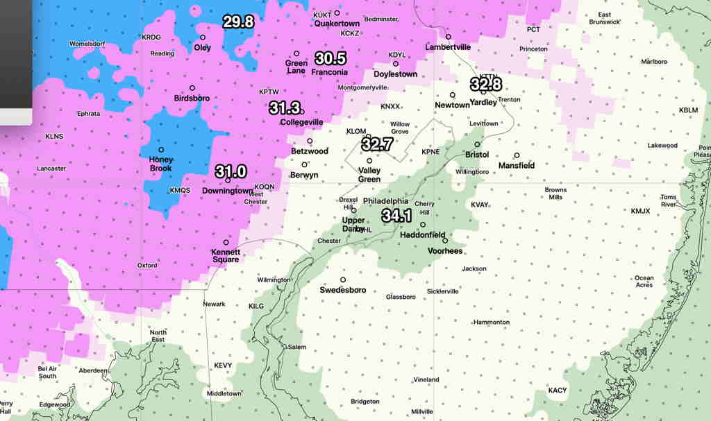
Last night’s forecast went pretty good. I checked our home’s security cameras and we had some snow flurries about 5:10 AM this morning. The temperature early this morning was 31º.
We also had the clouds move in this afternoon and the radar currently shows some widely scattered sprinkles.
Tonight’s minimum temp 35.4º sd 1.6º
The forecast for Sunday hasn’t changed much . We’ll still be under the influence of an upper air trough so temperatures, while warmer than today, will still be below average.
- Some cloudiness in the morning especially north and west of the city, then mostly sunny.
- Winds WSW 10-12 mph with gusts to ~ 20mph
- High temp 61.3º sd 1.3º