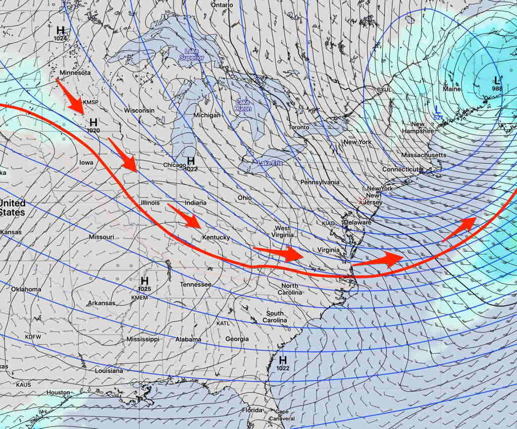
The southward movement of unseasonably cold air and dip in the jet stream has been well-advertised by the models for at least one week and mentioned in my post last Sunday.
While already chilly here, it will take another low pressure system to pull down the main batch of cold air into the Northeast as it moves through on late Friday and Friday night.
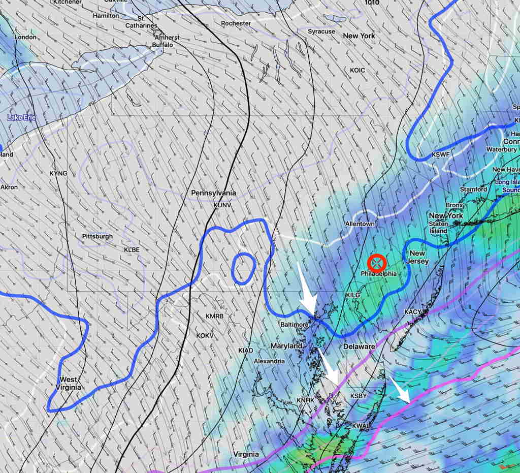
Friday will start cloudy and light rain will move in as early as late morning or shortly after noontime. Rain will increase in intensity in the afternoon and early evening. High temp 57.3º sd 3.3º (high spread/uncertainty)
Winds NE 8-12 mph, increasing towards evening. QPF 0.90 inches rain.
The actual front associated with the low pressure system moves through after 10 PM an increase in winds and gusts from the NW.
Cold air filters in after midnight and temperatures drop to near freezing by daybreak Saturday! There is a slight possibility of some snow showers before daybreak!
Saturday looks to be cloudy after a sunny cold start, with some instability cloudiness and widely scattered sprinkles (and even a wet flurry) possible late morning or early afternoon. Chilly and very windy. High near 48º