
Brief Forecast Update Fri 7:53AM— Some slight changes in the forecast, based on the early morning model runs from (06z or 2AM EDT):
The precipitation moves in earlier today (Friday) with light sprinkles or showers in some locations in the morning and before noontime.
Heavier rain after 1 PM. The front moves through earlier, about 8:30 PM instead of 10PM. Less QPF than previously predicted with totals of about 0.60-0.70 inches water.
With more cold air and faster exit, just a slight chance of the snow flurries about 2 AM. (Who will see them at that time?)
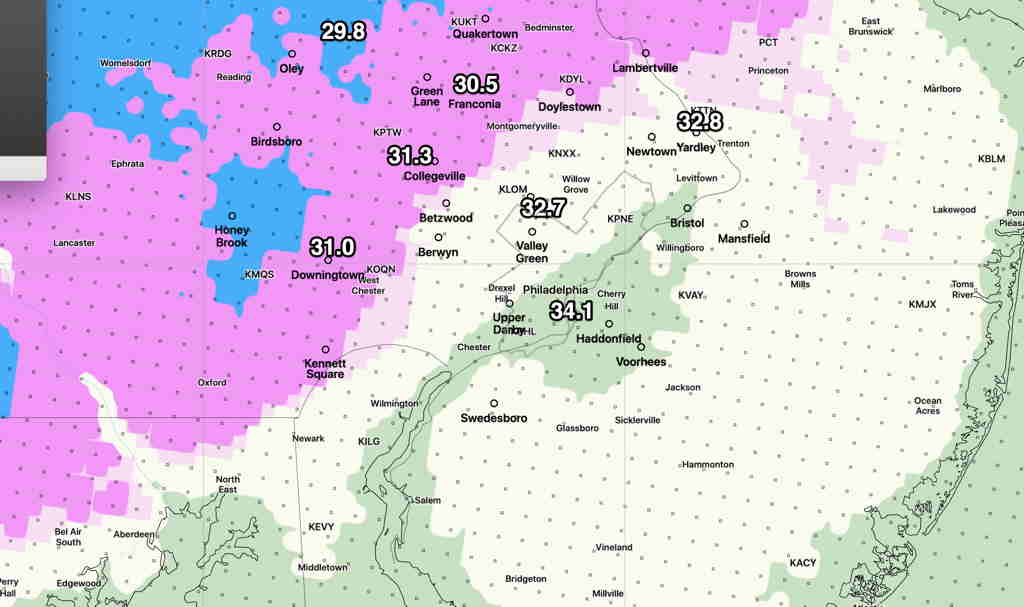
Updated Added Fri 09:08 AM — Mean low temperatures approach or below 32º from just west of the city and northwest around sunrise. (standard deviation is 1.5º to 2.2º’; think of it as ± 1.5 – 2.2º)
Uncertainty about the amount of cloud cover and instability showers on Saturday: the GFS and NAMNEST have sunshine becoming cloudy mid to late afternoon. High 48º sd 3.0º Windy to 30+ mph.
The new HIRESW-FV3 (pre-release version has significant periods of clouds and scattered instability sprinkles/(flurries?) throughout the day.