The forecast for this week has been a moving target with each day’s model forecast being different from the forecast of the previous day.
As an example— a cold front had been expected to move through, initially Wednesday evening, then Wednesday night and now Thursday morning according to the GFS and NAM NEST models.
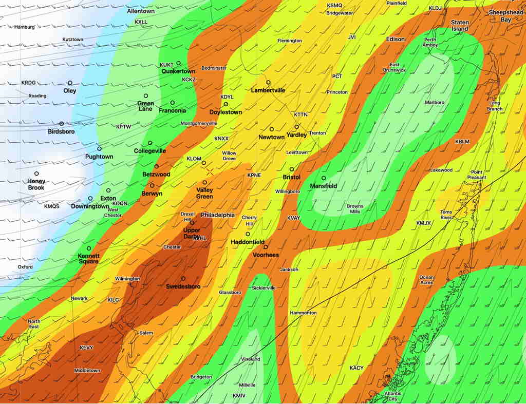
GFS 1 hour Convective Precipitation Rate (Thunderstorm) for 12 Noon Thursday (Click on image for a larger view.)
The Canadian GDPS and the German ICON are somewhat different, with each having a wave of low pressure develop along the front, slowing it down; the front moves through Thursday afternoon to late afternoon according to these models.
The timing differences will result in differences in weather severity; an afternoon frontal passage will occur during a time when the atmosphere is more unstable and result in more severe weather.
Obviously it’s too early to accurately model but the trend has been towards mid to later in the day Thursday. Stay tuned.
[su_note note_color=”#ffffff”]Updated Sat 08:23 AM — Clouds are beginning to thin out.
The most recent Model Blend (NBM) still shows scattered showers/thunderstorms between 3 PM -6 PM today, although not all models are on-board with this. High temp 87.2º sd 2.8º (high spread)
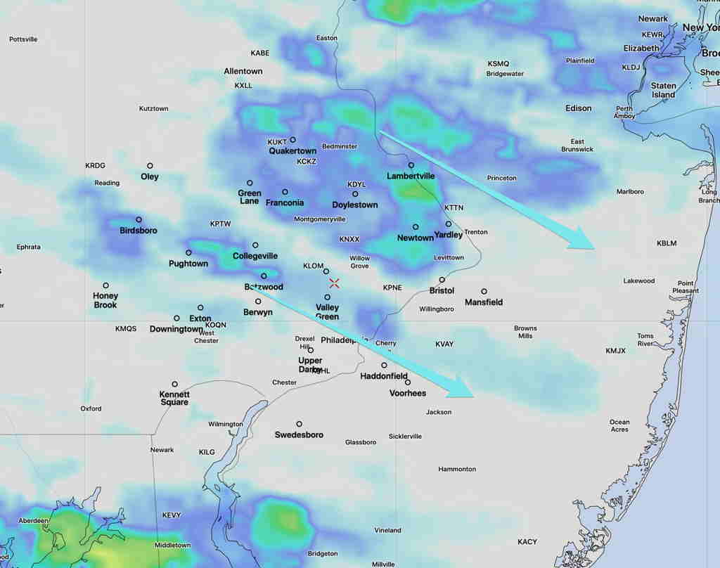
National Blend of Models Simulated Radar forecast 3:30 PM Saturday. (Click on image for a larger view.)
[/su_note]
[su_note note_color=”#ffffff”]Updated Fri 10:34 PM —Tonight’s major models just becoming available.
Some refinements in the Saturday forecast—
Some clouds very early morning, break for sunshine through high clouds.
A secondary cold front moves through late afternoon. The models predict a narrow and small area of showers/thunderstorms and clouds moving through between 3 and 6 PM, dissipating as it moves east.[/su_note]
The main thunderstorm complex moved in an hour or so earlier than forecast, but that’s about as good as the models can get.
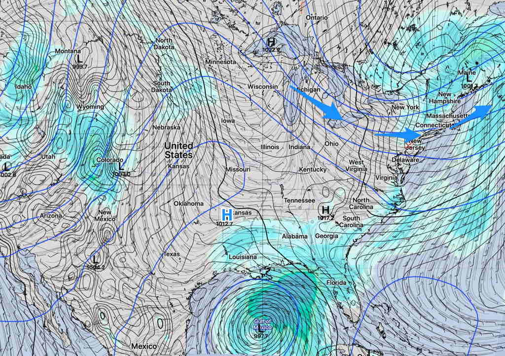
This weekend’s weather will be influenced by a building upper trough (blue arrows) and to some indirect extent, tropical storm Cristobal in the Gulf. (For reasons I don’t understand, tropical storm/hurricane presence seems to affect model forecast accuracy; something just to keep in mind.)
SREF Forecast 4 PM Saturday (Click on image for a larger view.)
Saturday will be a mostly sunny. A weak upper air disturbance moves through about 3 PM; some high resolution models have some sprinkles possible, but other models do not.
Saturday—
Mostly sunny. Somewhat more clouds in the mid afternoon
Light sprinkles possible about 3 PM, but chances are low.
High Temp 86.8º sd 2.8º
Winds NW 5-10 mph gusts to 17
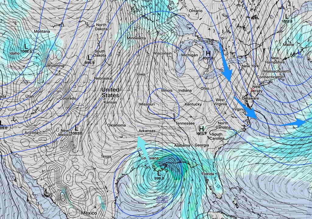
Sunday will continue to be influenced by this upper trough. Sunny, dry and cool temperatures expected.
SREF Sunday 4 PM (Click on image for a larger view.)