
Things have stabilized somewhat with my family medical situation, and I hope to be posting some thoughts and commentary about the current weather over the coming days. For the time being, postings won’t be as frequent or comprehensive as they have been in the recent past.
Posted Thursday 05/16/24 @ 4:03 PM — Just a quick update to yesterday’s note about the upcoming weekend weather. Many of the models, particularly the ECMWF and to some extent, the GFS, have moved towards a more southern track of the next low pressure system moving east near our area this weekend. As a result, they have little in the way of rain for us on Saturday and even less for Sunday.
Looking at the NAEFS (which combines the Canadian and NOAA’s GEFS), a measurable amount of rain is still forecast here for both Saturday and Sunday.
So there’s uncertainty with the weekend forecast at this time. I’m leaning towards the NAEFS with some light rain, but I’ll be the first to tell you I could be wrong here.
Previously Posted Wed 10:06 AM —
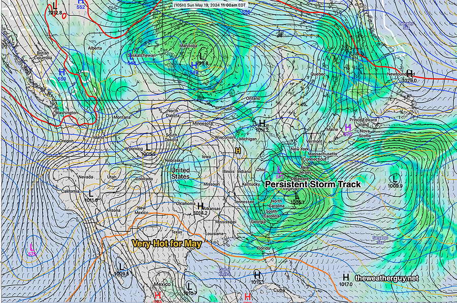
It’s been over a month since I last posted here. After weeks away bicycling and traveling in southern Spain, I’ve returned to a what appears to be an highly unusual weather pattern.
A few features of this pattern have caught my attention:
• Extremely hot wet weather in the southern US for early May
• Very dry and cooler far north of the US into Canada
• A persistent storm track that takes low pressure systems across our region with low pressure systems persisting repeatedly along the coast.
• Recurrent northeasterly surface winds resulting in cool temperatures for us.
Patterns that are a concern for our region:
• The extreme heat in the southern US will eventually push towards us.
• Forest Fires in central and western Canada have smoke trajectories that will enter the US, as they did last summer.
• I’m not sure but I think the excessive rainy pattern we’ve had will be replaced by very dry conditions here over the summer.
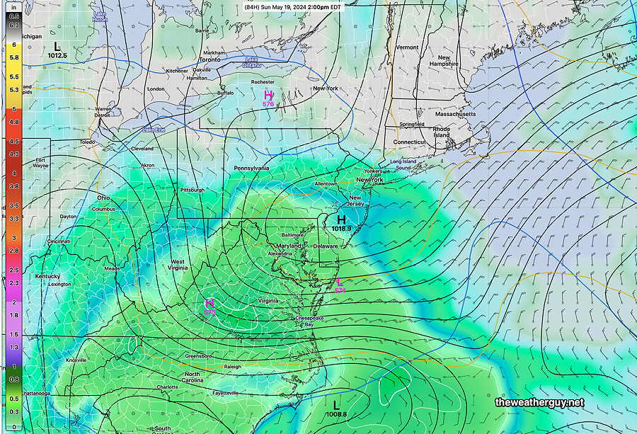
In the short term, the coming weekend looks to be wet. Here’s the latest NAEFS forecast for Sunday—
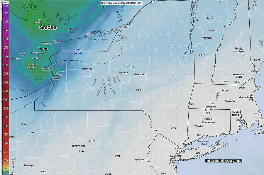
Regarding the smoke from fires in Canada, the latest HRRR smoke model shows some beginning to spill towards us—
More weather to follow…
Welcome back, I hope things are ok for you and your family, and thanks for whatever weather updates you can provide.
If you have a moment to elaborate on why you suspect a very dry summer, I’d be interested in the explanation.
Thank you for your words of encouragement. It’s good to be [partially] back. As for the dry summer, it’s speculation. I’m concerned that the tropical heat dome is so large that it has already punched into southern Florida while we’re still in mid May. It will undoubtedly push much further north. Once that heat dome establishes itself over our area, as it has in recent years, convection (thunderstorms) become difficult to form and low pressure systems get diverted away. Right now, that’s my current intuition. I could be wrong.