[su_note note_color=”#bceaed”]Forecast Review— We had additional showers this morning. Clouds did break in the afternoon. The HRRR model did poorly. Looking back, the HRESW and the NAM NEST were more on target. [/su_note]
The models have clearing skies from the southwest for Thursday. The predicted light showers we had earlier this morning appears to be all the showers most of us will have today.
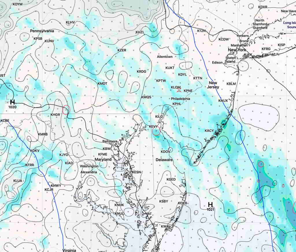
The HRRR shows clouds dissipating by afternoon and most areas without any showers this afternoon.
HRRR model 3:30 PM forecast for cloud cover and precip (Click on image for a larger view.)
Updated Thu 10:10 AM — It’s somewhat of a low confidence forecast, since this is a change from last night’s model forecasts. Additionally, the HRRR doesn’t reflect the current radar situation.
Updated Wed 07:32 PM — Updated with latest HIREF model showing showers mostly to the east, not west.
Earlier this week, I mentioned that the closed, cut off upper air low pressure system might linger and that appears to be the case; it appears that it will affect our weather through at least Saturday.
The problem with all closed cut off upper lows is that the associated precipitation is difficult to accurately model and predict. So far this week, the models haven’t done all that well with the cloud cover prediction either.
So with that backdrop, I’m still tempted to try to talk about the showers over the next few days.
At least for tomorrow, Thursday, the models are suggesting we may get some much needed showers in the morning.
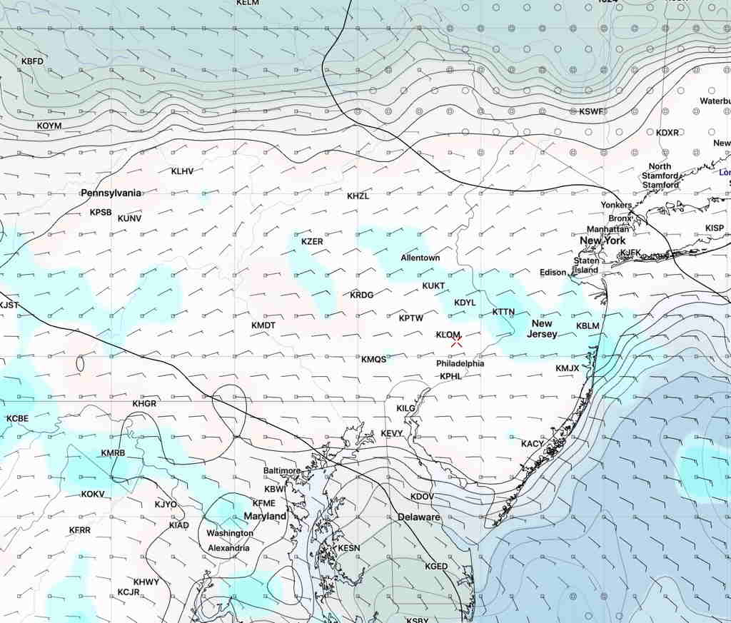
HIREF model precip forecast for 8 AM Thursday. (Click on image for a larger view.)
Same time tomorrow, different forecast:
GFS Precip forecast Thursday 8 AM (Click on image for a larger view.)
However, the models are also predicting that any precipitation will be lightand most of the showers will be west east of the immediate PHL area. Our area gets less than 0.1 inches
So you’ll probably have to water your lawn soon if the models are correct about this.
There’s a somewhat greater chance of showers on Friday and Saturday, but again, the majority of the precipitation may miss the immediate PHL area. I’m hedging here…upper cut off lows are tough to forecast.